Old Maps of Stonington, Maine for Genealogy
Trace your family roots with 33 historic maps of Stonington. These high-res maps reveal old neighborhoods, homesites, landmarks, and streets — helping you uncover where your ancestors lived and how the area evolved over time.
- Explore historic neighborhoods: Identify where your relatives may have lived in the 1800s or 1900s.
- Compare maps over time: Trace the changes in streets, buildings, and landmarks for multi-generational research.
- Perfect for genealogy & ancestry research: Used by family historians and researchers to map out lineage and migration.
These maps are an incredible resource for exploring your personal connection to Stonington's past.
Stonington, ME maps
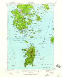
(33)- 1904 Map of Deer Isle
 1904 Deer Isle1904 Print · USGSThe Maine coast in the early nineteen-hundreds is defined by its network of island settlements and steamboat paths. Genealogists and historians can trace family locations from Stonington to Isle au Haut, or locate maritime landmarks like Deer I. Thorofare L.H. and The Haulover.4 unique versions available
 - 1905 Map of Penobscot Bay
 1905 Penobscot Bay1905 Print · USGSThe Maine coastline at the dawn of the twentieth century was a bustling network of maritime trade and summer retreats. Genealogists and historians can trace the foundations of coastal life through the STEAMBOAT ROUTE, the Northport Camp Ground, and settlements like Sargentville.3 unique versions available
 - 1942 Map of Deer Isle, 1958 Print
 1942 Deer Isle1958 Print · USGSCoastal Maine life in the 1940s centers on the granite industry and maritime trade routes throughout Deer Isle and the Penobscot Bay islands. Genealogists and historians can trace the foundations of local economies through the QUARRIES at Stonington and the many family-named landmarks like Greenlaw Neck or Conary Head.3 unique versions available
 - 1944 Map of Deer Isle
 1944 Deer Isle1944 Print · USGSPenobscot Bay and the Eggemoggin Reach appear here in the early 1940s, highlighting the granite and maritime hubs of the Maine coast. Genealogists and historians can locate family homes near Stonington, coastal Quarries, and landmarks like Forest Cem.2 unique versions available
 - 1948 Map of Bangor
 1948 Bangor1948 Print · USGSThe Maine coast and its industrial river valleys are captured here shortly after the war, showing the vital shipping and rail hubs of the late 1940s. Genealogists and historians can trace the tracks of the Maine Central RR connecting Bangor, Augusta, and Old Town.
 - 1956 Map of Bangor, 1966 Print
 1956 Bangor1966 Print · USGSMid-century Maine comes alive in this survey of the rugged coast and river valleys during the 1950s. Genealogists and historians can trace the vital rail corridors of the Maine Central RR connecting timber towns like Old Town to the coast at Bar Harbor.3 unique versions available
 - 1960 Map of Bangor
 1960 Bangor1960 Print · USGSCentral Maine in the sixties reveals a landscape of river-powered industry and sprawling coastal island chains. Researchers can trace the rail corridors of the Maine Central or locate mid-century aviation landmarks like Dow Air Force Base.
 - 1961 Map of Bangor
 1961 Bangor1961 Print · USGSMid-century Maine comes alive through its busy river ports and rocky archipelagoes during a period of steady maritime and rail commerce. Researchers can trace the path of the Maine Central railroad and locate coastal landmarks from Acadia National Park to Vinalhaven Island.
 - 1983 Map of Isle Au Haut West
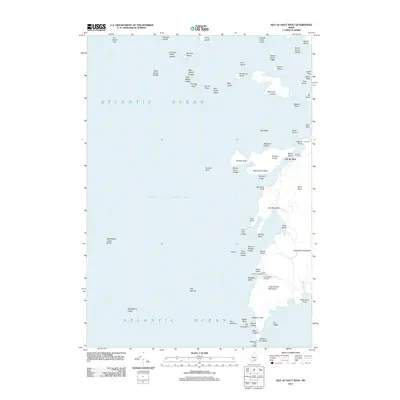
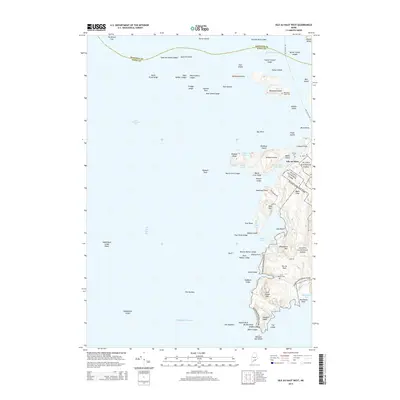
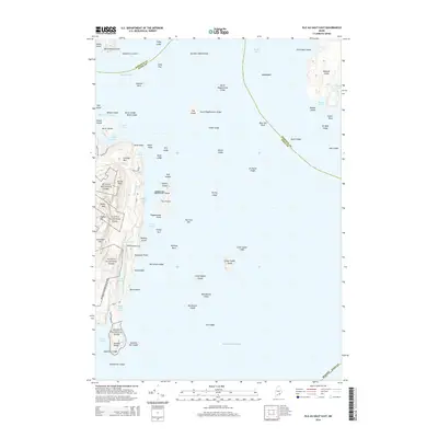
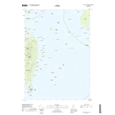
 1983 Isle Au Haut West1983 Print · USGSThe coastal waters of Knox County in the early 1980s reveal a landscape of secluded island life and maritime heritage. Genealogists and historians can locate family landmarks like Turners Cem or trace the coastline past the Robinson Point Lighthouse and Saddleback Ledge Lighthouse.
 - 1983 Map of Deer Isle
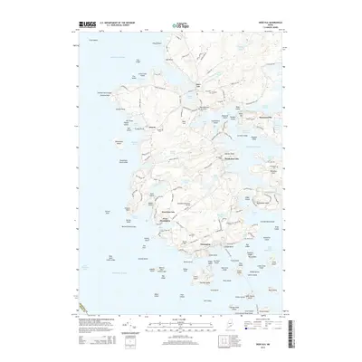
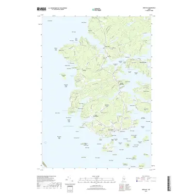
 1983 Deer Isle1983 Print · USGSDeer Isle and the busy harbor at Stonington appear in high detail during the early eighties. Researchers can trace family history at Mt Adams Cem or locate industrial sites like the quarries on Crotch Island and the Mark Island Lighthouse.
 - 1983 Map of Stinson Neck
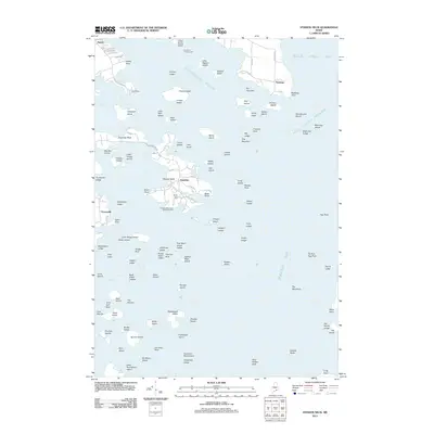
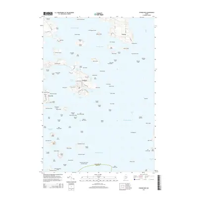
 1983 Stinson Neck1983 Print · USGSCoastal Hancock County in the early eighties is captured here across the islands and reaches of Stinson Neck. Genealogists and historians can locate family-named points and settlements like Sunshine, Oceanville, and the Beth Eden Ch near Naskeag.
 - 1983 Map of Isle Au Haut East
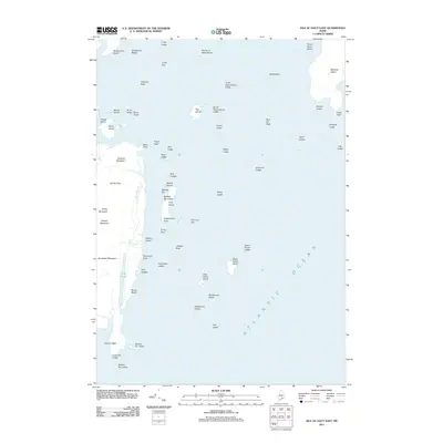
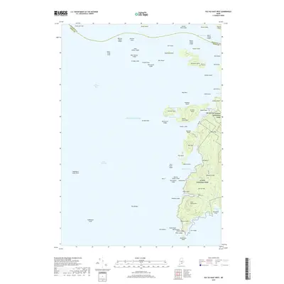
 1983 Isle Au Haut East1983 Print · USGSCoastal Maine's rugged island chains are captured in the early 1980s, featuring the eastern edge of Acadia National Park. Researchers can trace old footpaths like the Sawyer Notch Trail or locate maritime landmarks from Sheep Thief Gulch to York Island.
 - 1985 Map of Bar Harbor
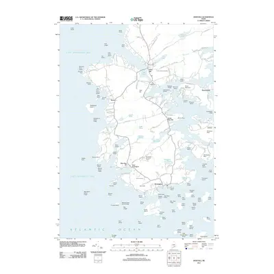
 1985 Bar Harbor1985 Print · USGSCoastal Hancock County in the mid-eighties shows an intricate landscape of island communities and protected wilderness. Trace the boundaries of Acadia National Park or locate seafaring hubs like Stonington and Bar Harbor.2 unique versions available
 - 2011 Map of Stinson Neck, 2011 Print
 2011 Stinson Neck2011 Print · USGSCovers Stonington, including Deer Isle, Brooklin, and other nearby areas
 - 2011 Map of Isle Au Haut West, 2011 Print
 2011 Isle Au Haut West2011 Print · USGSCovers Stonington, including Vinalhaven, North Haven, and other nearby areas
 - 2011 Map of Deer Isle, 2011 Print
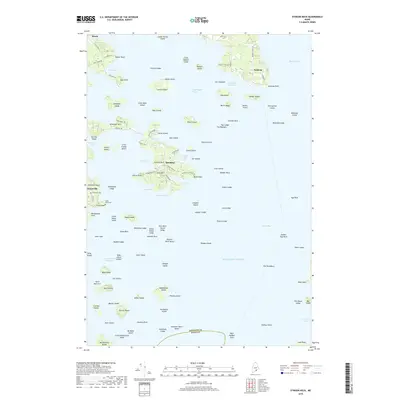
 2011 Deer Isle2011 Print · USGSCovers Stonington, including Deer Isle, North Haven, and other nearby areas
 - 2011 Map of Isle Au Haut East, 2011 Print
 2011 Isle Au Haut East2011 Print · USGSCovers Stonington, including Swan's Island, Isle au Haut, and other nearby areas
 - 2014 Map of Stinson Neck, 2014 Print
 2014 Stinson Neck2014 Print · USGSCovers Stonington, including Deer Isle, Brooklin, and other nearby areas
 - 2014 Map of Isle Au Haut West, 2014 Print
 2014 Isle Au Haut West2014 Print · USGSCovers Stonington, including Vinalhaven, North Haven, and other nearby areas
 - 2014 Map of Deer Isle, 2014 Print
 2014 Deer Isle2014 Print · USGSCovers Stonington, including Deer Isle, North Haven, and other nearby areas
 - 2014 Map of Isle Au Haut East, 2014 Print
 2014 Isle Au Haut East2014 Print · USGSCovers Stonington, including Swan's Island, Isle au Haut, and other nearby areas
 - 2018 Map of Deer Isle, 2018 Print
 2018 Deer Isle2018 Print · USGSCovers Stonington, including Deer Isle, North Haven, and other nearby areas
 - 2018 Map of Isle Au Haut West, 2018 Print
 2018 Isle Au Haut West2018 Print · USGSCovers Stonington, including Vinalhaven, North Haven, and other nearby areas
 - 2018 Map of Isle Au Haut East, 2018 Print
 2018 Isle Au Haut East2018 Print · USGSCovers Stonington, including Swan's Island, Isle au Haut, and other nearby areas
 - 2018 Map of Stinson Neck, 2018 Print
 2018 Stinson Neck2018 Print · USGSCovers Stonington, including Deer Isle, Brooklin, and other nearby areas
Showing maps 1-25 of 33
Top cities near Stonington
- Blue Hill historical maps
- Deer Isle historical maps
- Mount Desert historical maps
- Surry historical maps
- Tremont historical maps
- Castine historical maps
See more
Top neighborhoods of Stonington
Frequently asked questions
- What are the different types of historical maps available for Stonington?
- What is the oldest map of Stonington?
- Where can I purchase historical maps of Stonington for my home or office?
- Where can I download high-res historical maps of Stonington?
- Are there historical topographic maps available for Stonington?
- Is there historical aerial imagery available for Stonington?
- Where are historical maps of Stonington sourced from?