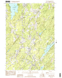
Old Maps of Palermo, Maine for Hiking & Exploration
Hike through history with 38 historic maps of Palermo. Explore old trails, ghost towns, and forgotten backroads — perfect for outdoor adventurers and local explorers.
- Rediscover forgotten places: Map out old mining camps, roads, and footpaths that no longer exist on modern maps.
- Layer with modern tools: Combine with LiDAR or satellite views to plan hikes through historical terrain.
- Made for exploration: Popular among hikers, overlanders, and local history lovers.
Use these maps to find adventure and explore the hidden past of Palermo.
Palermo, ME maps
(38)- 1893 Map of Vassalboro
 1893 Vassalboro1893 Print · USGSMaine's heartland in the 1890s reveals a network of mill villages and lakeside settlements along the Kennebec River. Genealogists can trace early homesteads and landmarks near China Lake, North Vassalboro, and the rural crossroads of Weeks Mills.5 unique versions available
 - 1898 Map of Vassalboro, 1935 Print
 1898 Vassalboro1935 Print · USGSKennebec County at the close of the nineteenth century reveals a landscape of mill towns and interconnected lakes. Researchers can trace the early industrial footprint at Weeks Mills and Cooper Mills or follow the path of the Maine Central R.R. along the Kennebec River.
 - 1916 Map of Liberty
 1916 Liberty1916 Print · USGSMid-coast Maine at the start of the Great War was a patchwork of small townships and family farmsteads connected by narrow-gauge rails. Researchers can locate dozens of country schools and named crossroads such as The Kingdom, Hibberts Gore, and Woodmans Mills.6 unique versions available
 - 1941 Map of Vassalboro, 1954 Print
 1941 Vassalboro1954 Print · USGSCentral Maine in the early 1940s reveals a landscape of lakeside settlements and scattered rural schoolhouses between the Kennebec and Sheepscot rivers. Genealogists can trace family roots through sites like Oak Grove Seminary, Friends Cem, and Weeks Mills.2 unique versions available
 - 1942 Map of Liberty
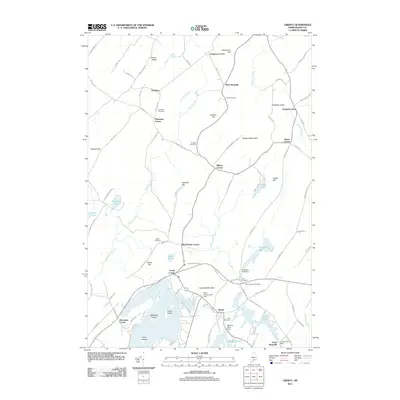
 1942 Liberty1942 Print · USGSWaldo and Lincoln County lands are documented here just before mid-century, showing a landscape of rural schools and family-named corners. Genealogists can trace property near Hibberts Gore or locate ancestral homesites near Handy Sch and Montville Post Office.
 - 1943 Map of Vassalboro
 1943 Vassalboro1943 Print · USGSCentral Maine in the early 1940s is a landscape of expansive lake systems and interconnected mill villages. Researchers can trace the heritage of local institutions like Oak Grove Seminary, the stop at Windsor Station, and the historic Friends Cem.
 - 1948 Map of Bangor
 1948 Bangor1948 Print · USGSThe Maine coast and its industrial river valleys are captured here shortly after the war, showing the vital shipping and rail hubs of the late 1940s. Genealogists and historians can trace the tracks of the Maine Central RR connecting Bangor, Augusta, and Old Town.
 - 1950 Map of Liberty
 1950 Liberty1950 Print · USGSMid-century Waldo County and its neighbors are defined here by a network of crossroad hamlets and upland ridges just after the war. Local historians can trace the foundations of The Kingdom, identify family sites near Hutchins Corner, or locate rural schoolhouses like Hallidale Sch.
 - 1956 Map of Vassalboro, 1958 Print
 1956 Vassalboro1958 Print · USGSThe Kennebec River valley and the shores of China Lake are captured here during the mid-fifties. Researchers can trace historic institutions and rural centers like the Oak Grove Seminary, Erskine Academy, and the Windsor Fairgrounds.3 unique versions available
 - 1956 Map of Bangor, 1966 Print
 1956 Bangor1966 Print · USGSMid-century Maine comes alive in this survey of the rugged coast and river valleys during the 1950s. Genealogists and historians can trace the vital rail corridors of the Maine Central RR connecting timber towns like Old Town to the coast at Bar Harbor.3 unique versions available
 - 1960 Map of Bangor
 1960 Bangor1960 Print · USGSCentral Maine in the sixties reveals a landscape of river-powered industry and sprawling coastal island chains. Researchers can trace the rail corridors of the Maine Central or locate mid-century aviation landmarks like Dow Air Force Base.
 - 1961 Map of Bangor
 1961 Bangor1961 Print · USGSMid-century Maine comes alive through its busy river ports and rocky archipelagoes during a period of steady maritime and rail commerce. Researchers can trace the path of the Maine Central railroad and locate coastal landmarks from Acadia National Park to Vinalhaven Island.
 - 1961 Map of Razorville, 1964 Print
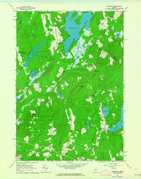 1961 Razorville1964 Print · USGSCoastal Maine's interior comes into focus during the early sixties, showing a landscape of unincorporated gores and rural plantations. Genealogists can trace family names at Hannan Cem and Lenfest Cem or locate the Sandhill Sch near Sandhill Corner.3 unique versions available
 - 1961 Map of Liberty, 1964 Print
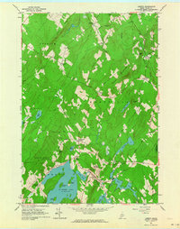 1961 Liberty1964 Print · USGSCoastal Waldo County's inland hills and ponds are captured here in the early sixties, showing a landscape of family-named crossroads and state preserves. Genealogists can trace family footprints at Thurstons Corner, Smithton Cem, and Mt Repose Cem.4 unique versions available
 - 1961 Map of Palermo, 1964 Print
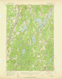
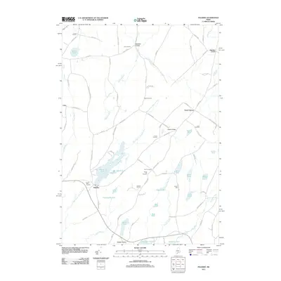
 1961 Palermo1964 Print · USGSThe Waldo County interior in the early sixties remains a landscape of rural settlements and glacial waters. Genealogists can locate family landmarks like Sennetts Corner, the Palermo Sch, and the Perkins Cem near the banks of Sheepscot Pond.3 unique versions available
 - 1975 Map of Vassalboro SE, 1980 Print
 1975 Vassalboro SE1980 Print · USGSKennebec County agriculture and river-valley settlements are captured in high detail in the mid-1970s. Genealogists and local historians can trace the exact buildings and field patterns of rural centers like Weeks Mills, Coopers Mills, and Windsorville.
 - 1982 Map of Weeks Mills, 1983 Print
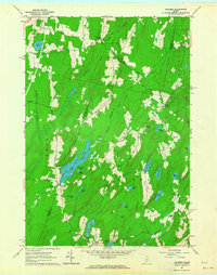
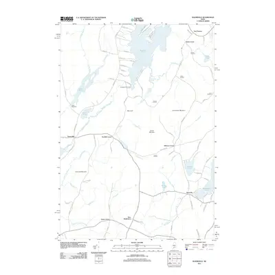
 1982 Weeks Mills1983 Print · USGSKennebec County in the early eighties is a landscape of river valleys and small crossroads settlements. Genealogists and historians can locate family burial grounds like Chadwick Hill Cem or trace the rural footprint of Erskine Academy and the Windsor Fairgrounds.2 unique versions available
 - 1984 Map of Augusta
 1984 Augusta1984 Print · USGSMid-coast and central Maine were undergoing steady change in the mid-eighties as traditional river and coastal industries met expanding recreation. You can trace the Maine Central RR through Augusta or explore the rugged shoreline from Rockland Harbor up to Mount Megunticook.
 - 2011 Map of Razorville, 2011 Print
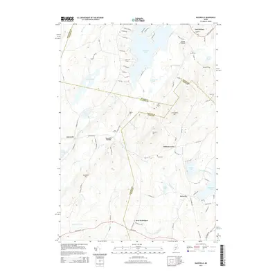
 2011 Razorville2011 Print · USGSCovers Palermo, including China, Jefferson, and other nearby areas
 - 2011 Map of Liberty, 2011 Print
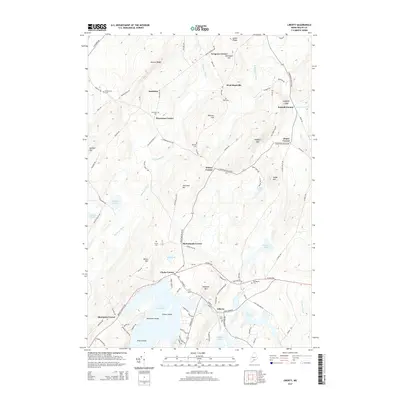
 2011 Liberty2011 Print · USGSCovers Palermo, including Searsmont, Montville, and other nearby areas
 - 2011 Map of Palermo, 2011 Print
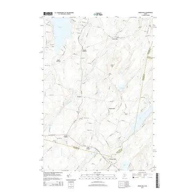
 2011 Palermo2011 Print · USGSCovers Palermo, including China, Albion, and other nearby areas
 - 2011 Map of Weeks Mills, 2011 Print
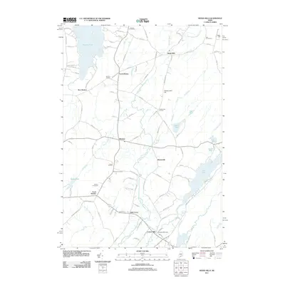 2011 Weeks Mills2011 Print · USGSCovers Palermo, including Vassalboro, China, and other nearby areas
 - 2014 Map of Weeks Mills, 2014 Print
 2014 Weeks Mills2014 Print · USGSCovers Palermo, including Vassalboro, China, and other nearby areas
 - 2014 Map of Liberty, 2014 Print
 2014 Liberty2014 Print · USGSCovers Palermo, including Searsmont, Montville, and other nearby areas
 - 2014 Map of Razorville, 2014 Print
 2014 Razorville2014 Print · USGSCovers Palermo, including China, Jefferson, and other nearby areas
Showing maps 1-25 of 38
Top cities near Palermo
- Augusta historical maps
- Waterville historical maps
- Winslow historical maps
- Fairfield historical maps
- Warren historical maps
- Vassalboro historical maps
See more
Top neighborhoods of Palermo
- East Palermo historical maps
- Jones Corner historical maps
- North Palermo historical maps
- Carrs Corner historical maps
- Greely Corner historical maps
Frequently asked questions
- What are the different types of historical maps available for Palermo?
- What is the oldest map of Palermo?
- Where can I purchase historical maps of Palermo for my home or office?
- Where can I download high-res historical maps of Palermo?
- Are there historical topographic maps available for Palermo?
- Is there historical aerial imagery available for Palermo?
- Where are historical maps of Palermo sourced from?