2020s Maps of Garrett County, Maryland
Explore 18 historic maps of Garrett County from the 2020s. These maps offer a rare glimpse into what life looked like during the 2020s — showing old roads, neighborhoods, homes, and landmarks that have changed or disappeared over time.
Whether you're researching your family's past, planning a metal detecting trip, or studying how Garrett County's landscape evolved across the 2020s, these high-resolution maps are a powerful tool for exploring the history of this region.
- Focus on a specific era: All maps on this page are from the 2020s, giving you a focused view of this time period.
- See what’s changed: Compare century-old streets, trails, and buildings to today's modern landscape using overlays and satellite layers.
- Research with precision: Use these maps for genealogy, historical research, land use analysis, or educational projects.
- View, download, or print: Maps are fully viewable online in high resolution, and can be downloaded or printed for your own records.
Start exploring Garrett County's history through authentic maps from the 2020s. This is your window into the past.
Garrett County, MD maps
(18)- 2023 Map of Table Rock, 2023 Print
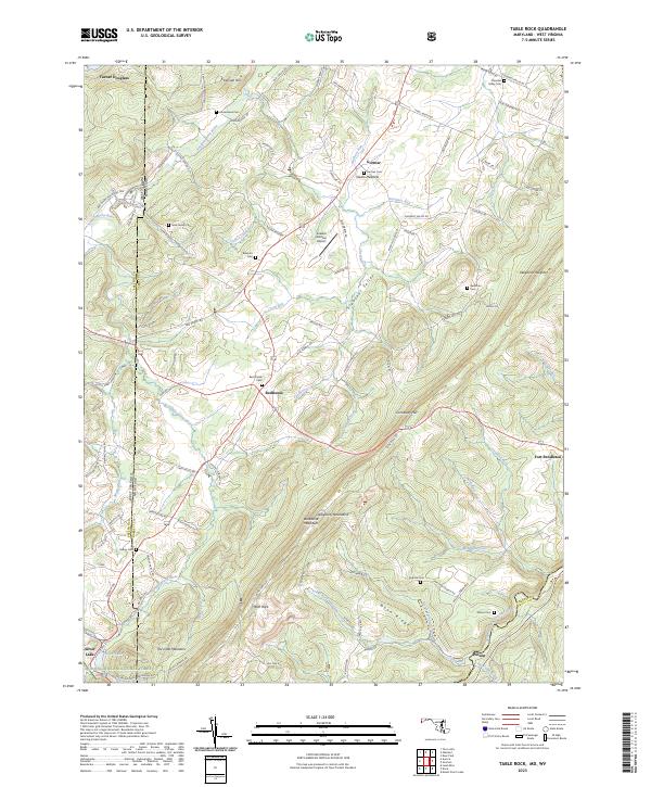 2023 Table Rock2023 Print · USGSThe high Allegheny plateau comes to life in this contemporary survey of the Maryland and West Virginia borderlands. Local historians can trace family plots at Nine Family Cem and Red House Cem or explore the mountain settlements of Redhouse and Gortner.
 - 2023 Map of Westernport, 2023 Print
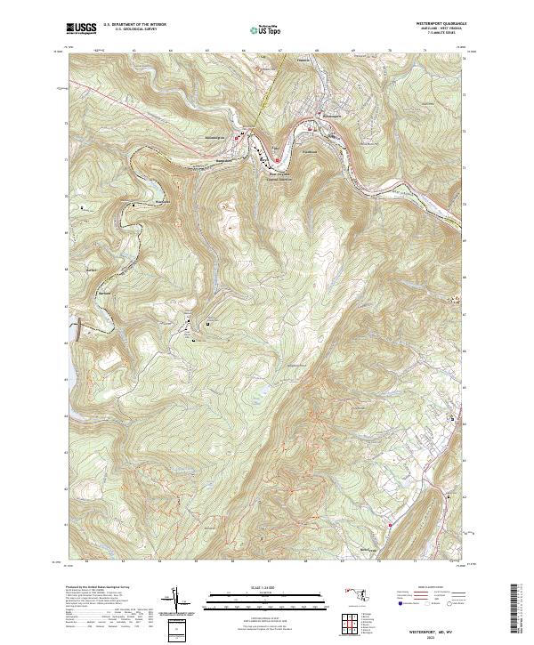 2023 Westernport2023 Print · USGSModern Westernport and the surrounding Potomac River valley appear in high detail at the junction of Maryland and West Virginia. Researchers can trace ancestral sites at Bloomington Cem or explore the mountain settlements of Warnocks and Barnum.
 - 2023 Map of Gorman, 2023 Print
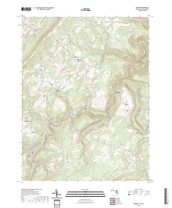 2023 Gorman2023 Print · USGSThe Potomac highlands come alive in this survey of the river-border communities between Maryland and West Virginia. Genealogists can trace family-named sites like Harvey-Wilson Cem and the small settlements of Gormania and Steyer.
 - 2023 Map of Oakland, 2023 Print
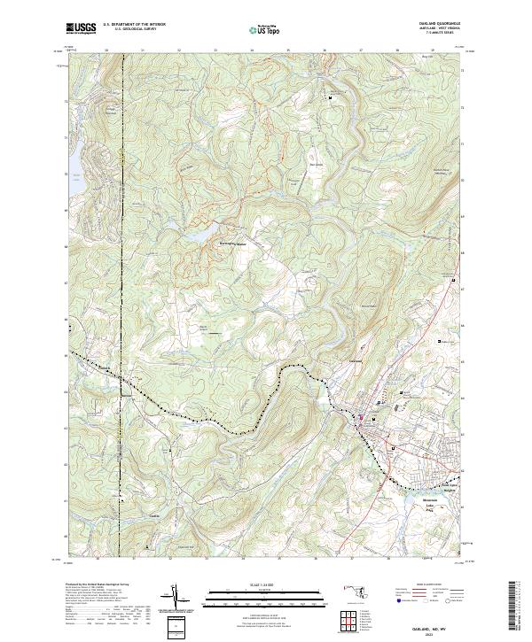 2023 Oakland2023 Print · USGSMaryland's high plateau comes into focus during this recent era as the Youghiogheny River winds past the mountain settlements of Oakland and Crellin. Researchers can trace local genealogy through the Oakland Cem and John Bunyan Brant Cem or locate the historic Corinth Mine.
 - 2023 Map of Deer Park, 2023 Print
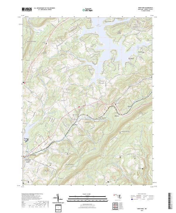 2023 Deer Park2023 Print · USGSGarrett County's high ridges and Appalachian headwaters are mapped here in the early twenty-first century, showing the enduring mountain settlements and lakeside developments. Researchers can trace family history through a high density of burial sites including Beckman Cem and Deer Park Cem alongside the waters of the Little Youghiogheny River.
 - 2023 Map of Friendsville, 2023 Print
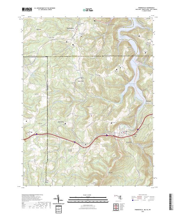 2023 Friendsville2023 Print · USGSThe tri-state border country of Maryland, Pennsylvania, and West Virginia is captured here in the contemporary era. Genealogists can trace deep local roots through numerous family sites like the Friend Family Cem and the Harden - Humberton Burial Ground.
 - 2023 Map of Grantsville, 2023 Print
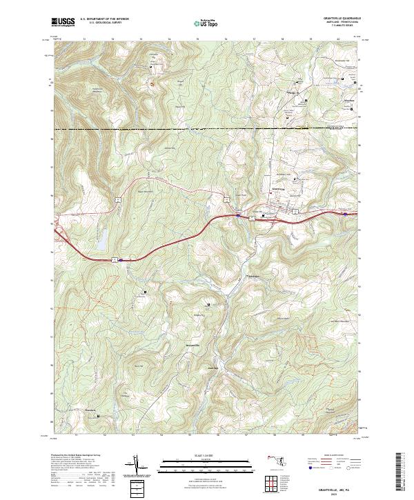 2023 Grantsville2023 Print · USGSGrantsville and the surrounding Garrett County highlands are captured here at the start of the 2020s, showing a landscape rich in family history and Appalachian geography. Genealogists can locate numerous small family plots such as the Beachy Grave Yard and the Negro Mountain Cem near the historic National Pike.
 - 2023 Map of Accident, 2023 Print
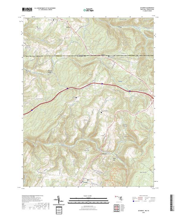 2023 Accident2023 Print · USGSGarrett County's high ridges and border valleys are shown here in detail during the early twenty-first century. Genealogists can trace family names through numerous remote burial sites like Augustine Burial Ground Number 1 and local industry at Kaese Mill.
 - 2023 Map of Barton, 2023 Print
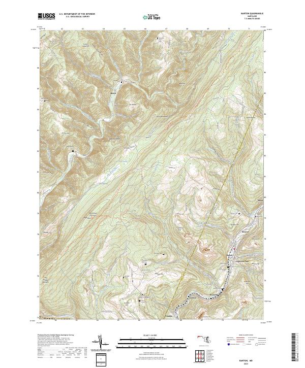 2023 Barton2023 Print · USGSAllegany County's steep ridges and coal-country valleys are shown here in recent detail, tracing the legacy of Maryland's mountain settlements. Researchers can locate numerous family burial sites like Sigler Family Cem and trace the paths of Georges Creek through Barton and Nikep.
 - 2023 Map of McHenry, 2023 Print
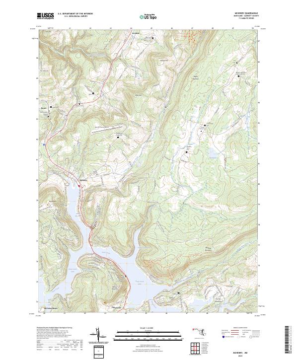 2023 McHenry2023 Print · USGSGarrett County's lakeside communities and high mountain ridges are mapped here in the contemporary era. Researchers can trace family history through numerous small burial grounds like Bumblebee Ridge Cem or locate landmarks near McHenry and Deep Creek Lake.
 - 2023 Map of Avilton, 2023 Print
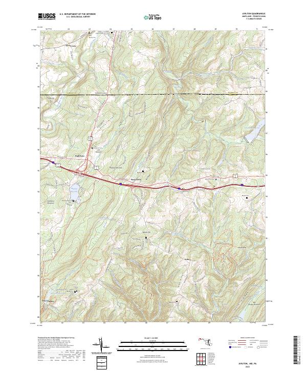 2023 Avilton2023 Print · USGSGarrett County's high ridges and crossing routes define this borderland during the early twenty-first century. Genealogists and historians can locate numerous family burial grounds like Old Peter Beachy Cem and traces of the old National Pike near Avilton.
 - 2023 Map of Bittinger, 2023 Print
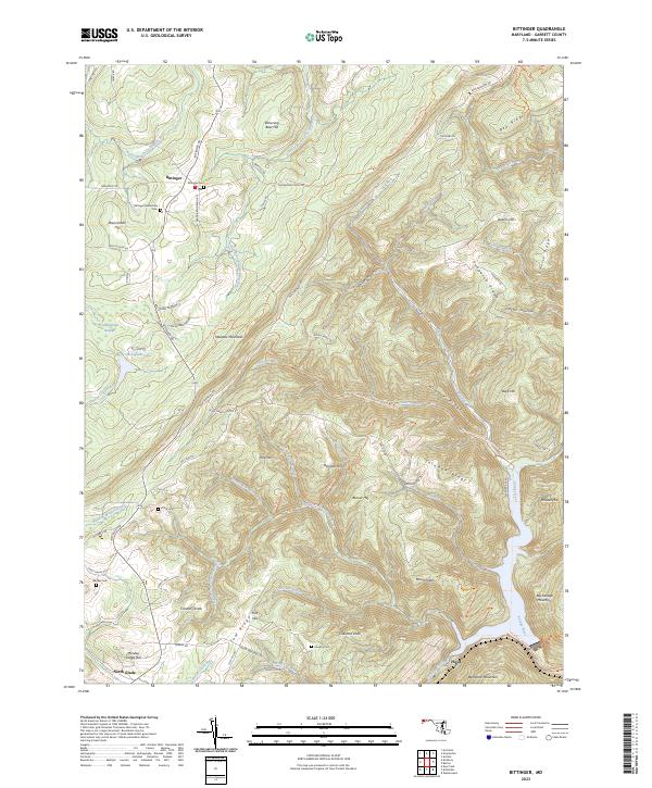 2023 Bittinger2023 Print · USGSGarrett County's high ridges and river headwaters are documented in this recent survey. Researchers can locate family landmarks such as Bittinger Mennonite Cem, trace the course of the Savage River, and find small settlements like North Glade.
 - 2023 Map of Kitzmiller, 2023 Print
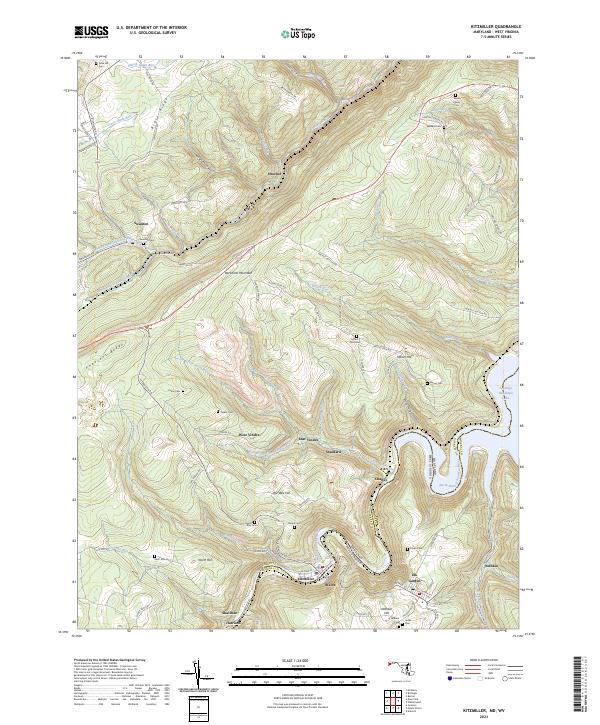 2023 Kitzmiller2023 Print · USGSThe industrial river towns of the Maryland and West Virginia border come alive in this detailed recent study. Genealogists can trace family burial sites like Evans Cem and Dixon Cem or locate former mining hubs at West Vindex and Shallmar.
 - 2023 Map of Sang Run, 2023 Print
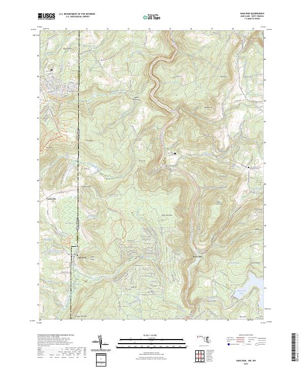 2023 Sang Run2023 Print · USGSThe West Virginia and Maryland border comes alive in this survey of the Youghiogheny River corridor. Researchers can locate the Oak Grove Church of the Brethren and family burial sites at Lake Ford Cem and Upper Sang Run Cem.
 - 2023 Map of Frostburg, 2023 Print
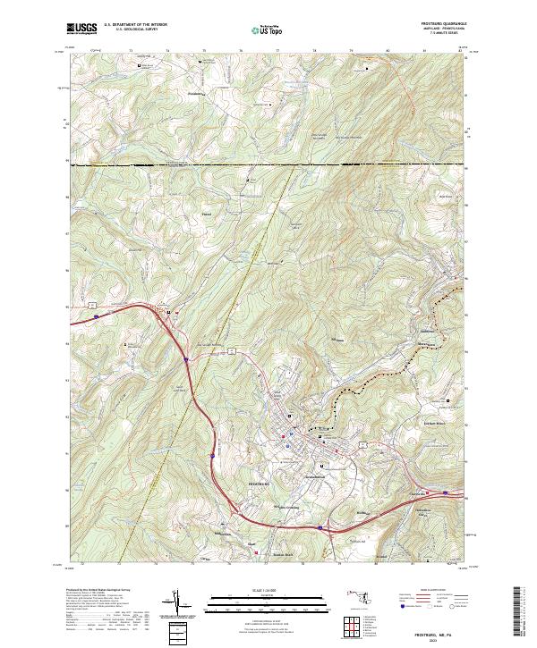 2023 Frostburg2023 Print · USGSFrostburg and the surrounding Allegheny ridges are captured here in the early twenty-first century, showing a landscape shaped by coal mining and mountain transit. Researchers can trace historic industrial sites like Eckhart Mines and Borden Shaft or locate family plots at Cutter McKenzie Cem and the Miller Burial Ground.
 - 2023 Map of Lonaconing, 2023 Print
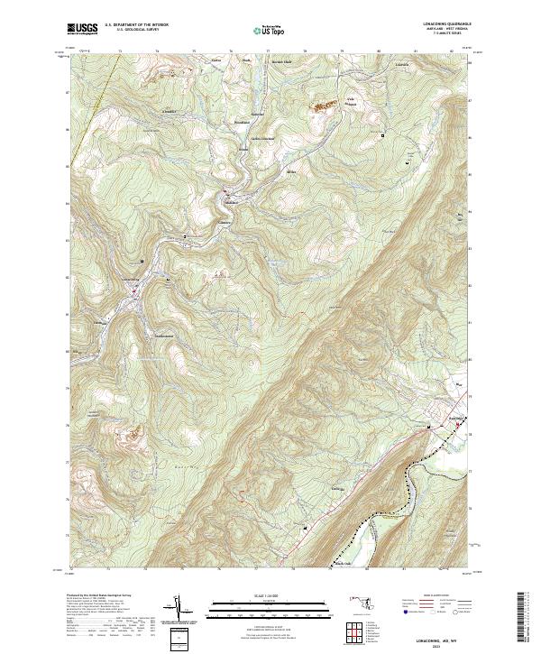 2023 Lonaconing2023 Print · USGSMaryland's mountain mining corridor along Georges Creek appears here in high detail, showing the modern layout of historic coal-country hamlets. Researchers can trace family ties through Saint Marys Cem, locate sites in Borden Shaft, or follow the CSX TRANSPORTATION line.
 - 2023 Map of Mount Storm, 2023 Print
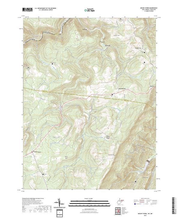 2023 Mount Storm2023 Print · USGSThe Potomac headwaters and the steep rise of the Allegheny Front define this corner of West Virginia. Researchers can trace family history through a network of small burial grounds like Murphy Cem and Evans Cem near the mountain community of Mount Storm.
 - 2023 Map of Davis, 2023 Print
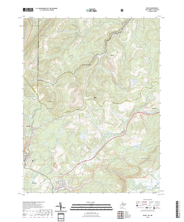 2023 Davis2023 Print · USGSDavis and Thomas sit at the center of this mountain landscape as it appeared in the early 2020s. Trace the high ridges of Backbone Mountain and find family heritage at the Knotts Family Cem or along the banks of the Blackwater River.
End of results
Showing maps 1-18 of 18
Top cities of Garrett County
- Mountain Lake Park historical maps
- Oakland historical maps
- Grantsville historical maps
- Loch Lynn Heights historical maps
- Finzel historical maps
- Friendsville historical maps
See more
Frequently asked questions
- What are the different types of historical maps available for Garrett County?
- What is the oldest map of Garrett County?
- Where can I purchase historical maps of Garrett County for my home or office?
- Where can I download high-res historical maps of Garrett County?
- Are there historical topographic maps available for Garrett County?
- Is there historical aerial imagery available for Garrett County?
- Where are historical maps of Garrett County sourced from?