Old Maps of Garrett County, Maryland for Genealogy
Trace your family roots with 173 historic maps of Garrett County. These high-res maps reveal old neighborhoods, homesites, landmarks, and streets — helping you uncover where your ancestors lived and how the area evolved over time.
- Explore historic neighborhoods: Identify where your relatives may have lived in the 1800s or 1900s.
- Compare maps over time: Trace the changes in streets, buildings, and landmarks for multi-generational research.
- Perfect for genealogy & ancestry research: Used by family historians and researchers to map out lineage and migration.
These maps are an incredible resource for exploring your personal connection to Garrett County's past.
Garrett County, MD maps
(173)- 1895 Map of Piedmont
 1895 Piedmont1895 Print · USGSThe West Virginia and Maryland borderlands come to life in the 1890s, when coal and timber drove the expansion of the Potomac River valleys. Genealogists can trace the early industrial roots of Piedmont, locate the historic Fairfax Stone, or find the long-lost operations at Rees Tannery.4 unique versions available
 - 1898 Map of Frostburg
 1898 Frostburg1898 Print · USGSMaryland's coal country and the Potomac borderlands are captured here at the height of the Victorian industrial era. Researchers can trace the extensive rail lines and mining infrastructure connecting settlements like Eckhart Mines, Mount Savage, and the historic C & O Canal.
 - 1899 Map of Grantsville
 1899 Grantsville1899 Print · USGSThe Maryland-Pennsylvania borderlands are documented here at the close of the nineteenth century, showing a landscape of high ridges and narrow valley settlements. Researchers can trace family-named landmarks like Ridgley Hill and early mountain hamlets such as New Germany or Moscow Mills.
 - 1899 Map of Oakland, 1961 Print
 1899 Oakland1961 Print · USGSGarrett County highlands at the end of the nineteenth century reveal a landscape of mountain resorts and timber railroads. Trace the B. & O. R. R. through Oakland or locate early landmarks like Fort Pendleton and Gnegy Church.
 - 1900 Map of Accident
 1900 Accident1900 Print · USGSGarrett County highlands at the turn of the century reveal a landscape of mountain settlements and river-valley industry. Genealogists can trace family roots through the Blooming Rose Settlement, early milling sites like Speelman Mills, and the Baltimore and Ohio RR corridor.6 unique versions available
 - 1900 Map of Oakland
 1900 Oakland1900 Print · USGSGarrett County and the West Virginia borderlands appear at the turn of the century as a landscape of mountain resorts and rail towns. Genealogists can trace family names at Gnegy Church, locate old stations like Altamont, and explore early settlements from Crellin to Bayard.5 unique versions available
 - 1901 Map of Frostburg
 1901 Frostburg1901 Print · USGSMaryland's coal country and the critical mountain pass at Cumberland are shown in detail at the turn of the century. Genealogists and industrial historians can locate old mining works at Eckhart Mines, the path of the C. & O. Canal, and the early layout of Frostburg.2 unique versions available
 - 1904 Map of Grantsville
 1904 Grantsville1904 Print · USGSGarrett County at the close of the nineteenth century is captured here as a rugged corridor of timbering and coal transport. You can trace the path of the National Road through Grantsville or locate early industrial sites like Moscow Mills and the Jennings Brothers RR.5 unique versions available
 - 1908 Map of Frostburg
 1908 Frostburg1908 Print · USGSAllegany County mining and rail networks are in full view at the turn of the century. Trace the old coal patches and rail spurs from Eckhart Mines to Borden Shaft, and follow the C & O Canal along the North Branch Potomac River.5 unique versions available
 - 1916 Map of Davis
 1916 Davis1916 Print · USGSHigh in the Allegheny plateau during the mid-teens, this area centers on the bustling timber and rail hubs of Thomas and Davis. Researchers can trace the path of the Lumber RR and locate rural neighborhood centers like Maple Grove School and Cortland School.2 unique versions available
 - 1918 Map of Davis
 1918 Davis1918 Print · USGSTucker County's high mountain plateaus and timber industry are at their peak during the First World War. Genealogists and historians can trace the early development of Davis and Thomas alongside rural landmarks like Maple Grove School and the Fairfax Stone.
 - 1919 Map of Elk Garden
 1919 Elk Garden1919 Print · USGSThe Potomac River corridor in the years following the Great War reveals a landscape defined by rail and ridge. Genealogists can trace family names at Rehoboth Church or locate vanished school sites like Terra Firma School and Empire School.2 unique versions available
 - 1919 Map of Davis, 1955 Print
 1919 Davis1955 Print · USGSThe West Virginia and Maryland borderlands are captured here during a peak era of timber and rail expansion. Genealogists can trace family roots through rural landmarks like the Fairfax Stone, the village of Cortland, and the Maple Grove School.2 unique versions available
 - 1920 Map of Elk Garden
 1920 Elk Garden1920 Print · USGSThe West Virginia highlands and the Potomac River border are captured here just after the Great War, during the peak of the rail-and-coal era. Genealogists can locate numerous rural landmarks including Elk Garden, Rehoboth Church, and the Nethken School.
 - 1920 Map of Davis
 1920 Davis1920 Print · USGSWest Virginia's high mountain plateaus and the Maryland border are captured here just after the Great War. Genealogists can trace family footprints near the Fairfax Stone or locate rural landmarks like Rohrbaugh School and the Stony River Dam.
 - 1921 Map of Davis, 1938 Print
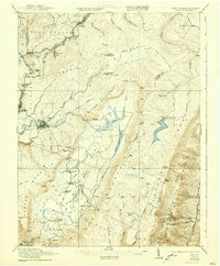 1921 Davis1938 Print · USGSThe West Virginia highlands and the Maryland border come alive in this early twentieth-century survey of the Allegheny Front. Researchers can trace the legacy of timber and coal through the Lumber RR and find local landmarks like the Fairfax Stone and Cortland School.2 unique versions available
 - 1922 Map of Elk Garden
 1922 Elk Garden1922 Print · USGSThe Potomac River highlands come to life in the early 1920s as rail and river industry define the border between Maryland and West Virginia. Genealogists and local historians can trace family roots through numerous small schools and churches like Sunnyside School, Mt Pisgah Church, and Hartmansville.2 unique versions available
 - 1946 Map of Grantsville, 1966 Print
 1946 Grantsville1966 Print · USGSGarrett County's high ridges and river valleys are captured here in the mid-1940s, showing a landscape defined by the historic National Pike and timbered heights. Genealogists can locate family-named features such as Zehner Hill, Yoder School, and the remote Dunghill Church.4 unique versions available
 - 1947 Map of Sang Run, 1960 Print
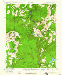 1947 Sang Run1960 Print · USGSGarrett County highlands at the end of the 1940s reveal a mountain economy transitioning from isolated farms to hydroelectric power. Genealogists can locate family-named sites like Sisler Cem, Elder Sch, and rural congregations at Pine Grove Ch.3 unique versions available
 - 1947 Map of Barton, 1964 Print
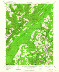 1947 Barton1964 Print · USGSMaryland's coal country comes into focus in the 1940s as industry and wilderness meet along the slopes of Big Savage Mountain. Genealogists can trace family sites from Barton to Pekin Nikep PO, including St Gabriels Cem and several local mines.4 unique versions available
 - 1947 Map of McHenry, 1965 Print
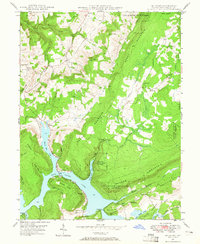 1947 McHenry1965 Print · USGSGarrett County's high country and the early shoreline of the lake are captured here just after the war. Local researchers can trace family roots through rural landmarks like Beachy Sch, Glendale Cem, and the settlement of Accident.4 unique versions available
 - 1947 Map of Friendsville, 1965 Print
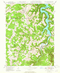 1947 Friendsville1965 Print · USGSMaryland's mountainous panhandle meets Pennsylvania and West Virginia in this mid-century study of the Youghiogheny valley. Genealogists can locate family landmarks like Thomas Cemetery and Emberson Cemetery, or rural schoolhouses like McCabe School.6 unique versions available
 - 1947 Map of Bittinger, 1966 Print
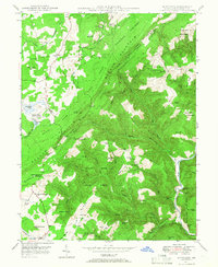 1947 Bittinger1966 Print · USGSGarrett County's high ridges and river headwaters are captured here just after the war, showing the mountain communities of the Allegheny Front. Genealogists and local historians can locate remote landmarks like Blackhawk Sch, the Meadow Mountain Mission, and Murphy Cem.3 unique versions available
 - 1947 Map of Avilton, 1968 Print
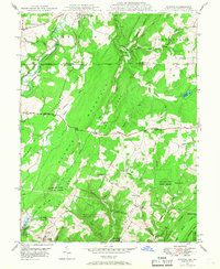 1947 Avilton1968 Print · USGSMaryland's high mountain ridges and the historic Mason-Dixon boundary are captured here in the late 1940s. Genealogists and historians can locate old mountain homesteads, the Avilton Sch, and rural cemeteries like Merrbach Cem or the Blocher Cem.4 unique versions available
 - 1947 Map of Accident, 1982 Print
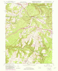 1947 Accident1982 Print · USGSMaryland's high plateau comes into focus at the middle of the century, centered on the historic National Road and the uniquely named town of Accident. Genealogists and local historians can trace family-named landmarks like Kaese Mill, Sausman Mine, and several rural Cem locations throughout the Bear Creek valley.2 unique versions available
Showing maps 1-25 of 173
Top cities of Garrett County
- Mountain Lake Park historical maps
- Oakland historical maps
- Grantsville historical maps
- Loch Lynn Heights historical maps
- Finzel historical maps
- Friendsville historical maps
See more
Frequently asked questions
- What are the different types of historical maps available for Garrett County?
- What is the oldest map of Garrett County?
- Where can I purchase historical maps of Garrett County for my home or office?
- Where can I download high-res historical maps of Garrett County?
- Are there historical topographic maps available for Garrett County?
- Is there historical aerial imagery available for Garrett County?
- Where are historical maps of Garrett County sourced from?