1900s (20th Century) Maps of Somerset County, Maryland
Explore 87 historic maps of Somerset County from the 1900s (20th Century). These maps offer a rare glimpse into what life looked like during the 1900s — showing old roads, neighborhoods, homes, and landmarks that have changed or disappeared over time.
Whether you're researching your family's past, planning a metal detecting trip, or studying how Somerset County's landscape evolved across the 1900s, these high-resolution maps are a powerful tool for exploring the history of this region.
- Focus on a specific era: All maps on this page are from the 1900s, giving you a focused view of this time period.
- See what’s changed: Compare century-old streets, trails, and buildings to today's modern landscape using overlays and satellite layers.
- Research with precision: Use these maps for genealogy, historical research, land use analysis, or educational projects.
- View, download, or print: Maps are fully viewable online in high resolution, and can be downloaded or printed for your own records.
Start exploring Somerset County's history through authentic maps from the 1900s. This is your window into the past.
Somerset County, MD maps
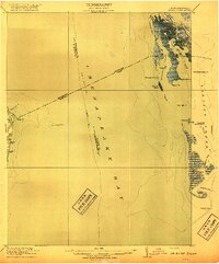
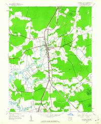
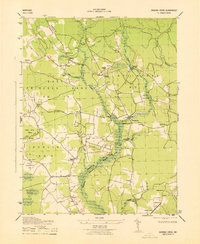
(87)- 1901 Map of Salisbury
 1901 Salisbury1901 Print · USGSWicomico County at the turn of the century centered on the steamboat and rail traffic through Salisbury. Trace historic family-named locations and rural infrastructure like Fooks School, Minksville, and the steam route at Shad Pt.4 unique versions available
 - 1903 Map of Crisfield
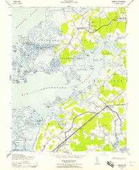
 1903 Crisfield1903 Print · USGSCoastal Somerset County at the turn of the century reveals a landscape defined by the water and the oyster trade. Genealogists and historians can trace old community footprints at Sackertown, Lawsonia, and Parsonville, or locate the Janes Island L.H. and the remote reaches of Smith Island.4 unique versions available
 - 1903 Map of Nanticoke
 1903 Nanticoke1903 Print · USGSThe Nanticoke River and Fishing Bay define this era of Eastern Shore life at the opening of the twentieth century. Genealogists can trace family names at waterfront landings like Lewis Ldg. or find early rail connections at Vienna and Mardela Springs.4 unique versions available
 - 1903 Map of Bloodsworth Island
 1903 Bloodsworth Island1903 Print · USGSCoastal life in the Dorchester County marshes is preserved here at the turn of the century. Genealogists and maritime historians can trace the early layout of Applegarth and Holland Island alongside landmarks like Hooper Strait L.H.3 unique versions available
 - 1903 Map of Deal Island
 1903 Deal Island1903 Print · USGSSomerset County's coastal marshes and island communities come to life in this turn-of-the-century survey of the Chesapeake. Genealogists and maritime historians can trace family locations from DEAL ISLAND to Upper Fairmount, and locate early navigation aids like Great Shoals L.H. or the rail terminus at Hopewell.3 unique versions available
 - 1906 Map of St. Marys
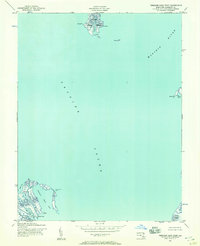
 1906 St. Marys1906 Print · USGSChesapeake Bay and the Potomac River converge in this 1906 survey of the Maryland and Virginia tidewater. Historians can trace the region's maritime heritage through dozens of named landings and islands, from Solomons Id. to the remote reaches of Smith Island.4 unique versions available
 - 1917 Map of Ewell
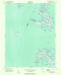
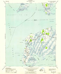
 1917 Ewell1917 Print · USGSIsolated island life in the Chesapeake comes into focus during the early twentieth century. Researchers can trace the original footprints of Ewell, Rhodes Point, and Tangier, alongside maritime landmarks like the Smith Point LH and old Steamboat Routes.2 unique versions available
 - 1920 Map of Crisfield
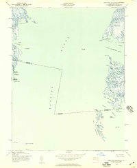
 1920 Crisfield1920 Print · USGSMaryland's seafood capital and the isolated island communities of the Chesapeake are captured just after the First World War. Researchers can trace the waterfront rail lines of the N.Y.P. & N. R.R. or locate ancestral homes in Sackertown, Birdtown, and Ewell.
 - 1942 Map of Terrapin Sand Point, 1957 Print
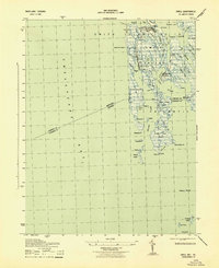
 1942 Terrapin Sand Point1957 Print · USGSCoastal Somerset County is captured here in the early 1940s, documenting a maritime landscape of marshes and tidal creeks. Researchers can trace historical shoreline features and remote outposts such as Barnes Landing, Hazard Pt, and the northern reaches of Smith Island.
 - 1942 Map of Kedges Straits, 1957 Print
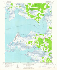
 1942 Kedges Straits1957 Print · USGSThe mid-century Chesapeake Bay shoreline comes to life through the tidal guts and marshes of the Somerset County islands. Trace the old waterway navigation routes past Holland Island Bar Lighthouse, Solomons Lump Lighthouse, and the landings at Smith Island.
 - 1942 Map of Ewell, 1957 Print
 1942 Ewell1957 Print · USGSSmith Island and its isolated waterman communities are captured here in the early 1940s, split by the Maryland and Virginia state line. Genealogists and historians can trace the small settlements of Ewell, Rhodes Point, and Tylerton alongside cemeteries and the Smith Island Light.
 - 1942 Map of Bloodsworth Island, 1957 Print
 1942 Bloodsworth Island1957 Print · USGSThe Dorchester County archipelago comes into focus during the early war years, revealing the complex marshes and tidal guts of the lower Chesapeake. Researchers can trace the maritime landscape of Bloodsworth Island and locate vanished landmarks like the Hooper Strait Lighthouse and the small settlement at Crocheron.
 - 1942 Map of Great Fox Island, 1957 Print
 1942 Great Fox Island1957 Print · USGSThe maritime borderlands of Maryland and Virginia appear in the early 1940s as a complex network of sounds, guts, and marshes. Genealogists and historians can trace local landmarks like Horse Hammock, the James Island Light, and the remote Great Fox Island.
 - 1942 Map of Marion, 1958 Print
 1942 Marion1958 Print · USGSSomerset County's coastal reaches are documented here during the early war years, highlighting the intricate marshlands and rail-dependent villages. Genealogists can locate family landmarks like Samuel Webster Ch or trace the old rail stops at Marion and Hopewell.2 unique versions available
 - 1942 Map of Deal Island, 1958 Print
 1942 Deal Island1958 Print · USGSCoastal Somerset County is shown here in the early 1940s, a landscape of isolated fishing villages and vital Chesapeake Bay navigation aids. Researchers can trace the waterfront settlements of Wenona, Chance, and Deal Island or locate maritime landmarks like Haines Point Light.2 unique versions available
 - 1942 Map of Monie, 1958 Print
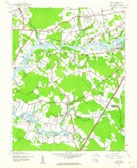
 1942 Monie1958 Print · USGSCoastal Somerset County in the early 1940s is a landscape of expansive tidal marshes and isolated necks. Genealogists can trace family footprints through the dispersed communities of Oriole, Venton, and Champ, or locate rural landmarks like St Peters ME Church.
 - 1942 Map of Wetipquin, 1962 Print
 1942 Wetipquin1962 Print · USGSCoastal Wicomico County comes to life in this mid-century survey of the river necks and marshlands along the Nanticoke. Genealogists can trace family roots through landings and local landmarks like Whitehaven, St Marys Ch, and the Wetipquin Ferry.
 - 1942 Map of Kingston, 1962 Print
 1942 Kingston1962 Print · USGSSomerset County's Eastern Shore landscapes are captured here during the 1940s, showing a world of river-fed marshes and rural crossroads. Genealogists can trace family landmarks at Pauls Corner or locate historic pulpits like Holly Grove Ch and Union Ch.2 unique versions available
 - 1942 Map of Princess Anne, 1962 Print
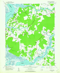
 1942 Princess Anne1962 Print · USGSSomerset County’s interior landscape is captured here during the early years of the war, centered on the riverine town of Princess Anne. Researchers can trace the mid-century layout of Princess Anne College, locate the Mt Hope Ch, and explore the sprawling U S Army Reservation.
 - 1942 Map of Eden, 1962 Print
 1942 Eden1962 Print · USGSThe Wicomico River dominates this wartime survey of the Maryland coast, showing the rural landscapes of Somerset and Wicomico Counties. Genealogists can trace family connections through riverfront landmarks like Wagner Landing, the remote Catchpenny settlement, and the Pine Bluff Sanitarium.2 unique versions available
 - 1942 Map of Saxis, 1962 Print
 1942 Saxis1962 Print · USGSCoastal Accomack County and Somerset County come to life in this mid-century survey of the tidal marshes and fishing villages along Pocomoke Sound. Genealogists can trace family roots through the island community of Saxis or locate rural landmarks like Halls Chapel and Pocomoke Church.
 - 1942 Map of Dividing Creek, 1962 Print
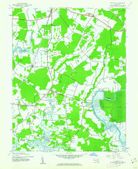
 1942 Dividing Creek1962 Print · USGSMaryland's Eastern Shore during the early 1940s is defined here by the winding marshlands of Dividing Creek and the small crossroads that sustained rural life. Genealogists can locate family landmarks like Friendship Ch, Adkinson Sch, and the quiet settlement of Whiteburg.
 - 1942 Map of Salisbury, 1962 Print
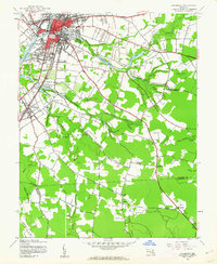 1942 Salisbury1962 Print · USGSMaryland's Eastern Shore hub of Salisbury and the nearby settlement of Fruitland are seen here in the early 1940s. Genealogists and historians can trace rail routes like the Pennsylvania RR and find rural landmarks like St Lukes Ch and the Wicomico Orphanage.2 unique versions available
 - 1943 Map of Dividing Creek
 1943 Dividing Creek1943 Print · USGSThe rural borderlands of Somerset and Worcester Counties are captured here during the early 1940s. Genealogists and local historians can trace family locations near Oakville and West, or locate rural landmarks like Olivet Cem and Ridgehill School.
 - 1943 Map of Ewell
 1943 Ewell1943 Print · USGSSmith Island during the early 1940s presents a unique view of Maryland's isolated island communities and their intricate waterborne geography. Local historians can trace the footings of Ewell and Tylerton, or locate landmarks like Smith Island Light and the curiously named Amen Corner.
Showing maps 1-25 of 87
Top cities of Somerset County
Frequently asked questions
- What are the different types of historical maps available for Somerset County?
- What is the oldest map of Somerset County?
- Where can I purchase historical maps of Somerset County for my home or office?
- Where can I download high-res historical maps of Somerset County?
- Are there historical topographic maps available for Somerset County?
- Is there historical aerial imagery available for Somerset County?
- Where are historical maps of Somerset County sourced from?