1980s Maps of Barnstable County, Massachusetts
Explore 5 historic maps of Barnstable County from the 1980s. These maps offer a rare glimpse into what life looked like during the 1980s — showing old roads, neighborhoods, homes, and landmarks that have changed or disappeared over time.
Whether you're researching your family's past, planning a metal detecting trip, or studying how Barnstable County's landscape evolved across the 1980s, these high-resolution maps are a powerful tool for exploring the history of this region.
- Focus on a specific era: All maps on this page are from the 1980s, giving you a focused view of this time period.
- See what’s changed: Compare century-old streets, trails, and buildings to today's modern landscape using overlays and satellite layers.
- Research with precision: Use these maps for genealogy, historical research, land use analysis, or educational projects.
- View, download, or print: Maps are fully viewable online in high resolution, and can be downloaded or printed for your own records.
Start exploring Barnstable County's history through authentic maps from the 1980s. This is your window into the past.
Barnstable County, MA maps
(5)- 1984 Map of Provincetown, 1986 Print
 1984 Provincetown1986 Print · USGSThe Massachusetts coastline and the tip of Cape Cod appear here during the mid-eighties, highlighting the region's dense coastal settlements and maritime defenses. You can locate family landmarks in Marshfield, trace the grounds of the North Truro Air Force Station, and explore the islands of Boston Harbor like Peddocks Island.2 unique versions available
 - 1986 Map of New Bedford
 1986 New Bedford1986 Print · USGSSoutheastern Massachusetts and the Cape are shown here during the mid-eighties, a period of notable coastal growth and modernization. Researchers can trace the development of maritime hubs like Woods Hole and New Bedford or locate landmarks within Myles Standish State Forest.
 - 1986 Map of Chatham
 1986 Chatham1986 Print · USGSThe outer Cape Cod coastline is frozen in the mid-1980s, showing the delicate barrier beaches and maritime infrastructure before more recent coastal erosion. Researchers can trace landforms and local landmarks like Nauset Beach Lighthouse, the settlements of Chatham, and the protected waters of Pleasant Bay.
 - 1986 Map of Siasconset
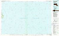 1986 Siasconset1986 Print · USGSEastern Nantucket in the mid-1980s displays a landscape of coastal bluffs and tidal ponds. Trace the shoreline from Siasconset to Wauwinet, locating Sankaty Head Lighthouse and the Cranberry Bog.
 - 1986 Map of Martha's Vineyard
 1986 Martha's Vineyard1986 Print · USGSThe Massachusetts islands of the mid-eighties appear in detail, showing the settled towns and wild coastlines before modern development shifts. Researchers can trace land use through the Martha's Vineyard State Forest or find old roads in Siasconset and Clevelandtown.
End of results
Showing maps 1-5 of 5
Top cities of Barnstable County
- Falmouth historical maps
- Yarmouth historical maps
- Sandwich historical maps
- Bourne historical maps
- Dennis historical maps
- Mashpee historical maps
See more
Frequently asked questions
- What are the different types of historical maps available for Barnstable County?
- What is the oldest map of Barnstable County?
- Where can I purchase historical maps of Barnstable County for my home or office?
- Where can I download high-res historical maps of Barnstable County?
- Are there historical topographic maps available for Barnstable County?
- Is there historical aerial imagery available for Barnstable County?
- Where are historical maps of Barnstable County sourced from?