Old Maps of Norfolk County, Massachusetts for Academic Research
Study the evolution of Norfolk County with 253 high-resolution historic maps. Whether you're teaching, researching, or modeling changes in land use, these maps provide essential visual documentation of urban, environmental, and geographic change.
- Analyze long-term change: Track patterns in development, transportation, and natural features.
- Ideal for environmental or urban studies: Support academic projects with primary historical map data.
- Use in the classroom or lab: Educators and researchers rely on these maps to bring historical context to life.
These maps are a powerful tool for teaching, research, and visualizing how Norfolk County has changed over the decades.
Norfolk County, MA maps
(253)- 1885 Map of Abington
 1885 Abington1885 Print · USGSCoastal Plymouth County villages and the early rail network are frozen in time just before the turn of the century. Genealogists can trace family footprints from the maritime hubs of Scituate Harbor to inland junctions like Queen Ann Corners and Weymouth Landing.
 - 1886 Map of Blackstone
 1886 Blackstone1886 Print · USGSThe Blackstone Valley at the height of its industrial era reveals a landscape of thriving mill towns and complex rail networks. Genealogists and historians can trace the growth of Whitinsville, Uxbridge, and East Douglas alongside landmarks like Purgatory Chasm.
 - 1886 Map of Dedham
 1886 Dedham1886 Print · USGSNorfolk County and its neighbors are captured here in the late nineteenth century as the rail networks expanded across eastern Massachusetts. Local historians can trace the routes of the Old Colony Railroad and find early village sites like Furnace Village and Sharon Heights.
 - 1886 Map of Framingham
 1886 Framingham1886 Print · USGSMiddlesex County emerges as a bustling hub of rail transit and water infrastructure at the close of the 1800s. Genealogists and historians can trace family locations near the Mass. State Muster Grounds, the State Prison, or the historic Wayside Inn.
 - 1887 Map of Franklin
 1887 Franklin1887 Print · USGSNorfolk County at the peak of the industrial rail era shows a complex landscape of mill villages and expanding transit lines. Trace the development of City Mills, follow the Old Colony R. R. Wrentham Branch, or locate old landmarks like Burnt Swamp Corner.
 - 1887 Map of Providence
 1887 Providence1887 Print · USGSProvidence and its surrounding mill towns are captured here at the height of the industrial era. Trace the rail-and-river infrastructure of the Blackstone River through Lorraine Mills, Saylesville, and the Cranston Print Works.
 - 1888 Map of Abington
 1888 Abington1888 Print · USGSCoastal Plymouth County thrives in the late 1880s as a hub of manufacturing and maritime trade connected by a dense rail network. Genealogists and historians can trace family-named sites like King Oak Hill or industrial landmarks such as the Iron Works and Old Spain.
 - 1889 Map of Providence
 1889 Providence1889 Print · USGSProvidence and its industrial corridors thrive at the close of the nineteenth century as a massive rail-and-water network takes shape. Genealogists and historians can trace the foundations of local industry at the Sayles Bleachery or locate long-standing institutions like Friends School and Dexter Asylum.
 - 1889 Map of Blackstone
 1889 Blackstone1889 Print · USGSThe Blackstone River valley thrives as an industrial powerhouse in the late 1880s, defined by its dense network of mill towns and competing rail lines. Researchers can trace the legacy of textile manufacturing and early commerce through Whitinsville, the Hayden Row P.O., and Millville.
 - 1889 Map of Franklin
 1889 Franklin1889 Print · USGSThe industrial and rail hubs of Norfolk County are detailed in the late 1880s, documenting a time of rapid growth for mill towns and village centers. Researchers can trace historic station stops and hamlets like City Mills, Unionville, and Whitney Sta.
 - 1889 Map of Framingham
 1889 Framingham1889 Print · USGSThe Framingham and Concord region flourished as a late nineteenth-century rail and industrial hub. Genealogists and historians can trace the early layouts of Saxonville, the American Powder Co., and the Mass. State Muster Grounds.
 - 1892 Map of Boston Bay
 1892 Boston Bay1892 Print · USGSThe outer harbor and North Shore coastline are captured in the late Victorian era, before modern development reshaped the beaches and islands. Genealogists and maritime historians can trace the early rail lines to Revere Beach or locate historic defenses like Fort Warren and the iconic Boston Light.4 unique versions available
 - 1893 Map of Abington
 1893 Abington1893 Print · USGSCoastal and inland Massachusetts thrive at the peak of the rail era, where the Old Colony Railroad links maritime harbors to inland factory towns. You can trace 19th-century village life through local landmarks like Weymouth Landing, Queen Ann Corners, and the Old Oaken Bucket Homestead.9 unique versions available
 - 1893 Map of Franklin
 1893 Franklin1893 Print · USGSEastern Massachusetts at the close of the nineteenth century was a landscape of busy rail junctions and riverside mill towns. Researchers can trace the era's industrial footprint through sites like City Mills, Medfield Junc., and the isolated Burnt Swamp Corner.8 unique versions available
 - 1893 Map of Boston
 1893 Boston1893 Print · USGSGreater Boston and the Massachusetts coast are captured here in the late nineteenth century as streetcar suburbs and rail lines redefined the region. Trace family roots and local history across old neighborhoods like Washington Village, coastal landmarks like Fort Independence, and the sprawling Middlesex Fells.4 unique versions available
 - 1893 Map of Blackstone
 1893 Blackstone1893 Print · USGSThe Blackstone River valley at the height of its industrial era reveals a landscape of vital mill towns and complex rail networks. Genealogists and historians can trace the early footprints of Whitinsville, Uxbridge, and Millville alongside landmarks like Purgatory Chasm.2 unique versions available
 - 1894 Map of Dedham
 1894 Dedham1894 Print · USGSGreater Boston's southern suburbs emerge during the late nineteenth century as a dense network of railroad lines and water-powered industrial centers. Genealogists and historians can trace old neighborhoods from Readville and Endicott to the heights of Great Blue Hill.10 unique versions available
 - 1894 Map of Framingham
 1894 Framingham1894 Print · USGSMiddlesex County in the late nineteenth century is a landscape of thriving rail depots and literary landmarks. Genealogists and historians can trace the foundations of local life at the Wayside Inn, the State Prison, and the Mass. State Muster Grounds.11 unique versions available
 - 1894 Map of Providence
 1894 Providence1894 Print · USGSThe industrial corridor from Providence to Pawtucket thrives in the 1890s as a hub of rail and river commerce. Genealogists can trace early neighborhood lines and locate vanished institutions like the Dexter Asylum, Sayles Bleachery, and the Butler Hospital.10 unique versions available
 - 1900 Map of Blackstone
 1900 Blackstone1900 Print · USGSThe Blackstone Valley was a bustling manufacturing corridor when this late Victorian-era survey was published. Genealogists and historians can trace the industrial mill villages along the Blackstone River, including Whitinsville, Manchaug, and Millville.7 unique versions available
 - 1903 Map of Boston
 1903 Boston1903 Print · USGSThe Greater Boston area and its sprawling rail-and-river network are captured here at the turn of the century. Genealogists and historians can trace neighborhood blocks, the grounds of Tufts College, and military landmarks like Ft. Winthrop and Ft. Independence.13 unique versions available
 - 1903 Map of Boston Bay
 1903 Boston Bay1903 Print · USGSThe Massachusetts North and South Shores are seen here at the turn of the century as a hub of rail-connected maritime life. You can trace the path of old rail divisions to historic coastal landings at Point of Pines, Marblehead, and the naval defenses at Ft. Warren.9 unique versions available
 - 1908 Map of Quinsigamond
 1908 Quinsigamond1908 Print · USGSCentral Massachusetts and its bordering states are seen here in the early twentieth century as industry and transit reshaped the Blackstone Valley. Genealogists and historians can trace the early footprints of Worcester, the expansion of the Wachusett Reservoir, and rail lines like the Boston and Albany Railroad.3 unique versions available
 - 1918 Map of Framingham
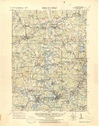 1918 Framingham1918 Print · USGSEastern Massachusetts is seen here as a bustling rail-and-river corridor during the early twentieth century. Genealogists and historians can trace old property lines and landmarks like the Wayside Inn, the State Prison, and Nine Acre Corner.2 unique versions available
 - 1919 Map of Dedham
 1919 Dedham1919 Print · USGSNorfolk County at the close of the Great War reveals a landscape defined by the Blue Hills Reservation and a dense network of industrial rail lines. Genealogists and historians can trace old neighborhood boundaries in Readville and Islington or locate lost trackside stops along the Old Colony RR.
Showing maps 1-25 of 253
Top cities of Norfolk County
- Quincy historical maps
- Brookline historical maps
- Weymouth historical maps
- Braintree historical maps
- Randolph historical maps
- Franklin historical maps
See more
Frequently asked questions
- What are the different types of historical maps available for Norfolk County?
- What is the oldest map of Norfolk County?
- Where can I purchase historical maps of Norfolk County for my home or office?
- Where can I download high-res historical maps of Norfolk County?
- Are there historical topographic maps available for Norfolk County?
- Is there historical aerial imagery available for Norfolk County?
- Where are historical maps of Norfolk County sourced from?