1970s Maps of Plymouth County, Massachusetts
Explore 41 historic maps of Plymouth County from the 1970s. These maps offer a rare glimpse into what life looked like during the 1970s — showing old roads, neighborhoods, homes, and landmarks that have changed or disappeared over time.
Whether you're researching your family's past, planning a metal detecting trip, or studying how Plymouth County's landscape evolved across the 1970s, these high-resolution maps are a powerful tool for exploring the history of this region.
- Focus on a specific era: All maps on this page are from the 1970s, giving you a focused view of this time period.
- See what’s changed: Compare century-old streets, trails, and buildings to today's modern landscape using overlays and satellite layers.
- Research with precision: Use these maps for genealogy, historical research, land use analysis, or educational projects.
- View, download, or print: Maps are fully viewable online in high resolution, and can be downloaded or printed for your own records.
Start exploring Plymouth County's history through authentic maps from the 1970s. This is your window into the past.
Plymouth County, MA maps
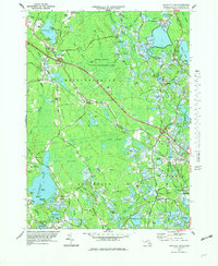
(41)- 1971 Map of Blue Hills, 1972 Print
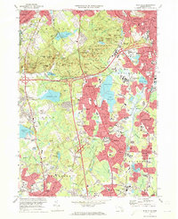 1971 Blue Hills1972 Print · USGSGreater Boston's southern suburbs and the forested Blue Hills are captured here during the early seventies' era of suburban expansion. Trace local family history at Blue Hill Cemetery or Holy Sepulchre Cem, and locate long-standing institutions like Curry College and Thayer Academy.2 unique versions available
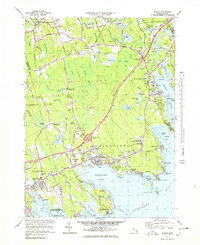
 - 1971 Map of Hull, 1972 Print
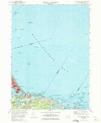
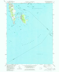
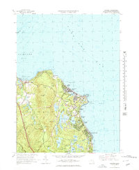
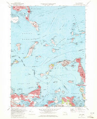 1971 Hull1972 Print · USGSThe outer Boston islands and the Nantasket peninsula are shown in detail during the early seventies, capturing a landscape of coastal defense and maritime history. Researchers can trace the footprints of Fort Warren, the iconic Boston Lighthouse, and institutional sites like the Long Island Hospital.2 unique versions available
 - 1971 Map of Weymouth, 1973 Print
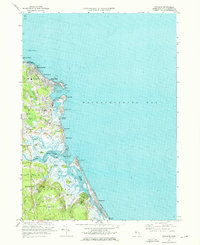
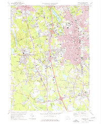
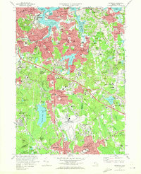 1971 Weymouth1973 Print · USGSThe Norfolk County coastline and its industrial suburbs are captured here in the early seventies, showing a period of high military and maritime activity. Genealogists and local historians can trace the grounds of the South Weymouth Naval Air Station or locate family plots in Fairmount Cemetery and Old North Cem.2 unique versions available
 - 1972 Map of Wareham, 1974 Print
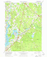
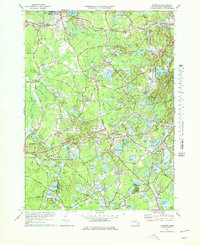
 1972 Wareham1974 Print · USGSCoastal Massachusetts in the early seventies shows a balance between sprawling wildlands and the industrial cranberry harvest. Genealogists and historians can trace the town's development through the Penn Central rail corridor and sites like St Patricks Cem and the State Correctional Institution Forestry Camp.3 unique versions available
 - 1974 Map of Nantasket Beach, 1975 Print
 1974 Nantasket Beach1975 Print · USGSThe South Shore's famous coastal resorts and hazardous shipping lanes are detailed in this mid-seventies survey of the Massachusetts coast. Genealogists and historians can trace the footprint of Paragon Park, the homes of North Cohasset, and the offshore beacons like Boston Light.2 unique versions available
 - 1974 Map of Scituate, 1976 Print
 1974 Scituate1976 Print · USGSThe South Shore of Massachusetts in the mid-seventies reveals a mix of coastal resort life and deep-seated maritime history. Genealogists and historians can trace family plots at Union Cem, locate the old Railroad Grade near Greenbush, or study the shoreline at Peggotty Beach.3 unique versions available
 - 1974 Map of Cohasset, 1976 Print
 1974 Cohasset1976 Print · USGSCoastal Massachusetts at the height of the 1970s reveals a mix of maritime villages and expanding suburban centers nestled between massive state parklands. Genealogists and historians can trace lineage through First Parish Cem or locate the historic Maryknoll Seminary and Glastonbury Monastery.2 unique versions available
 - 1974 Map of Duxbury, 1978 Print
 1974 Duxbury1978 Print · USGSCoastal Massachusetts in the mid-seventies shows a fascinating blend of Pilgrim-era landmarks and modern coastal growth. Genealogists and historians can trace the Site of Myles Standish Homestead, locate the Old Burying Ground (Myles Standish), and explore the rail corridor of the Penn Central.2 unique versions available
 - 1975 Map of Brockton, 1977 Print
 1975 Brockton1977 Print · USGSThe city of Brockton and surrounding towns are shown in the mid-seventies just as the modern highway system was fully integrating with old village centers. Researchers can trace historic institutions and local landmarks like Stonehill College, Stoughton Junction, and the Hockomock Swamp.2 unique versions available
 - 1975 Map of Sconticut Neck, 1977 Print
 1975 Sconticut Neck1977 Print · USGSThe Fairhaven coastline at the mid-seventies is defined by the narrow reach of Sconticut Neck and the offshore community of West Island. Local researchers can trace the residential road networks and identify coastal landmarks like Silver Shell Beach, Wilbur Pt, and the Causeway.2 unique versions available
 - 1977 Map of Assonet
 1977 Assonet1977 Print · USGSCoastal Massachusetts at the height of the 1970s shows a landscape of tidal rivers and growing infrastructure near the Bristol and Plymouth county lines. Genealogists and local historians can trace family plots at Old Quaker Cem or Richmond Cem and locate landmarks like Old Town Landing.3 unique versions available
 - 1977 Map of Plympton
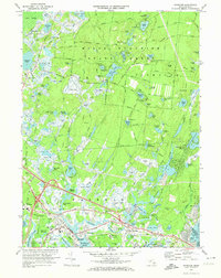
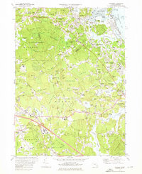
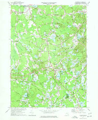 1977 Plympton1977 Print · USGSCranberry bogs and sprawling wetlands dominate the Plymouth County landscape in the mid-seventies. Genealogists and local historians can trace family roots near Lakenham Cem, locate the Cole Mill, and explore old crossroads like Harrubs Corner and Eddyville.4 unique versions available
 - 1977 Map of Plymouth, 1978 Print
 1977 Plymouth1978 Print · USGSThe cranberry-growing heartland of Plympton and Carver is captured here in the late seventies, showing a landscape defined by industrial bogs and old crossroads. Genealogists and local historians can trace family-named landmarks like Maxim Corner and Lakenham Cem or the route of the Penn Central railroad.4 unique versions available
 - 1977 Map of Whitman, 1978 Print
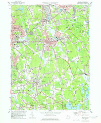 1977 Whitman1978 Print · USGSPlymouth County in the late seventies is a landscape of established rail corridors and industrial waterworks. Researchers can trace family sites near St Patricks Cemetery, Massasoit College, or the extensive Cranberry Bogs bordering Hanson.4 unique versions available
 - 1977 Map of Bridgewater, 1978 Print
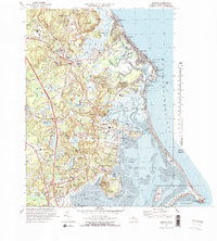
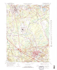 1977 Bridgewater1978 Print · USGSBridgewater and Middleboro appear in the late seventies as significant rail and river hubs south of Brockton. Genealogists and local historians can trace family plots at St Marys Cem or locate the Pratt Free Sch and Paper Mill Village.3 unique versions available
 - 1977 Map of Manomet, 1978 Print
 1977 Manomet1978 Print · USGSThe Plymouth coastline in the mid-1970s reveals a unique blend of heritage sites and working landscapes. Researchers can trace family-named landmarks and local industry from the Plimoth Plantation to the Cranberry Bogs and the coastal bluffs of Churchill Landing.3 unique versions available
 - 1977 Map of Snipatuit Pond, 1979 Print
 1977 Snipatuit Pond1979 Print · USGSPlymouth County's cranberry country and wetland heritage are preserved in this mid-seventies survey of the Middleborough and Wareham borderlands. Genealogists and local historians can trace family-named crossroads like Douglas Corner, find old burial sites at Union Cem, and locate the Seaplane Base on the shore of Snipatuit Pond.2 unique versions available
 - 1977 Map of Marion, 1979 Print
 1977 Marion1979 Print · USGSCoastal life in the late seventies is centered on the harbor towns of Marion and Mattapoisett during a period of modern infrastructure expansion. Genealogists and historians can trace family roots through Barlow Cem, the historic Sturtevant Mill, and local schools like Tabor Academy.4 unique versions available
 - 1977 Map of Weymouth, 1980 Print
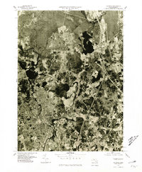
 1977 Weymouth1980 Print · USGSThe South Shore landscape comes into sharp focus in the late seventies through this detailed aerial orthophoto. Trace the residential growth of Weymouth and Braintree, or study the coastal inlets of the Weymouth Fore River.
 - 1977 Map of Nantasket Beach, 1980 Print
 1977 Nantasket Beach1980 Print · USGSThe South Shore's coastline in the late seventies is captured here through detailed aerial photography. You can trace the residential patterns of North Cohasset and the fragile peninsula of Nantasket Beach along Straits Pond.
 - 1977 Map of Hull, 1980 Print
 1977 Hull1980 Print · USGSThe Massachusetts coastline and Boston Harbor islands are captured in high detail in the late seventies. Genealogists and historians can trace the exact footprint of neighborhoods in Hull and Winthrop or follow the paths of the Fore River and Weir River.
 - 1977 Map of Blue Hills, 1980 Print
 1977 Blue Hills1980 Print · USGSSouth of the city in the late seventies, this aerial survey captures the evolving suburban landscape between the Blue Hills Range and Stoughton. Researchers can trace the development of residential neighborhoods and highway corridors in Randolph, Quincy, and Braintree.
 - 1977 Map of Cohasset, 1980 Print
 1977 Cohasset1980 Print · USGSThe South Shore landscape of the late seventies is captured here in literal detail, from the coastline to the inland woods. Researchers can examine the exact layout of settlements like Cohasset, North Scituate, and Greenbush.
 - 1977 Map of Taunton, 1981 Print
 1977 Taunton1981 Print · USGSThe Bristol County landscape in the late seventies is shown in photographic detail, capturing the dense street patterns and suburban growth around the Taunton River. Researchers can trace the layout of Taunton and Raynham Center or locate properties near the shores of Lake Nippenicket.
 - 1977 Map of Sconticut Neck, 1981 Print
 1977 Sconticut Neck1981 Print · USGSThe Bristol County coast appears as it did in the late seventies through this detailed aerial imagery. Local historians can trace the development patterns across Sconticut Neck, the connection to West Island, and the shoreline of Buzzards Bay.
Showing maps 1-25 of 41
Top cities of Plymouth County
- Brockton historical maps
- Plymouth historical maps
- Bridgewater historical maps
- Marshfield historical maps
- Hingham historical maps
- Wareham historical maps
See more
Frequently asked questions
- What are the different types of historical maps available for Plymouth County?
- What is the oldest map of Plymouth County?
- Where can I purchase historical maps of Plymouth County for my home or office?
- Where can I download high-res historical maps of Plymouth County?
- Are there historical topographic maps available for Plymouth County?
- Is there historical aerial imagery available for Plymouth County?
- Where are historical maps of Plymouth County sourced from?