Old Maps of Hulbert Township, Michigan for Hiking & Exploration
Hike through history with 20 historic maps of Hulbert Township. Explore old trails, ghost towns, and forgotten backroads — perfect for outdoor adventurers and local explorers.
- Rediscover forgotten places: Map out old mining camps, roads, and footpaths that no longer exist on modern maps.
- Layer with modern tools: Combine with LiDAR or satellite views to plan hikes through historical terrain.
- Made for exploration: Popular among hikers, overlanders, and local history lovers.
Use these maps to find adventure and explore the hidden past of Hulbert Township.
Hulbert Township, MI maps
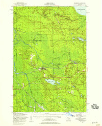
(20)- 1931 Map of Epoufette NE
 1931 Epoufette NE1931 Print · USGSUpper Peninsula timber and rail corridors come alive in this early 1930s survey of the Chippewa and Mackinac county line. Genealogy and transit researchers can trace the tracks of the Duluth South Shore and Atlantic near Wilwin and the waters of Trout Lake.
 - 1931 Map of Epoufette NW
 1931 Epoufette NW1931 Print · USGSMackinac County's industrial and rail corridor is captured here in the early thirties as stone and timber drove the local economy. Genealogists and historians can trace the foundations of Rexton, Caffey, and the extensive works at Fiborn Quarry.
 - 1951 Map of Piatt Lake, 1955 Print
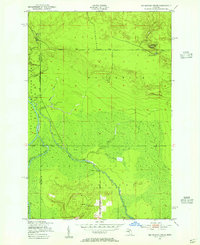
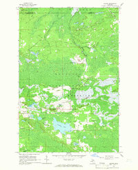
 1951 Piatt Lake1955 Print · USGSUpper Peninsula timberlands and the Lake Superior coast are captured here in the early fifties. Local historians can trace the forestry network around Eckerman Lookout Tower or locate the shoreline camps near Tahquamenon Bay and Piatt Lake.3 unique versions available
 - 1951 Map of Big Beaver Creek, 1955 Print
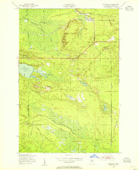
 1951 Big Beaver Creek1955 Print · USGSUpper Peninsula timberlands and river systems are captured in the early fifties at the junction of three forests. Researchers can trace the logging history of the region via Cadillac Soo Camp 14, Buckhorn Lodge, and a Sawmill.3 unique versions available
 - 1951 Map of Hulbert, 1955 Print
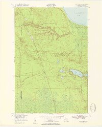
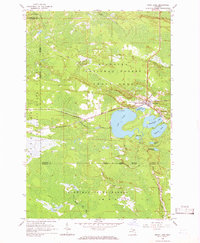
 1951 Hulbert1955 Print · USGSChippewa County timberlands and river systems are shown here in the early fifties, centered on the village of Hulbert. Trace the path of the Duluth South Shore and Atlantic railroad or locate Hulbert Cem and The Antlers Cabins near the lake.3 unique versions available
 - 1951 Map of Eckerman, 1955 Print
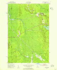
 1951 Eckerman1955 Print · USGSUpper Peninsula timberlands and hunting grounds are captured here in the early fifties, centered on the rail junction at Eckerman. Genealogists and local historians can locate private camps like Petersburg Club, the O Conner Airstrip, and the Eckerman Corner Lookout Tower.2 unique versions available
 - 1951 Map of Eckerman, 1958 Print
 1951 Eckerman1958 Print · USGSIn the early 1950s, this portion of Chippewa County remained a landscape of remote sporting camps and timber interests tied to the rail line. Researchers can locate family landmarks like the Hulbert Cem, Eckerman Corner, and the Cadillac Soo Camp 14.2 unique versions available
 - 1954 Map of Sault Sainte Marie, 1979 Print
 1954 Sault Sainte Marie1979 Print · USGSThe Eastern Upper Peninsula and Ontario borderlands are captured here at the height of the mid-century era. Family historians can trace settlements like Grand Marais and Stalwart, while mapping the strategic grounds of Kincheloe AFB.3 unique versions available
 - 1956 Map of Sault Sainte Marie, 1964 Print
 1956 Sault Sainte Marie1964 Print · USGSThe Eastern Upper Peninsula and the Canadian border meet in this mid-sixties survey of the bustling Soo Locks region. Genealogists and historians can trace the paths of the Soo Line and locate lakeside communities from Grand Marais to Shelldrake.2 unique versions available
 - 1957 Map of Sault Sainte Marie
 1957 Sault Sainte Marie1957 Print · USGSThe Upper Peninsula and Ontario border come alive in this mid-century portrait of the eastern Lake Superior shoreline and the vital St. Marys River corridor. Genealogists and historians can trace rail-era settlements from Newberry to Detour, while locating military landmarks like Kinross Air Force Base.
 - 1958 Map of Sault Sainte Marie
 1958 Sault Sainte Marie1958 Print · USGSThe eastern Upper Peninsula and the Canadian borderland appear here during the late fifties, a time of military growth and forest management. Researchers can locate vanished rail stops along the Soo Line, early sites like the Fiborn Quarry, and the sprawling Kinross Air Force Base.
 - 1964 Map of Rexton, 1966 Print
 1964 Rexton1966 Print · USGSThe Upper Peninsula’s timber and mining heritage is on display in this mid-century survey of Mackinac County. Researchers can trace the legacy of the Fiborn Quarry and the Soo Line railroad near Rexton and the Caffey Cem.2 unique versions available
 - 1964 Map of Trout Lake, 1966 Print
 1964 Trout Lake1966 Print · USGSTrout Lake emerged as a vital Upper Peninsula rail hub in the mid-twentieth century, surrounded by the deep woods of the Hiawatha and Mackinac State Forests. Researchers can trace the original Soo Line rail corridors, the historic Lakeview Cem, and local landmarks like School No 15.2 unique versions available
 - 1985 Map of Manistique Lake
 1985 Manistique Lake1985 Print · USGSThe eastern Upper Peninsula’s wilderness and rail-side villages are captured here in the mid-1980s, from the Soo Line corridor to the Lake Michigan shore. Genealogists and historians can trace the foundations of local life in Newberry, Engadine, and Seney, alongside industrial landmarks like the Calspar Quarry Pool.2 unique versions available
 - 2023 Map of Big Beaver Creek, 2023 Print
 2023 Big Beaver Creek2023 Print · USGSChippewa and Luce counties are mapped here in the early twenty-first century, showcasing the wetland interior of the Upper Peninsula. Genealogists and historians can trace the paths of the Tahquamenon River and Hendrie River or locate remote landmarks like Young's Airport.
 - 2023 Map of Eckerman, 2023 Print
 2023 Eckerman2023 Print · USGSChippewa County in the early twenty-first century remains a landscape of deep woods and winding waterways. Researchers can trace the quiet settlements of Eckerman and Seewhy alongside recreational corridors like the Trout Lake-Hulbert Snowmo Trl.
 - 2023 Map of Hulbert, 2023 Print
 2023 Hulbert2023 Print · USGSChippewa County is defined by the wetlands and winding river branches of the Upper Peninsula in this modern survey. Researchers can trace the layout of Hulbert, locate the Hulbert Cem, and follow the courses of the Hendrie River and Riley Creek.
 - 2023 Map of Rexton, 2023 Print
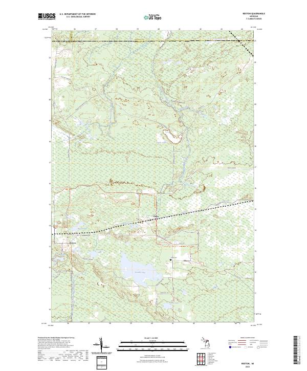 2023 Rexton2023 Print · USGSMackinac County's timber and marshlands are documented here in the early twenty-first century, centered on the communities of Rexton and Caffey. Genealogists and outdoor historians can locate the Caffey Cemetery and trace old transit routes like Dinkey Line Road and the Hiawatha Trail.
 - 2023 Map of Trout Lake, 2023 Print
 2023 Trout Lake2023 Print · USGSTrout Lake sits at the junction of Mackinac and Chippewa counties in the Upper Peninsula during the early 2020s. Researchers can locate local landmarks like Lakeview Cem and trace the paths of the South Branch Carp River and Frenchman Lake.
 - 2023 Map of Piatt Lake, 2023 Print
 2023 Piatt Lake2023 Print · USGSChippewa County’s northern shoreline meets the Great Lakes in this recent study of the Upper Peninsula’s forest lands. Trace the routes of the North Country National Scenic Trl and Raco Paradise Sno-mo Trl as they navigate the woods around Piatt Lake and Roxbury Pond.
End of results
Showing maps 1-20 of 20
Top cities near Hulbert Township
Top neighborhoods of Hulbert Township
Frequently asked questions
- What are the different types of historical maps available for Hulbert Township?
- What is the oldest map of Hulbert Township?
- Where can I purchase historical maps of Hulbert Township for my home or office?
- Where can I download high-res historical maps of Hulbert Township?
- Are there historical topographic maps available for Hulbert Township?
- Is there historical aerial imagery available for Hulbert Township?
- Where are historical maps of Hulbert Township sourced from?