2020s Maps of Orange Township, Michigan
Explore 4 historic maps of Orange Township from the 2020s. These maps offer a rare glimpse into what life looked like during the 2020s — showing old roads, neighborhoods, homes, and landmarks that have changed or disappeared over time.
Whether you're researching your family's past, planning a metal detecting trip, or studying how Orange Township's landscape evolved across the 2020s, these high-resolution maps are a powerful tool for exploring the history of this region.
- Focus on a specific era: All maps on this page are from the 2020s, giving you a focused view of this time period.
- See what’s changed: Compare century-old streets, trails, and buildings to today's modern landscape using overlays and satellite layers.
- Research with precision: Use these maps for genealogy, historical research, land use analysis, or educational projects.
- View, download, or print: Maps are fully viewable online in high resolution, and can be downloaded or printed for your own records.
Start exploring Orange Township's history through authentic maps from the 2020s. This is your window into the past.
Orange Township, MI maps
(4)- 2023 Map of Portland South, 2023 Print
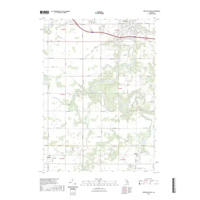 2023 Portland South2023 Print · USGSThe Grand River valley and the agricultural border between Ionia and Eaton Counties are documented here in recent years. Researchers can trace family sites at Portland City Cem or East Sebewa Cem and locate local landmarks like Hiram Cure Airport.
 - 2023 Map of Portland North, 2023 Print
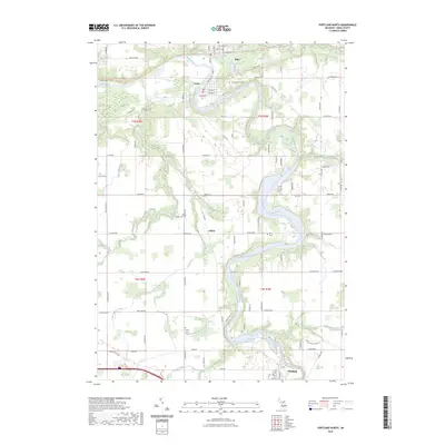 2023 Portland North2023 Print · USGSIonia County's river valleys come alive in the 2020s, showing the enduring layouts of Muir, Lyons, and Portland along the water. Researchers can locate family heritage sites at Lyons Township Cemetery or trace the historic Union Burial Ground and Keefer Cemetery.
 - 2023 Map of Woodbury, 2023 Print
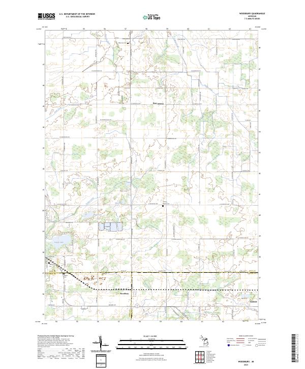 2023 Woodbury2023 Print · USGSThe rural borders of Ionia, Barry, and Eaton counties come into focus during this modern era of Michigan agriculture. Genealogists and local historians can trace family ties through the Sebewa Baptist Cem or explore the wetlands surrounding Tupper Lake and Woodbury.
 - 2023 Map of Ionia, 2023 Print
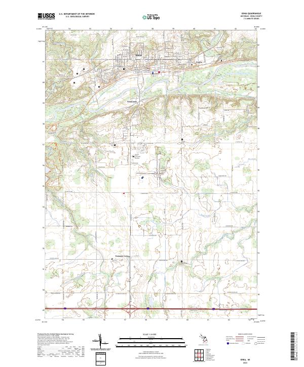 2023 Ionia2023 Print · USGSIonia and the Grand River valley are shown here in the 2020s, blending historic civic centers with expansive riverfront trails. Researchers can trace family sites at Oakhill Cem and Highland Park Cem or locate the rural crossroads at Tremain Corners.
End of results
Showing maps 1-4 of 4
Top cities near Orange Township
- Ionia historical maps
- Belding historical maps
- Portland historical maps
- Orleans historical maps
- Lake Odessa historical maps
- Saranac historical maps
See more
Top neighborhoods of Orange Township
Frequently asked questions
- What are the different types of historical maps available for Orange Township?
- What is the oldest map of Orange Township?
- Where can I purchase historical maps of Orange Township for my home or office?
- Where can I download high-res historical maps of Orange Township?
- Are there historical topographic maps available for Orange Township?
- Is there historical aerial imagery available for Orange Township?
- Where are historical maps of Orange Township sourced from?