1910s Maps of Ada Township, Michigan
Explore 3 historic maps of Ada Township from the 1910s. These maps offer a rare glimpse into what life looked like during the 1910s — showing old roads, neighborhoods, homes, and landmarks that have changed or disappeared over time.
Whether you're researching your family's past, planning a metal detecting trip, or studying how Ada Township's landscape evolved across the 1910s, these high-resolution maps are a powerful tool for exploring the history of this region.
- Focus on a specific era: All maps on this page are from the 1910s, giving you a focused view of this time period.
- See what’s changed: Compare century-old streets, trails, and buildings to today's modern landscape using overlays and satellite layers.
- Research with precision: Use these maps for genealogy, historical research, land use analysis, or educational projects.
- View, download, or print: Maps are fully viewable online in high resolution, and can be downloaded or printed for your own records.
Start exploring Ada Township's history through authentic maps from the 1910s. This is your window into the past.
Ada Township, MI maps
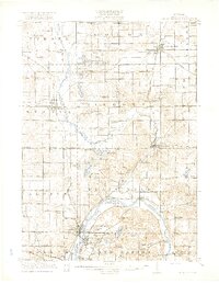
(3)- 1914 Map of Grand Rapids
 1914 Grand Rapids1914 Print · USGSGrand Rapids and its southern townships are captured in detail just before the Great War, showing a landscape defined by river industry and rail lines. Local historians can trace early settlements and schools such as Kelloggsville and Red School, or locate family landmarks near Reeds Lake.5 unique versions available
 - 1918 Map of Cedar Springs
 1918 Cedar Springs1918 Print · USGSKent County north of Grand Rapids is shown here during the First World War, when railroads and small-town commerce linked the rural townships. Genealogists can trace family landmarks and schools like Block Tavern School, Soldiers Home, and the milling sites at Raines Mill.3 unique versions available
 - 1918 Map of Lowell
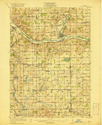 1918 Lowell1918 Print · USGSThe Kent and Ionia county borderlands come into focus during the Great War era as a landscape of interconnected river valleys and rural school districts. Genealogists and historians can trace old homesteads near Fallassburg, the rail junctions at Elmdale, and dozens of local landmarks like the Little Brick School.4 unique versions available
End of results
Showing maps 1-3 of 3
Top cities near Ada Township
- Grand Rapids historical maps
- Wyoming historical maps
- Kentwood historical maps
- Plainfield Charter Township historical maps
- Gaines Charter Township historical maps
- Byron Township historical maps
See more
Top neighborhoods of Ada Township
Frequently asked questions
- What are the different types of historical maps available for Ada Township?
- What is the oldest map of Ada Township?
- Where can I purchase historical maps of Ada Township for my home or office?
- Where can I download high-res historical maps of Ada Township?
- Are there historical topographic maps available for Ada Township?
- Is there historical aerial imagery available for Ada Township?
- Where are historical maps of Ada Township sourced from?