Old Maps of Saint Ignace Township, Michigan
Explore 22 old maps of Saint Ignace Township, spanning from 1931 to today. These high-resolution historic maps reveal how streets, neighborhoods, landmarks, and natural features evolved over time — perfect for genealogy, metal detecting, research, and local history exploration.
What you can do with these maps:
- See how Saint Ignace Township changed over time: Compare historical maps to modern-day views to trace roads, homesites, rail lines & more.
- View detailed metadata: Each map includes creators, publishers, year, scale, and archive source.
- Overlay maps with satellite & LiDAR: Visualize the past alongside modern tools to explore terrain & human change.
- Trusted historical sources: Maps sourced from the USGS, Library of Congress, and other archives.
- Access maps your way: View online, download high-res files, or order prints for personal or research use.
Start exploring old maps of Saint Ignace Township to uncover forgotten places, hidden landmarks, and the deep history beneath your feet.
Saint Ignace Township, MI maps
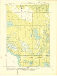
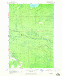
(22)- 1931 Map of St Ignace NW
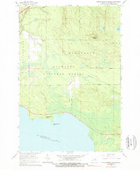
 1931 St Ignace NW1931 Print · USGSCovers Saint Ignace Township, including Saint Ignace, Mackinac Island, and other nearby areas
 - 1931 Map of Moran NE
 1931 Moran NE1931 Print · USGSCovers Saint Ignace Township, including Moran, Brevort Township, and other nearby areas
 - 1931 Map of Ozark SE
 1931 Ozark SE1931 Print · USGSCovers Saint Ignace Township, including Brevort Township, Mackinac County, and other nearby areas2 unique versions available
 - 1932 Map of St Ignace NE
 1932 St Ignace NE1932 Print · USGSCovers Saint Ignace Township, including Mackinac Island, Marquette Township, and other nearby areas
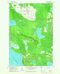
 - 1948 Map of Moran NE
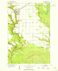
 1948 Moran NE1948 Print · USGSCovers Saint Ignace Township, including Moran, Brevort Township, and other nearby areas
 - 1953 Map of Rudyard, 1955 Print
 1953 Rudyard1955 Print · USGSCovers Saint Ignace Township, including Rudyard, Marquette Township, and other nearby areas2 unique versions available
 - 1953 Map of Fibre, 1955 Print
 1953 Fibre1955 Print · USGSCovers Saint Ignace Township, including Trout Lake Township, Dryburg, and other nearby areas3 unique versions available
 - 1954 Map of Sault Sainte Marie, 1979 Print
 1954 Sault Sainte Marie1979 Print · USGSCovers Saint Ignace Township, including Sault Ste. Marie, Sault Sainte Marie, and other nearby areas3 unique versions available
 - 1955 Map of Cheboygan, 1964 Print
 1955 Cheboygan1964 Print · USGSCovers Saint Ignace Township, including Petoskey, Peninsula Township, and other nearby areas5 unique versions available
 - 1956 Map of Sault Sainte Marie, 1964 Print
 1956 Sault Sainte Marie1964 Print · USGSCovers Saint Ignace Township, including Sault Ste. Marie, Sault Sainte Marie, and other nearby areas2 unique versions available
 - 1957 Map of Sault Sainte Marie
 1957 Sault Sainte Marie1957 Print · USGSCovers Saint Ignace Township, including Sault Ste. Marie, Sault Sainte Marie, and other nearby areas
 - 1958 Map of Cheboygan
 1958 Cheboygan1958 Print · USGSCovers Saint Ignace Township, including Petoskey, Peninsula Township, and other nearby areas2 unique versions available
 - 1958 Map of Sault Sainte Marie
 1958 Sault Sainte Marie1958 Print · USGSCovers Saint Ignace Township, including Sault Ste. Marie, Sault Sainte Marie, and other nearby areas
 - 1964 Map of Ozark NE, 1965 Print
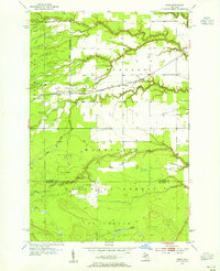
 1964 Ozark NE1965 Print · USGSCovers Saint Ignace Township, including Trout Lake Township, Brevort Township, and other nearby areas2 unique versions available
 - 1964 Map of Ozark SE, 1965 Print
 1964 Ozark SE1965 Print · USGSCovers Saint Ignace Township, including Brevort Township, Mackinac County, and other nearby areas2 unique versions available
 - 1964 Map of Moran, 1966 Print
 1964 Moran1966 Print · USGSCovers Saint Ignace Township, including Moran, Brevort Township, and other nearby areas2 unique versions available
 - 1964 Map of Evergreen Shores, 1966 Print
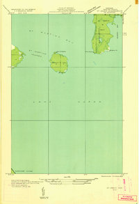
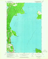 1964 Evergreen Shores1966 Print · USGSCovers Saint Ignace Township, including Saint Ignace, Mackinac Island, and other nearby areas2 unique versions available
 - 1964 Map of Charles, 1966 Print
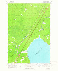 1964 Charles1966 Print · USGSCovers Saint Ignace Township, including Charles, Mackinac County, and other nearby areas2 unique versions available
 - 1964 Map of Pontchartrain Shores, 1966 Print
 1964 Pontchartrain Shores1966 Print · USGSCovers Saint Ignace Township, including Marquette Township, Simmons, and other nearby areas2 unique versions available
 - 1964 Map of St. Martin Island, 1966 Print
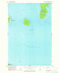 1964 St. Martin Island1966 Print · USGSCovers Saint Ignace Township, including Mackinac Island, Marquette Township, and other nearby areas2 unique versions available
 - 1984 Map of Cheboygan, 1985 Print
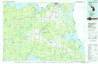
 1984 Cheboygan1985 Print · USGSCovers Saint Ignace Township, including Cheboygan, Saint Ignace, and other nearby areas
 - 1984 Map of Sault Ste. Marie South, 1985 Print
 1984 Sault Ste. Marie South1985 Print · USGSCovers Saint Ignace Township, including Sault Ste. Marie, Sault Sainte Marie, and other nearby areas2 unique versions available
End of results
Showing maps 1-22 of 22
Top cities near Saint Ignace Township
- Saint Ignace historical maps
- Rudyard historical maps
- Moran historical maps
- Mackinac Island historical maps
Top neighborhoods of Saint Ignace Township
Frequently asked questions
- What are the different types of historical maps available for Saint Ignace Township?
- What is the oldest map of Saint Ignace Township?
- Where can I purchase historical maps of Saint Ignace Township for my home or office?
- Where can I download high-res historical maps of Saint Ignace Township?
- Are there historical topographic maps available for Saint Ignace Township?
- Is there historical aerial imagery available for Saint Ignace Township?
- Where are historical maps of Saint Ignace Township sourced from?