Old Maps of Menominee, Michigan for Academic Research
Study the evolution of Menominee with 22 high-resolution historic maps. Whether you're teaching, researching, or modeling changes in land use, these maps provide essential visual documentation of urban, environmental, and geographic change.
- Analyze long-term change: Track patterns in development, transportation, and natural features.
- Ideal for environmental or urban studies: Support academic projects with primary historical map data.
- Use in the classroom or lab: Educators and researchers rely on these maps to bring historical context to life.
These maps are a powerful tool for teaching, research, and visualizing how Menominee has changed over the decades.
Menominee, MI maps
(22)- 1939 Map of Marinette
 1939 Marinette1939 Print · USGSThe Green Bay shoreline and the Menominee River border come to life in the late 1930s as industrial and rural landscapes intersect. Genealogists can trace family footprints through numerous rural schools like Garfield Sch and Columbus Sch or the settlement at Winesville.
 - 1954 Map of Escanaba, 1967 Print
 1954 Escanaba1967 Print · USGSThe Upper Peninsula and Door County shorelines meet here in the mid-fifties, showing the vital maritime and timber networks of the Great Lakes. Researchers can trace historic rail lines, old fire lookouts like the Stonington Fire Tower, and island settlements such as Washington Island.2 unique versions available
 - 1957 Map of Escanaba
 1957 Escanaba1957 Print · USGSThe Upper Peninsula and Door County shorelines meet in the mid-fifties, capturing a landscape of timber, iron, and maritime trade. Genealogists and local historians can trace the Chicago & North Western RR through settlements like Hermansville or locate St Vitals Church and the Potawatome Indian Reservation.
 - 1958 Map of Escanaba
 1958 Escanaba1958 Print · USGSNorthern Lake Michigan maritime commerce and timberlands are captured here in the mid-fifties. Genealogists and historians can trace rail networks like the Escanaba and Lake Superior or locate island settlements such as Detroit Harbor and Fish Creek.
 - 1963 Map of Marinette West, 1964 Print
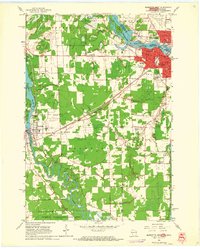 1963 Marinette West1964 Print · USGSMarinette and Peshtigo were bustling hubs of industry and education in the early sixties as they expanded along their respective rivers. Genealogists and historians can trace numerous family sites at Forest Home Cemetery and Riverside Cemetery, or locate vanished rural landmarks like Stewart Sch.2 unique versions available
 - 1963 Map of Birch Creek, 1964 Print
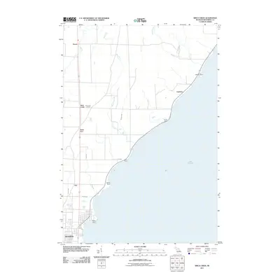
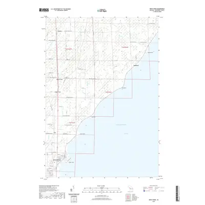
 1963 Birch Creek1964 Print · USGSThe Menominee County shoreline comes alive in the early sixties as a mix of growing neighborhoods and rural outposts. Genealogists can trace family roots through several local landmarks like Evergreen Sch, Grant Sch, and the community at Birch Creek.2 unique versions available
 - 1963 Map of Chappee Rapids, 1964 Print
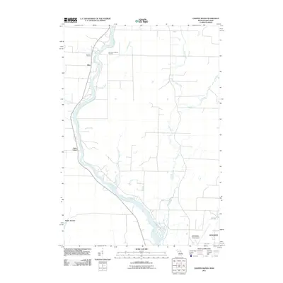
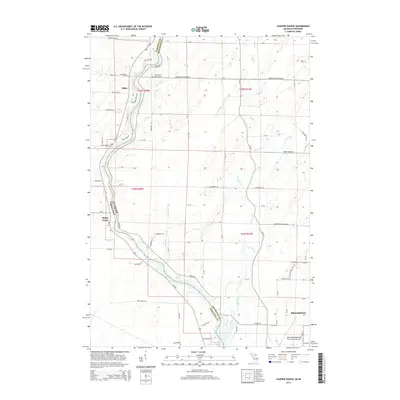
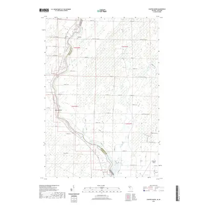
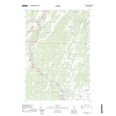
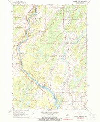 1963 Chappee Rapids1964 Print · USGSThe Menominee River borderlands are captured here in the mid-1960s, showing the rural transition between Wisconsin and Michigan. Genealogists and historians can trace family locations near St Marys Mission, the Winesville Cem, and the tracks of the Chicago Milwaukee St Paul and Pacific railroad.2 unique versions available
 - 1963 Map of Marinette East, 1964 Print
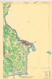
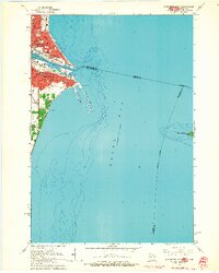 1963 Marinette East1964 Print · USGSMarinette and Menominee appear as vibrant twin ports in the early 1960s, flanking the river mouth where the Wisconsin and Michigan borders meet. Genealogists and historians can trace neighborhood growth through local schools like Sacred Heart Sch, the busy rail lines of the C & N W, and landmarks like Spies Field.2 unique versions available
 - 1963 Map of Marinette, 1965 Print
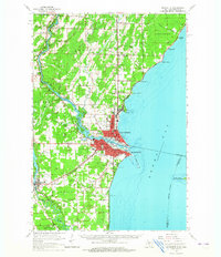 1963 Marinette1965 Print · USGSThe industrial twin cities of the Michigan-Wisconsin border are captured here in the early sixties, centered on the Menominee River and Green Bay coast. Genealogists and historians can trace rail lines, rural schoolhouses like Hamilton Sch, and family sites at Riverside Cem.
 - 1981 Map of Marinette, 1982 Print
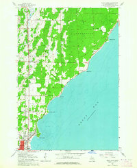
 1981 Marinette1982 Print · USGSThe Menominee River valley and Door County peninsula are captured here in the early 1980s, showcasing the region's timber and maritime foundations. Researchers can trace historic shorelines from Fish Creek to Deathdoor Bluff or locate inland landmarks like Lake Noquebay and Kangaroo Lake.
 - 2011 Map of Chappee Rapids, 2011 Print
 2011 Chappee Rapids2011 Print · USGSCovers Menominee, including Porterfield, Wagner, and other nearby areas
 - 2011 Map of Birch Creek, 2011 Print
 2011 Birch Creek2011 Print · USGSCovers Menominee, including Ingallston, Birch Creek, and other nearby areas
 - 2014 Map of Chappee Rapids, 2014 Print
 2014 Chappee Rapids2014 Print · USGSCovers Menominee, including Porterfield, Wagner, and other nearby areas
 - 2014 Map of Birch Creek, 2014 Print
 2014 Birch Creek2014 Print · USGSCovers Menominee, including Ingallston, Birch Creek, and other nearby areas
 - 2017 Map of Chappee Rapids, 2017 Print
 2017 Chappee Rapids2017 Print · USGSCovers Menominee, including Porterfield, Wagner, and other nearby areas
 - 2017 Map of Birch Creek, 2017 Print
 2017 Birch Creek2017 Print · USGSCovers Menominee, including Ingallston, Birch Creek, and other nearby areas
 - 2019 Map of Birch Creek, 2019 Print
 2019 Birch Creek2019 Print · USGSCovers Menominee, including Ingallston, Birch Creek, and other nearby areas
 - 2019 Map of Chappee Rapids, 2019 Print
 2019 Chappee Rapids2019 Print · USGSCovers Menominee, including Porterfield, Wagner, and other nearby areas
 - 2022 Map of Marinette East, 2022 Print
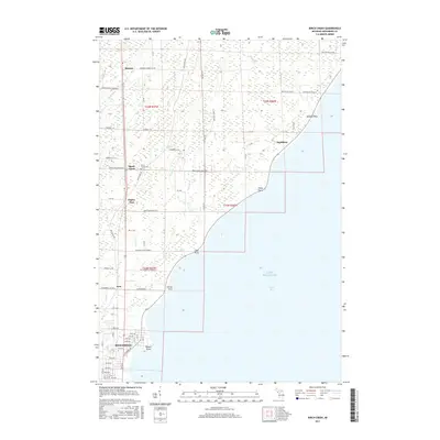
 2022 Marinette East2022 Print · USGSThe twin border cities of the Menominee River estuary are shown here in detail during the early 2020s. Trace the urban development near the Menominee County Courthouse or explore the coastal features of Seagull Bar and Green Island.
 - 2022 Map of Marinette West, 2022 Print
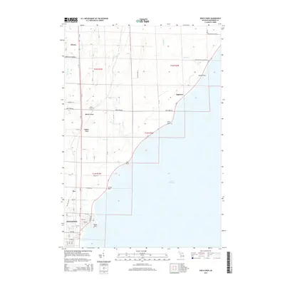
 2022 Marinette West2022 Print · USGSThe riverfront border between Wisconsin and Michigan comes into focus in this recent survey of the Twin Cities region. Genealogists and historians can trace numerous burial sites like Forest Home Cem and explore the area surrounding the Indian Mound.
 - 2023 Map of Birch Creek, 2023 Print
 2023 Birch Creek2023 Print · USGSThe Menominee County shoreline comes into focus during the early twenty-first century, showing the transition from rural woodlands to the city's edge. Researchers can locate the Birch Creek Cem and trace coastal landmarks like Stony Point and Beattie Point.
 - 2023 Map of Chappee Rapids, 2023 Print
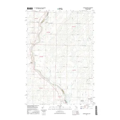
 2023 Chappee Rapids2023 Print · USGSThe river border between Michigan and Wisconsin is captured here in the 2020s, showcasing the rural landscapes along the Menominee River. Genealogists can locate Saint Mary's Mission Cem and Winesville Cem, while tracing local landmarks like Chappee Rapids and Rubys Corner.
End of results
Showing maps 1-22 of 22
Top cities near Menominee
- Marinette historical maps
- Oconto historical maps
- Peshtigo historical maps
- Peshtigo historical maps
- Porterfield historical maps
- Ingallston historical maps
See more
Top neighborhoods of Menominee
Frequently asked questions
- What are the different types of historical maps available for Menominee?
- What is the oldest map of Menominee?
- Where can I purchase historical maps of Menominee for my home or office?
- Where can I download high-res historical maps of Menominee?
- Are there historical topographic maps available for Menominee?
- Is there historical aerial imagery available for Menominee?
- Where are historical maps of Menominee sourced from?