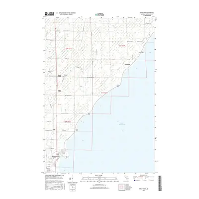
2017 Map of Birch Creek
USGS Topo · Published 2017About this map
Lake Michigan dominates the eastern shore of this Upper Peninsula landscape, where numerous points of land like Beattie Point and Stony Point define the rugged coastline of Green Bay. The interior is marked by a network of small creeks including Beattie Cr, Hill Cr, and Birch Cr, which drain the low-lying terrain. Small settlements and named locales such as Ingallston, Hansen, and Eagles Nest are connected by a grid of numbered roads and rural lanes, reflecting the post-war development of Menominee County.
Find a feature on this map
61 named features on this map. Tap any name to fly to it.
Don’t see what you’re looking for? This feature index may not catch every label — zoom into the map to look around manually.
Map Details
Editions of this 2017 Birch Creek Map
This is the sole edition of this map. No revisions or reprints were ever made.
Other maps of this area

1939 · Marinette
USGS Topo · 1:48,000

1949 · Stephenson
USGS Topo · 1:48,000

1954 · Escanaba
USGS Topo · 1:250,000

1957 · Escanaba
USGS Topo · 1:250,000

1958 · Escanaba
USGS Topo · 1:250,000

1961 · Chambers Island
USGS Topo · 1:62,500

1963 · Cedar River
USGS Topo · 1:62,500
1963 · Marinette West
USGS Topo · 1:24,000
1963 · Birch Creek
USGS Topo · 1:24,000
1963 · Chappee Rapids
USGS Topo · 1:24,000