2020s Maps of Midland County, Michigan
Explore 16 historic maps of Midland County from the 2020s. These maps offer a rare glimpse into what life looked like during the 2020s — showing old roads, neighborhoods, homes, and landmarks that have changed or disappeared over time.
Whether you're researching your family's past, planning a metal detecting trip, or studying how Midland County's landscape evolved across the 2020s, these high-resolution maps are a powerful tool for exploring the history of this region.
- Focus on a specific era: All maps on this page are from the 2020s, giving you a focused view of this time period.
- See what’s changed: Compare century-old streets, trails, and buildings to today's modern landscape using overlays and satellite layers.
- Research with precision: Use these maps for genealogy, historical research, land use analysis, or educational projects.
- View, download, or print: Maps are fully viewable online in high resolution, and can be downloaded or printed for your own records.
Start exploring Midland County's history through authentic maps from the 2020s. This is your window into the past.
Midland County, MI maps
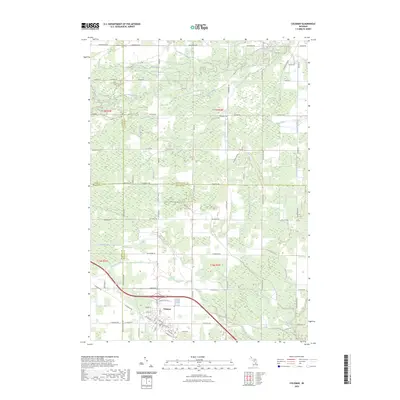
(16)- 2023 Map of Hemlock, 2023 Print
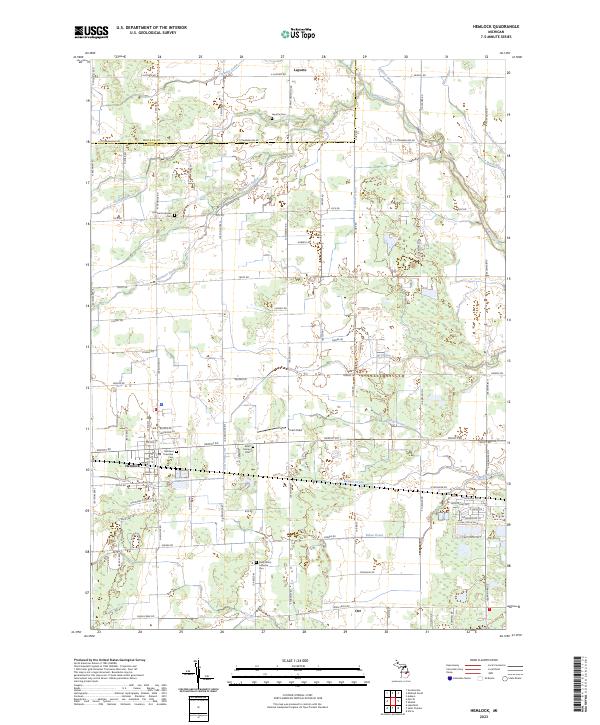 2023 Hemlock2023 Print · USGSSaginaw County rural life is documented here during the early 2020s, showcasing the intricate web of agricultural drainage and small-town centers. Genealogists can locate several historic burial grounds, including Laporte Cem and Richland Lutheran Cem.
 - 2023 Map of Alamando, 2023 Print
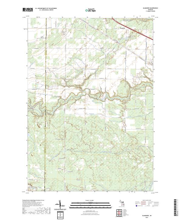 2023 Alamando2023 Print · USGSMidland County's rural townships are captured here in the early twenty-first century, showing a landscape defined by river confluences and country roads. Researchers can locate Warren Township Cem and trace the winding paths of the Salt River and Chippewa River.
 - 2023 Map of Breckenridge, 2023 Print
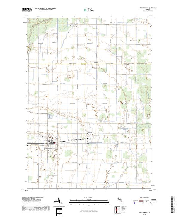 2023 Breckenridge2023 Print · USGSGratiot County's agricultural heartland is mapped here in the early twenty-first century, showing the enduring grid of farm roads and drainage systems. Genealogists and local historians can locate specific burial sites at Ridgelawn Cem or trace the early settlement footprints of Wheeler and Redstone.
 - 2023 Map of Floyd, 2023 Print
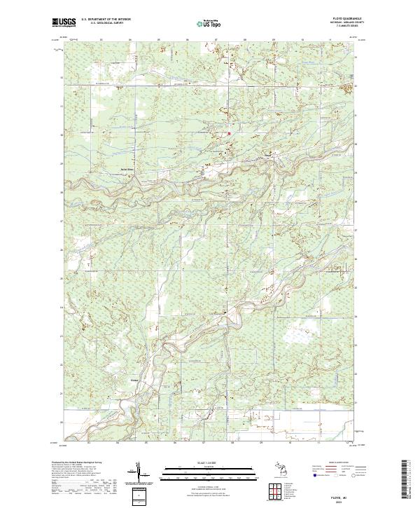 2023 Floyd2023 Print · USGSMidland County's river valleys and rural townships are captured in this recent survey of the central Michigan landscape. Researchers can trace family history at Lee Township Cem and Porter Township Cem or locate the settlements of Floyd and Porter.
 - 2023 Map of Pleasant Valley, 2023 Print
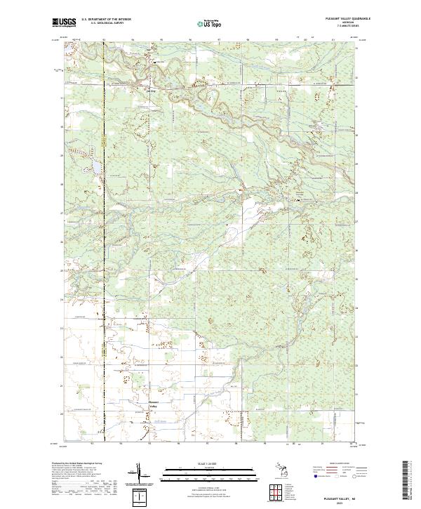 2023 Pleasant Valley2023 Print · USGSThe rural borders of Isabella and Midland Counties are captured here in the early twenty-first century. Researchers can trace family history through local sites like Kelly Cem or follow the paths of the Chippewa River and Little Salt Creek through the countryside.
 - 2023 Map of Edenville, 2023 Print
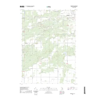
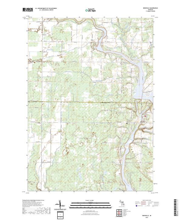 2023 Edenville2023 Print · USGSThe river confluence at Edenville and the surrounding rural landscapes of Midland and Gladwin counties are shown in high detail. Researchers can trace family roots at the New Edenville Township Cem and Dale Cem or follow the paths of the Tobacco River and Mud Creek.
 - 2023 Map of Hope, 2023 Print
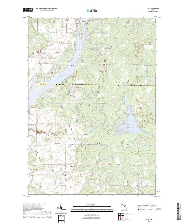 2023 Hope2023 Print · USGSMidland and Gladwin Counties are mapped here in the early 2020s, showing a landscape defined by the Tittabawassee River and rural townships. Researchers can locate family sites at Hope Cem and Billings Cem or trace drainage history through the McCoy Drain.
 - 2023 Map of Estey, 2023 Print
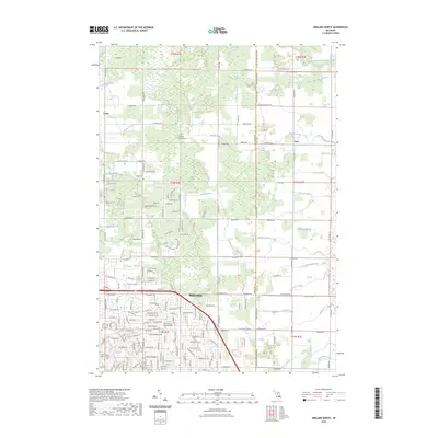
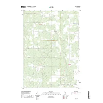 2023 Estey2023 Print · USGSThe tri-county border of Midland, Gladwin, and Bay counties is captured in the early 2020s, showing a landscape defined by its rural drainage network. Researchers can trace land tracts near Estey and follow the paths of Chubb Drain and the Pinconning River.
 - 2023 Map of Sanford, 2023 Print
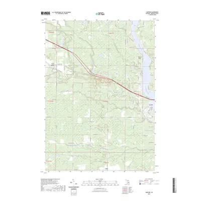 2023 Sanford2023 Print · USGSMidland County settlement and drainage patterns are on full display in this contemporary survey of the Tittabawassee River valley. Researchers can trace local lineage through several burial grounds, including Sullivan Cem and Geneva Cem, and locate early community centers like North Bradley and Sanford.
 - 2023 Map of Coleman, 2023 Print
 2023 Coleman2023 Print · USGSMidland and Isabella counties meet at Coleman in this modern survey of central Michigan's rural landscape. Genealogists and local historians can trace family properties along W Baker Rd or follow the old Railroad Grade and the banks of Bluff Creek.
 - 2023 Map of Midland South, 2023 Print
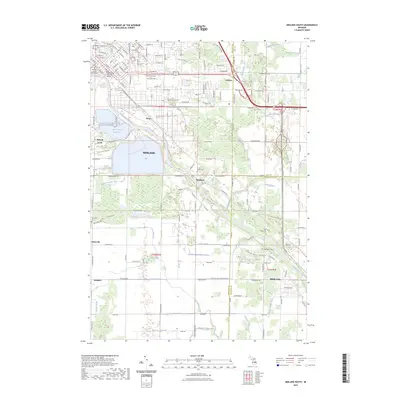 2023 Midland South2023 Print · USGSThe Tittabawassee River valley comes into focus during this contemporary survey of the Midland and Freeland areas. Genealogists can trace family heritage through the Arrance Family Cem and West Side Cem or locate old community hubs like Poseyville and Mapleton.
 - 2023 Map of Averill, 2023 Print
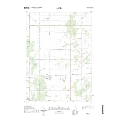
 2023 Averill2023 Print · USGSMidland County's river-fed landscapes are captured here in the early twenty-first century, showing the development around the Tittabawassee River. Researchers can trace the grounds of Northwood University, find the The Old Amish Cem, or locate the historic settlement of Averill.
 - 2023 Map of Merrill, 2023 Print
 2023 Merrill2023 Print · USGSMerrill and its surrounding farmsteads are documented here at the convergence of Saginaw, Midland, and Gratiot counties. Genealogists and local historians can trace family land along Handy Creek or locate the rural crossroads of Ryan and Iva.
 - 2023 Map of Midland North, 2023 Print
 2023 Midland North2023 Print · USGSThe northern reaches of Midland and the rural townships of Larkin and Duel are documented in the early 2020s. Trace local family history at Old Calvary Cem - Midland or follow the complex drainage networks of Waldo Drain and Snake Creek.
 - 2023 Map of Gordonville, 2023 Print
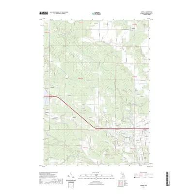
 2023 Gordonville2023 Print · USGSMidland and its southwestern outskirts are documented in this recent survey of the river-crossed interior of Midland County. Researchers can trace family history at the Homer Township Cem or follow the paths of the Chippewa River and Bullock Creek.
 - 2023 Map of Saint Louis, 2023 Print
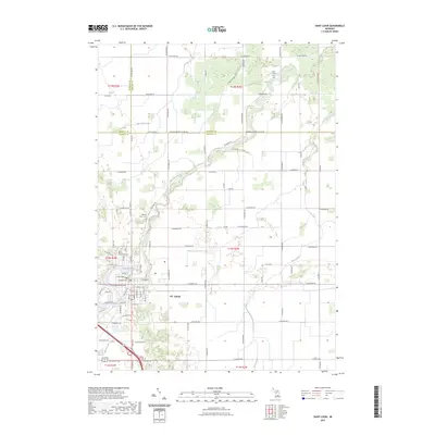 2023 Saint Louis2023 Print · USGSThe riverfront community of St. Louis is shown in modern detail as it spans the borders of Gratiot, Isabella, and Midland counties. Genealogists can locate family landmarks such as Bethany Indian Cem, Oak Grove Cem, and the Jasper Township Cem.
End of results
Showing maps 1-16 of 16
Top cities of Midland County
Frequently asked questions
- What are the different types of historical maps available for Midland County?
- What is the oldest map of Midland County?
- Where can I purchase historical maps of Midland County for my home or office?
- Where can I download high-res historical maps of Midland County?
- Are there historical topographic maps available for Midland County?
- Is there historical aerial imagery available for Midland County?
- Where are historical maps of Midland County sourced from?