Old Maps of Addison Township, Michigan for Metal Detecting
Plan your next treasure hunt with 39 historic maps of Addison Township. Find old homesites, ghost towns, trails, and gathering spots that may be lost to time — perfect for identifying promising metal detecting locations.
- Locate forgotten sites: Uncover places like long-lost settlements, abandoned rail lines, or gathering spots.
- Plan better hunts: Use map overlays combined with LiDAR or satellite views to narrow in on historically rich areas.
- Made for detectorists: Thousands of hobbyists use these maps to discover relics, coins, and hidden history.
Use these historic maps to boost your research and find new opportunities beneath the surface of Addison Township.
Addison Township, MI maps
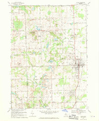
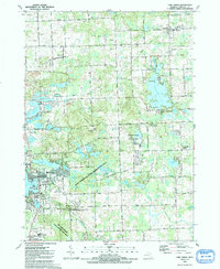
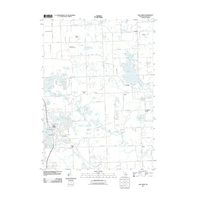
(39)- 1943 Map of Lake Orion, 1960 Print
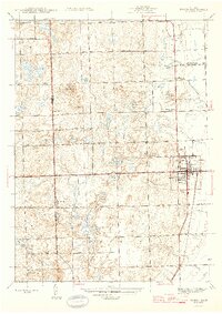
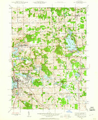 1943 Lake Orion1960 Print · USGSOakland County's lake country and agricultural highlands are captured here during the wartime era. Genealogists and local historians can locate old rural schoolhouses like National Sch, early settlements at Rudds Mill, and original railroad alignments for the Grand Trunk Western.2 unique versions available
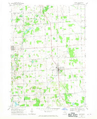
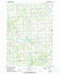
 - 1943 Map of Romeo, 1965 Print
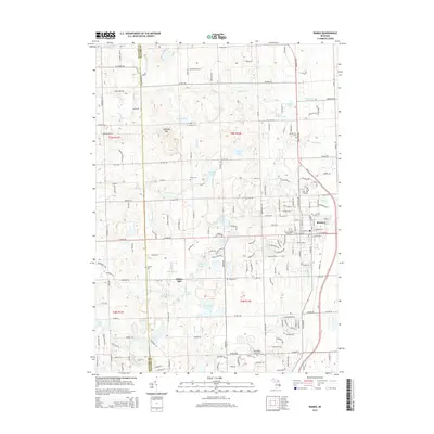
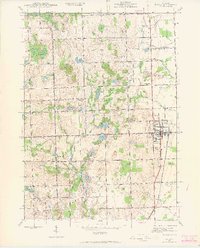 1943 Romeo1965 Print · USGSNorthern Macomb and Oakland counties are captured during the 1940s, centered on the village of Romeo and its surrounding townships. Researchers can trace the rural school systems at Clifton Sch and Mack Sch or locate the Simpson Park Camp Ground near East Mill Lake.
 - 1945 Map of Almont
 1945 Almont1945 Print · USGSAlmont and Dryden are the focal points of this mid-1940s survey of the Lapeer and Macomb county borders during a time of rural schoolhouses and family farms. Researchers can locate many local landmarks like Ferguson Cem, Rider Sch, and Neil Sch along the upper reaches of the Belle River.2 unique versions available
 - 1945 Map of Thornville
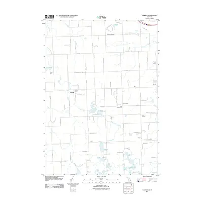
 1945 Thornville1945 Print · USGSLapeer County townships are shown here during the mid-forties, characterized by a dense landscape of glacial lakes and crossroads settlements. Researchers can pinpoint several country schoolhouses and four distinct burial grounds, including Foot Cem and South Attica Cem.3 unique versions available
 - 1945 Map of Romeo
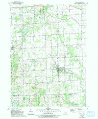
 1945 Romeo1945 Print · USGSNorthern Macomb County comes into focus just after the war, centered on the village of Romeo. Researchers can trace the rural schoolhouse system through Clifton Sch and Sikes Sch, or locate the Clifton Mill along the winding Stony Creek.2 unique versions available
 - 1945 Map of Lake Orion
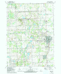
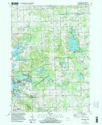
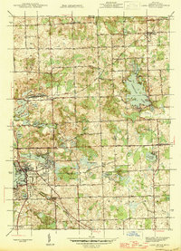 1945 Lake Orion1945 Print · USGSOakland County's lake district is captured here just after the war, showing the rural character of northern townships like Oxford and Addison. Genealogists can locate family-named landmarks and institutions like Rudds Mill, Kingsbury Sch, and Lakeville Cem.
 - 1954 Map of Detroit
 1954 Detroit1954 Print · USGSThe Detroit metro and its Ontario neighbors are shown at the height of the mid-century industrial era, just as the suburbs were rapidly expanding. Researchers can trace the massive rail networks of the Wabash Railroad or locate landmarks like Grosse Ile and Selfridge Air Force Base.
 - 1961 Map of Detroit, 1973 Print
 1961 Detroit1973 Print · USGSThe international border between Michigan and Ontario was a bustling industrial corridor in the early sixties. Researchers can trace the transit networks and riverfront infrastructure connecting Detroit to Windsor via the Detroit-Windsor Tunnel and major air hubs like Willow Run Airport.2 unique versions available
 - 1965 Map of Detroit
 1965 Detroit1965 Print · USGSThe industrial corridor between Michigan and Ontario is captured here at mid-century, showing the dense rail and river networks of the Great Lakes. Local historians can trace the paths of the Grand Trunk Western RR and locate key landmarks like Selfridge Air Force Base and Grosse Ile.
 - 1968 Map of Thornville, 1970 Print
 1968 Thornville1970 Print · USGSThe Lapeer County countryside in the late sixties reveals a network of farming hamlets and glacial lakes. Family history researchers can trace sites like Dryden Center Cem, the village of Thornville, and the Grand Trunk Western rail line.
 - 1968 Map of Lake Orion, 1970 Print
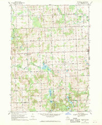
 1968 Lake Orion1970 Print · USGSNorthern Oakland County was a patchwork of quiet lakefront villages and glacial hills in the late sixties. Researchers can trace the layout of old settlements at Lakeville and Leonard, or locate family sites near Kingsbury Sch Cem and Rudds Mill.2 unique versions available
 - 1968 Map of Romeo, 1970 Print
 1968 Romeo1970 Print · USGSThe village of Romeo and its surrounding townships appear in the late sixties as a landscape of glacial lakes and growing parklands. Researchers can locate family burial plots at Brabb Cem, the historic Clifton Mill, and early municipal landmarks like the Grange Hall.2 unique versions available
 - 1968 Map of Almont, 1970 Print
 1968 Almont1970 Print · USGSLapeer County is captured in the late sixties as a traditional farming landscape beginning to modernize. Genealogists and historians can trace family-named sites like Hunters Cem and Hough Cem or follow the Grand Trunk Western rail line through Dryden.2 unique versions available
 - 1985 Map of Pontiac
 1985 Pontiac1985 Print · USGSSoutheast Michigan in the mid-1980s shows a landscape of growing suburban corridors and expansive public parklands. Genealogists and local historians can trace the footprint of rail lines like the Grand Trunk Western or locate family sites near Oakwood Cem and White Chapel Cem.2 unique versions available
 - 1991 Map of Romeo
 1991 Romeo1991 Print · USGSRomeo and the surrounding townships are shown here in the early nineties as the area balanced its village character with large-scale industrial research and parklands. Genealogists and local historians can locate family plots at Bruce Cem and McCafferty Cem or trace the early settlement at Clifton Mill.
 - 1991 Map of Almont
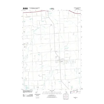
 1991 Almont1991 Print · USGSAlmont and Dryden are captured in the early nineties at the junction of Lapeer, Macomb, and Oakland counties. Researchers can trace land use through numerous family burial sites like Hough Cem and community landmarks such as Gen Squier Mem Park.
 - 1991 Map of Lake Orion
 1991 Lake Orion1991 Print · USGSOakland County's lake country is captured here in the early 1990s as classic village centers and recreation areas began to merge. Researchers can locate family landmarks such as Kingsbury Cem, the historic Rudds Mill (Site), and the route of the Grand Trunk Western Railroad.
 - 1991 Map of Thornville
 1991 Thornville1991 Print · USGSLapeer County in the early 1990s shows a landscape of glacial lakes and rural settlements centered on the village of Dryden. Researchers can trace the path of the GT RR or locate family history at the South Dryden Pioneer Cem and Thornville Cem.
 - 1996 Map of Lake Orion, 1999 Print
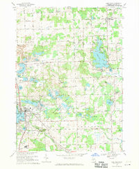
 1996 Lake Orion1999 Print · USGSMid-century Oakland County transitions from a rural lake district to a prominent recreation hub in the 1990s. Trace old community centers like Leonard and Oakwood, or locate local landmarks such as Rudds Mill, Lakeville Cem, and the St Benedict Monastery.
 - 2011 Map of Romeo, 2011 Print
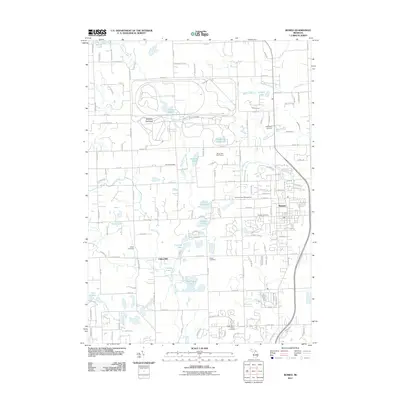 2011 Romeo2011 Print · USGSCovers Addison Township, including Washington Charter Township, Oakland Charter Township, and other nearby areas
 - 2011 Map of Thornville, 2011 Print
 2011 Thornville2011 Print · USGSCovers Addison Township, including Oxford Charter Township, Dryden, and other nearby areas
 - 2011 Map of Almont, 2011 Print
 2011 Almont2011 Print · USGSCovers Addison Township, including Imlay City, Almont, and other nearby areas
 - 2011 Map of Lake Orion, 2011 Print
 2011 Lake Orion2011 Print · USGSCovers Addison Township, including Orion Charter Township, Oxford Charter Township, and other nearby areas
 - 2014 Map of Lake Orion, 2014 Print
 2014 Lake Orion2014 Print · USGSCovers Addison Township, including Orion Charter Township, Oxford Charter Township, and other nearby areas
 - 2014 Map of Romeo, 2014 Print
 2014 Romeo2014 Print · USGSCovers Addison Township, including Washington Charter Township, Oakland Charter Township, and other nearby areas
Showing maps 1-25 of 39
Top cities near Addison Township
- Sterling Heights historical maps
- Clinton Township historical maps
- Macomb Township historical maps
- Troy historical maps
- Shelby Charter Township historical maps
- Rochester Hills historical maps
See more
Top neighborhoods of Addison Township
- Campbells Corner historical maps
- Lakeville historical maps
- Leonard historical maps
- Hidden Lake Estates historical maps
Frequently asked questions
- What are the different types of historical maps available for Addison Township?
- What is the oldest map of Addison Township?
- Where can I purchase historical maps of Addison Township for my home or office?
- Where can I download high-res historical maps of Addison Township?
- Are there historical topographic maps available for Addison Township?
- Is there historical aerial imagery available for Addison Township?
- Where are historical maps of Addison Township sourced from?