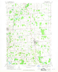
1968 Map of Almont
USGS Topo · Published 1970About this map
The agricultural landscape of southeastern Lapeer County in the late 1960s is defined by the headwaters of the North Branch Belle River and the North Branch Clinton River. The village of Almont serves as a local hub, featuring a Gaging Station and Sewage Disposal infrastructure along the river, while Dryden sits to the west along the Grand Trunk Western railroad. The map records numerous family and community landmarks, including Mt Pleasant Cem and the Mc Kail School near Second Lake.
Find a feature on this map
65 named features on this map. Tap any name to fly to it.
Don’t see what you’re looking for? This feature index may not catch every label — zoom into the map to look around manually.
Map Details
Editions of this 1968 Almont Map
2 editions found
Other maps of this area

1914 · Armada
USGS Topo · 1:62,500

1928 · Armada
USGS Topo · 1:62,500

1943 · Lake Orion
USGS Topo · 1:24,000

1943 · Romeo
USGS Topo · 1:24,000

1945 · Armada
USGS Topo · 1:24,000

1945 · Almont
USGS Topo · 1:24,000

1945 · Allenton
USGS Topo · 1:24,000

1945 · Thornville
USGS Topo · 1:24,000

1945 · Romeo
USGS Topo · 1:24,000
1945 · Lake Orion
USGS Topo · 1:24,000