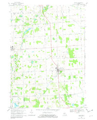
1968 Map of Almont
USGS Topo · Published 1982About this map
The Grand Trunk Western railroad corridor shapes the development of this Lapeer County landscape, connecting the village of Dryden in the west to the larger settlement of Almont in the south. The terrain is defined by a complex network of agricultural drains and small glacial lakes, including O'Neil Lake and Mud Lake, which feed the North Branch Belle River and the North Branch Clinton River.
Find a feature on this map
73 named features on this map. Tap any name to fly to it.
Don’t see what you’re looking for? This feature index may not catch every label — zoom into the map to look around manually.
Map Details
Editions of this 1968 Almont Map
2 editions found
Other maps of this area

1914 · Armada
USGS Topo · 1:62,500

1928 · Armada
USGS Topo · 1:62,500

1943 · Lake Orion
USGS Topo · 1:24,000

1943 · Romeo
USGS Topo · 1:24,000

1945 · Armada
USGS Topo · 1:24,000

1945 · Almont
USGS Topo · 1:24,000

1945 · Allenton
USGS Topo · 1:24,000

1945 · Thornville
USGS Topo · 1:24,000

1945 · Romeo
USGS Topo · 1:24,000
1945 · Lake Orion
USGS Topo · 1:24,000