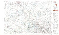
1985 Map of Pontiac
USGS Topo · Published 1985About this map
Oakland County and its neighbors appear here at a moment of significant suburban expansion and recreational development during the mid-1980s. The map illustrates a landscape where growing residential centers like Pontiac and Grand Blanc are interspersed with a dense network of state and local parks, such as the Holly State Recreation Area and Indian Springs Metropolitan Park. This era is defined by the heavy reliance on the interstate system, including I-75 and I-96, which facilitated the movement between industrial hubs and the burgeoning bedroom communities.
Find a feature on this map
196 named features on this map. Tap any name to fly to it.
Don’t see what you’re looking for? This feature index may not catch every label — zoom into the map to look around manually.
Map Details
Editions of this 1985 Pontiac Map
2 editions found
Other maps of this area

1902 · South Lyon
USGS Topo · 1:62,500

1902 · Dexter
USGS Topo · 1:62,500

1904 · Ann Arbor
USGS Topo · 1:125,000

1905 · Wayne
USGS Topo · 1:62,500

1905 · Detroit
USGS Topo · 1:62,500

1905 · Grosse Pointe
USGS Topo · 1:62,500

1906 · Dexter
USGS Topo · 1:62,500

1906 · South Lyon
USGS Topo · 1:62,500

1907 · Pontiac
USGS Topo · 1:62,500

1907 · Howell
USGS Topo · 1:62,500