Old Maps of Hiawatha Township, Michigan for Metal Detecting
Plan your next treasure hunt with 125 historic maps of Hiawatha Township. Find old homesites, ghost towns, trails, and gathering spots that may be lost to time — perfect for identifying promising metal detecting locations.
- Locate forgotten sites: Uncover places like long-lost settlements, abandoned rail lines, or gathering spots.
- Plan better hunts: Use map overlays combined with LiDAR or satellite views to narrow in on historically rich areas.
- Made for detectorists: Thousands of hobbyists use these maps to discover relics, coins, and hidden history.
Use these historic maps to boost your research and find new opportunities beneath the surface of Hiawatha Township.
Hiawatha Township, MI maps
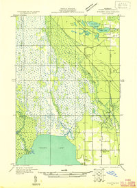
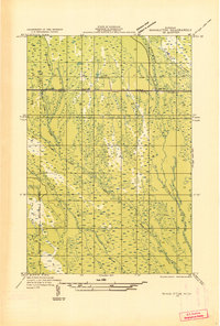
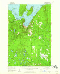
(125)- 1931 Map of Cooks NE
 1931 Cooks NE1931 Print · USGSCoastal Schoolcraft County comes alive in this early 1930s survey of the northern Lake Michigan shoreline. Genealogists and local historians can trace the rail lines of the Manistique Ry and locate family landmarks like Heights Sch and Dufour.
 - 1931 Map of Steuben SE
 1931 Steuben SE1931 Print · USGSUpper Peninsula timberlands and wetlands are surveyed here in the early thirties. Genealogists and local researchers can trace the rail stops and rural schools of Schoolcraft County, from Hiawatha Sta to the Maple Grove Sch near Indian Lake.
 - 1931 Map of Steuben NE
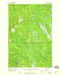
 1931 Steuben NE1931 Print · USGSSchoolcraft County in the early thirties reveals a landscape of dense forests and emerging infrastructure within the Hiawatha National Forest Boundary. Researchers can trace the old Manistique and Lake Superior rail line to the Smith Creek Station or locate the rural Hiawatha School No 2.
 - 1931 Map of Shingleton SW
 1931 Shingleton SW1931 Print · USGSThe Upper Peninsula timber and rail landscape at Shingleton comes alive in the early 1930s. Genealogists and historians can trace the intersection of the Duluth South Shore and Atlantic railroad and landmarks like Lilley Lake or Boot Lake.
 - 1931 Map of Steuben NW
 1931 Steuben NW1931 Print · USGSThe Upper Peninsula wilderness in the early 1930s is defined here by its intricate network of lakes and the essential Manistique and Lake Superior railroad. You can trace the development of the Steuben settlement or locate historic camps like Jack Pine Lodge and the Woods Club along the Indian River.
 - 1931 Map of Manistique River NW
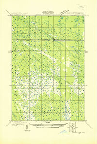
 1931 Manistique River NW1931 Print · USGSUpper Peninsula wetlands dominate this Depression-era wilderness survey in Schoolcraft County. You can trace the intricate meanders of the West Branch Manistique River and its tributaries like Stutts Creek and Hickey Creek.
 - 1931 Map of Shingleton NE
 1931 Shingleton NE1931 Print · USGSThe Alger and Schoolcraft county line in the early 1930s shows a landscape of deep marshes and glacial waters. Trace the path of the L S and Ishpeming railroad or locate the Buck Hill Fire Tower overlooking Spider Lake and the Creighton River.
 - 1931 Map of Driggs Lake NW
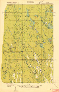
 1931 Driggs Lake NW1931 Print · USGSUpper Peninsula wetlands and glacial lakes are documented in the early 1930s as aerial photography began to transform modern mapping. Researchers can trace the original courses of the Driggs River and Little Fox River or locate remote landmarks like Nevins Lake and Mahoney Creek.2 unique versions available
 - 1931 Map of Skeels Lake NE
 1931 Skeels Lake NE1931 Print · USGSThe Upper Peninsula wilderness of the early thirties is captured here as a labyrinth of glacial waters. Researchers can trace the winding Indian River and locate remote landmarks like Hill Tower, Skeels Lake, and Straits Lake.
 - 1931 Map of Shingleton SE
 1931 Shingleton SE1931 Print · USGSSchoolcraft County in the early 1930s shows a landscape of expansive wetlands being crossed by new industrial infrastructure. Researchers can trace the path of the Duluth South Shore and Atlantic railroad and find localized points like Creighton and Hickey Creek.
 - 1931 Map of Munising SE
 1931 Munising SE1931 Print · USGSThe Michigan Upper Peninsula was a junction of major timber and freight rails in the 1930s. Genealogists and rail historians can trace the paths of the Duluth South Shore and Atlantic and old stops like Evelyn and Doty.
 - 1931 Map of Manistique River SW
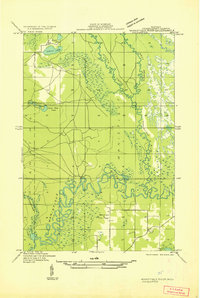 1931 Manistique River SW1931 Print · USGSSchoolcraft County in the early 1930s is defined by the winding Manistique River and its intricate marshland tributaries. Genealogists and local historians can trace rural landmarks like the Brick Sch and the Manistique Fire Tower.
 - 1931 Map of Driggs Lake SW
 1931 Driggs Lake SW1931 Print · USGSUpper Peninsula wetlands and rail infrastructure are captured here in the early 1930s, showing the intersection of transport and terrain. Trace the early corridor of the Duluth South Shore and Atlantic railroad and the settlement of Walsh near the Driggs River.
 - 1954 Map of Escanaba, 1967 Print
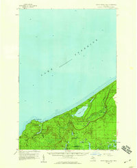
 1954 Escanaba1967 Print · USGSThe Upper Peninsula and Door County shorelines meet here in the mid-fifties, showing the vital maritime and timber networks of the Great Lakes. Researchers can trace historic rail lines, old fire lookouts like the Stonington Fire Tower, and island settlements such as Washington Island.2 unique versions available
 - 1957 Map of Escanaba
 1957 Escanaba1957 Print · USGSThe Upper Peninsula and Door County shorelines meet in the mid-fifties, capturing a landscape of timber, iron, and maritime trade. Genealogists and local historians can trace the Chicago & North Western RR through settlements like Hermansville or locate St Vitals Church and the Potawatome Indian Reservation.
 - 1958 Map of Escanaba
 1958 Escanaba1958 Print · USGSNorthern Lake Michigan maritime commerce and timberlands are captured here in the mid-fifties. Genealogists and historians can trace rail networks like the Escanaba and Lake Superior or locate island settlements such as Detroit Harbor and Fish Creek.
 - 1958 Map of Cooks, 1959 Print
 1958 Cooks1959 Print · USGSThe Upper Peninsula shoreline south of Manistique comes alive in the late fifties, showing a mix of timber forest and new beach settlements. Trace family sites at Cooks Cem, locate the Cooks Lookout Tower, and follow the Garden Trail through the woods.
 - 1958 Map of Corner Lake, 1959 Print
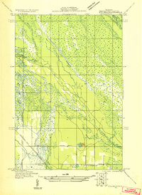
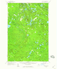 1958 Corner Lake1959 Print · USGSIn Michigan's Upper Peninsula during the late fifties, this wilderness terrain was a hub for forestry and seasonal camps within the Hiawatha National Forest. Researchers can locate the settlement of Steuben, trace the Railroad Grade, or identify isolated sites like Camp Twenty-six and the Petoskey Hunting Club.2 unique versions available
 - 1958 Map of Munising, 1959 Print
 1958 Munising1959 Print · USGSThe Lake Superior shoreline near Munising is captured here in the late fifties, showcasing the area's timber and transport roots. Genealogists and researchers can trace local landmarks like Maple Grove Cem, the Hanely Landing Field, and the rail junction at Coalwood.3 unique versions available
 - 1958 Map of Shingleton, 1959 Print
 1958 Shingleton1959 Print · USGSUpper Peninsula timber and rail history come alive in the late fifties across the Alger and Schoolcraft county lines. Trace old transport routes through Shingleton and Creighton, or locate logging era sites like Hartman Camp and the Old Railroad Grade.3 unique versions available
 - 1958 Map of Grand Portal Point, 1959 Print
 1958 Grand Portal Point1959 Print · USGSThe Lake Superior shoreline in the late fifties reveals a wilderness of dramatic coastal features and inland lakes. Researchers can trace the drainage of the Mosquito River and locate landmarks like Chapel Rock and the Buck Hill Lookout Tower.2 unique versions available
 - 1958 Map of Steuben, 1959 Print
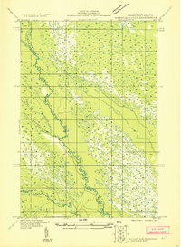
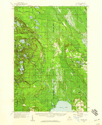 1958 Steuben1959 Print · USGSIn the central Upper Peninsula during the late fifties, this wilderness landscape shows the intersection of conservation and industry. Trace the remote settlement of Steuben, the Hiawatha (Station), and the fire-watching height of the Steuben Lookout Tower.2 unique versions available
 - 1958 Map of Marquette, 1968 Print
 1958 Marquette1968 Print · USGSThe Upper Peninsula’s central corridor is captured here in the mid-twentieth century as mining and timber industries thrived alongside new military installations. Genealogists and historians can trace the rail lines of the Soo Line Railroad through settlements like Gwinn, Turin, and Chatham.2 unique versions available
 - 1960 Map of Marquette
 1960 Marquette1960 Print · USGSUpper Peninsula mining and maritime commerce reach their peak in the late fifties across the Lake Superior shoreline. Genealogists and historians can locate remote settlements like Big Bay and Dukes, while tracing the Cyr Mine and the active rail lines of the Lake Superior and Ishpeming railroad.
 - 1961 Map of Marquette
 1961 Marquette1961 Print · USGSUpper Peninsula life in the early sixties centered on the iron docks and timber stands of the Lake Superior shore. Genealogists and historians can trace rail-to-port connections via the Lake Superior and Ishpeming Railroad and locate active sites like Republic Mine or the K.I. Sawyer Air Force Base.
Showing maps 1-25 of 125
Top cities near Hiawatha Township
Top neighborhoods of Hiawatha Township
- Copenhagen Beach historical maps
- Harrison Beach historical maps
- Cusino historical maps
- Ossawinamakee Beach historical maps
- Pines historical maps
- Creighton historical maps
See more
Frequently asked questions
- What are the different types of historical maps available for Hiawatha Township?
- What is the oldest map of Hiawatha Township?
- Where can I purchase historical maps of Hiawatha Township for my home or office?
- Where can I download high-res historical maps of Hiawatha Township?
- Are there historical topographic maps available for Hiawatha Township?
- Is there historical aerial imagery available for Hiawatha Township?
- Where are historical maps of Hiawatha Township sourced from?