1950s Maps of Wayne County, Michigan
Explore 21 historic maps of Wayne County from the 1950s. These maps offer a rare glimpse into what life looked like during the 1950s — showing old roads, neighborhoods, homes, and landmarks that have changed or disappeared over time.
Whether you're researching your family's past, planning a metal detecting trip, or studying how Wayne County's landscape evolved across the 1950s, these high-resolution maps are a powerful tool for exploring the history of this region.
- Focus on a specific era: All maps on this page are from the 1950s, giving you a focused view of this time period.
- See what’s changed: Compare century-old streets, trails, and buildings to today's modern landscape using overlays and satellite layers.
- Research with precision: Use these maps for genealogy, historical research, land use analysis, or educational projects.
- View, download, or print: Maps are fully viewable online in high resolution, and can be downloaded or printed for your own records.
Start exploring Wayne County's history through authentic maps from the 1950s. This is your window into the past.
Wayne County, MI maps
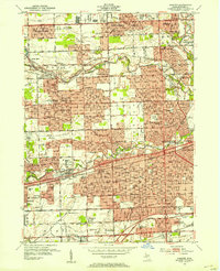
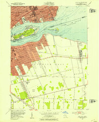
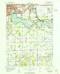
(21)- 1952 Map of Belleville, 1953 Print
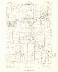 1952 Belleville1953 Print · USGSWayne County during the early fifties shows a fascinating mix of classic rail towns and new high-speed transit. Trace the older routes of the Wabash RR or locate family history at Little Farms, French Landing, and the Martinsville Cem.3 unique versions available
 - 1952 Map of Flat Rock, 1953 Print
 1952 Flat Rock1953 Print · USGSThe Huron River valley in the early fifties shows a landscape of busy rail corridors and small-town growth. Trace family roots and local history through Michigan Memorial Park Cemetery, the Flat Rock Yard, and rural landmarks like Evergreen Cem.2 unique versions available
 - 1952 Map of Grosse Pointe, 1953 Print
 1952 Grosse Pointe1953 Print · USGSThe Lake St. Clair shoreline and Detroit's northeast suburbs are captured here during the post-war population boom. Researchers can trace mid-century neighborhood growth and find dozens of local landmarks like the Grosse Pointe Yacht Club and Assumption Sch & Cem.2 unique versions available
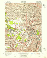
 - 1952 Map of Detroit Wayne Airport, 1954 Print
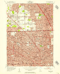
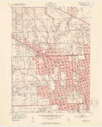
 1952 Detroit Wayne Airport1954 Print · USGSMid-century Wayne County is captured here as the townships of Taylor and Romulus transition from rural landscapes to suburban hubs. Genealogists can trace family roots through Huron Cem, St Johns Sch, and the residential blocks of Rosenworth.2 unique versions available
 - 1952 Map of Royal Oak, 1954 Print
 1952 Royal Oak1954 Print · USGSNorth of Detroit in the early fifties, the post-war suburban boom is in full swing across Oakland County. Genealogists and local historians can trace family locations near Oakview Cemetery, Detroit Zoological Park, and dozens of neighborhood schools.2 unique versions available
 - 1952 Map of Rockwood, 1954 Print
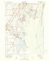 1952 Rockwood1954 Print · USGSThe Detroit River archipelago and the marshlands of Lake Erie come into focus in the early fifties. Genealogists and historians can trace South Road Sch, St Marys Ch, and the sprawling Grosse Ile Naval Air Station.2 unique versions available
 - 1952 Map of Northville, 1954 Print
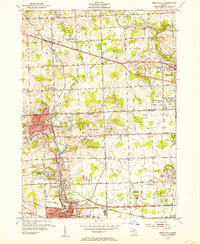 1952 Northville1954 Print · USGSThe settlement of Novi is shown at a pivotal moment in the early fifties before the rapid growth of the Detroit suburbs. Genealogists and local historians can trace the historical layout and early road systems centered around Novi.2 unique versions available
 - 1952 Map of Detroit, 1954 Print
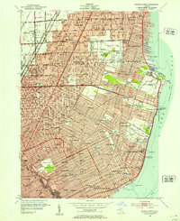
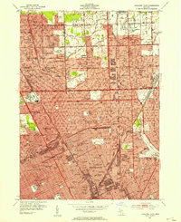
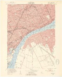 1952 Detroit1954 Print · USGSThe industrial border between Michigan and Ontario is captured here at the mid-century peak of the automotive era. Researchers can trace the massive rail networks of the New York Central, locate neighborhood landmarks like Briggs Stadium, or find family sites near Mt Elliot Cemetery.2 unique versions available
 - 1952 Map of Inkster, 1954 Print
 1952 Inkster1954 Print · USGSWestern Wayne County was rapidly transforming during the early fifties as the Detroit suburbs expanded toward the Rouge River forks. Genealogists and historians can locate numerous landmarks including Eloise Cem, the County Hospital, and the historic Nankin Mills.2 unique versions available
 - 1952 Map of Highland Park, 1954 Print
 1952 Highland Park1954 Print · USGSMid-century Detroit and its northern enclave cities show a bustling urban landscape at the height of the industrial era. Trace neighborhood roots across Highland Park and Hamtramck using landmarks like Evergreen Cemetery and the City Airport.2 unique versions available
 - 1952 Map of Wayne, 1954 Print
 1952 Wayne1954 Print · USGSWestern Wayne County underwent a massive suburban transformation in the early fifties as Detroit's residential grid pushed westward. Researchers can trace the development of Norwayne, find family plots in Sheldon Cem, or locate historic flight paths at Mettetal Airport.2 unique versions available
 - 1952 Map of Redford, 1954 Print
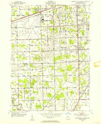
 1952 Redford1954 Print · USGSNorthwest of Detroit in the early fifties, the landscape was quickly transforming from rural townships into a dense suburban grid. Genealogists and historians can trace family plots and school districts at Holy Sepulchre Cemetery, St Agatha Sch, and the Boys Republic campus.2 unique versions available
 - 1952 Map of Belle Isle, 1954 Print
 1952 Belle Isle1954 Print · USGSThe Detroit River international border comes alive in the early fifties, showing the urban density of Detroit alongside the growing suburbs of Windsor. Genealogists and historians can trace neighborhood schools like Lillibridge Sch or follow the rail lines through Walkerville Junction.2 unique versions available
 - 1952 Map of Carleton, 1954 Print
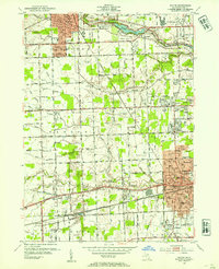
 1952 Carleton1954 Print · USGSThe crossroads of Wayne and Monroe Counties are captured here during a period of post-war rural transition. Researchers can trace family homesteads near landmarks like Felt Cem, the McGowan Sch, or the rail junction at Carleton.2 unique versions available
 - 1952 Map of Dearborn, 1954 Print
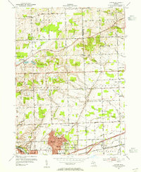
 1952 Dearborn1954 Print · USGSMid-century Dearborn and western Detroit show a landscape defined by the automotive industry and rapid postwar expansion. Researchers can trace the massive rail yards, the Ford Rotunda, and neighborhood landmarks like Greenfield Village and Woodmere Cemetery.2 unique versions available
 - 1952 Map of Wyandotte, 1954 Print
 1952 Wyandotte1954 Print · USGSThe downriver industrial corridor south of Detroit thrives in the early fifties as suburbs like Allen Park and Lincoln Park expand. Genealogists and historians can trace neighborhood growth through dozens of local schools and landmarks like Elizabeth Park, Hange Airport, and Bloomdale Cem.2 unique versions available
 - 1953 Map of Ypsilanti East, 1955 Print
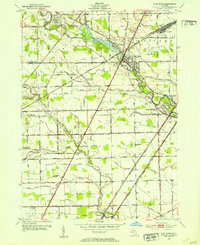
 1953 Ypsilanti East1955 Print · USGSEastern Washtenaw County underwent significant industrial and aviation expansion in the 1950s, centered around the Huron River valley. Researchers can trace the development of the Willow Run Airport and locate local landmarks like the Friends Ch and Lincoln Sch.
 - 1953 Map of Denton, 1955 Print
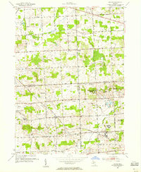
 1953 Denton1955 Print · USGSWashtenaw County transitions from rural farmland to industrial suburban hubs during the mid-fifties. Genealogists and historians can trace the numerous local schoolhouses and rural crossroads, from Cherry Hill and Denton to the Leland Sanatorium.2 unique versions available
 - 1953 Map of Salem, 1955 Print
 1953 Salem1955 Print · USGSSoutheast Michigan’s rural townships are captured here in the early 1950s as small farming communities began to interface with large county institutions. Researchers can trace family sites near Salem and Brookville, or locate landmarks like Thayer Cem and the Maybury Sanitarium.
 - 1954 Map of Detroit
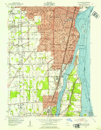
 1954 Detroit1954 Print · USGSThe Detroit metro and its Ontario neighbors are shown at the height of the mid-century industrial era, just as the suburbs were rapidly expanding. Researchers can trace the massive rail networks of the Wabash Railroad or locate landmarks like Grosse Ile and Selfridge Air Force Base.
 - 1954 Map of Detroit
 1954 Detroit1954 Print · USGSDetroit and Windsor sit at their industrial peak in the early fifties, linked by the Ambassador Bridge and busy rail tunnels. Trace neighborhood roots across a dense grid of parish schools, the sprawling Wayne University campus, and landmarks like Briggs Stadium.2 unique versions available
End of results
Showing maps 1-21 of 21
Top cities of Wayne County
- Detroit historical maps
- Canton Township historical maps
- Livonia historical maps
- Dearborn historical maps
- Westland historical maps
- Taylor historical maps
See more
Frequently asked questions
- What are the different types of historical maps available for Wayne County?
- What is the oldest map of Wayne County?
- Where can I purchase historical maps of Wayne County for my home or office?
- Where can I download high-res historical maps of Wayne County?
- Are there historical topographic maps available for Wayne County?
- Is there historical aerial imagery available for Wayne County?
- Where are historical maps of Wayne County sourced from?