1950s Maps of Detroit, Michigan
Explore 10 historic maps of Detroit from the 1950s. These maps offer a rare glimpse into what life looked like during the 1950s — showing old roads, neighborhoods, homes, and landmarks that have changed or disappeared over time.
Whether you're researching your family's past, planning a metal detecting trip, or studying how Detroit's landscape evolved across the 1950s, these high-resolution maps are a powerful tool for exploring the history of this region.
- Focus on a specific era: All maps on this page are from the 1950s, giving you a focused view of this time period.
- See what’s changed: Compare century-old streets, trails, and buildings to today's modern landscape using overlays and satellite layers.
- Research with precision: Use these maps for genealogy, historical research, land use analysis, or educational projects.
- View, download, or print: Maps are fully viewable online in high resolution, and can be downloaded or printed for your own records.
Start exploring Detroit's history through authentic maps from the 1950s. This is your window into the past.
Detroit, MI maps
(10)- 1952 Map of Grosse Pointe, 1953 Print
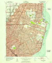 1952 Grosse Pointe1953 Print · USGSThe Lake St. Clair shoreline and Detroit's northeast suburbs are captured here during the post-war population boom. Researchers can trace mid-century neighborhood growth and find dozens of local landmarks like the Grosse Pointe Yacht Club and Assumption Sch & Cem.2 unique versions available
 - 1952 Map of Royal Oak, 1954 Print
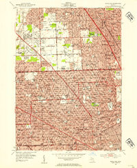 1952 Royal Oak1954 Print · USGSNorth of Detroit in the early fifties, the post-war suburban boom is in full swing across Oakland County. Genealogists and local historians can trace family locations near Oakview Cemetery, Detroit Zoological Park, and dozens of neighborhood schools.2 unique versions available
 - 1952 Map of Detroit, 1954 Print
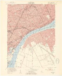 1952 Detroit1954 Print · USGSThe industrial border between Michigan and Ontario is captured here at the mid-century peak of the automotive era. Researchers can trace the massive rail networks of the New York Central, locate neighborhood landmarks like Briggs Stadium, or find family sites near Mt Elliot Cemetery.2 unique versions available
 - 1952 Map of Inkster, 1954 Print
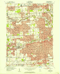 1952 Inkster1954 Print · USGSWestern Wayne County was rapidly transforming during the early fifties as the Detroit suburbs expanded toward the Rouge River forks. Genealogists and historians can locate numerous landmarks including Eloise Cem, the County Hospital, and the historic Nankin Mills.2 unique versions available
 - 1952 Map of Highland Park, 1954 Print
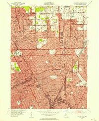 1952 Highland Park1954 Print · USGSMid-century Detroit and its northern enclave cities show a bustling urban landscape at the height of the industrial era. Trace neighborhood roots across Highland Park and Hamtramck using landmarks like Evergreen Cemetery and the City Airport.2 unique versions available
 - 1952 Map of Redford, 1954 Print
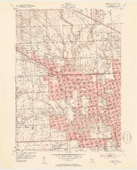 1952 Redford1954 Print · USGSNorthwest of Detroit in the early fifties, the landscape was quickly transforming from rural townships into a dense suburban grid. Genealogists and historians can trace family plots and school districts at Holy Sepulchre Cemetery, St Agatha Sch, and the Boys Republic campus.2 unique versions available
 - 1952 Map of Belle Isle, 1954 Print
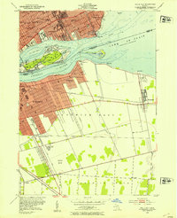 1952 Belle Isle1954 Print · USGSThe Detroit River international border comes alive in the early fifties, showing the urban density of Detroit alongside the growing suburbs of Windsor. Genealogists and historians can trace neighborhood schools like Lillibridge Sch or follow the rail lines through Walkerville Junction.2 unique versions available
 - 1952 Map of Dearborn, 1954 Print
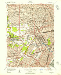 1952 Dearborn1954 Print · USGSMid-century Dearborn and western Detroit show a landscape defined by the automotive industry and rapid postwar expansion. Researchers can trace the massive rail yards, the Ford Rotunda, and neighborhood landmarks like Greenfield Village and Woodmere Cemetery.2 unique versions available
 - 1954 Map of Detroit
 1954 Detroit1954 Print · USGSThe Detroit metro and its Ontario neighbors are shown at the height of the mid-century industrial era, just as the suburbs were rapidly expanding. Researchers can trace the massive rail networks of the Wabash Railroad or locate landmarks like Grosse Ile and Selfridge Air Force Base.
 - 1954 Map of Detroit
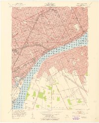 1954 Detroit1954 Print · USGSDetroit and Windsor sit at their industrial peak in the early fifties, linked by the Ambassador Bridge and busy rail tunnels. Trace neighborhood roots across a dense grid of parish schools, the sprawling Wayne University campus, and landmarks like Briggs Stadium.2 unique versions available
End of results
Showing maps 1-10 of 10
Top cities near Detroit
- Sterling Heights historical maps
- Warren historical maps
- Clinton Township historical maps
- Livonia historical maps
- Dearborn historical maps
- Troy historical maps
See more
Top neighborhoods of Detroit
- Oak historical maps
- Delray Junction historical maps
- New Center historical maps
- Midtown historical maps
- Warrendale historical maps
- Northwest Detroit historical maps
See more
Frequently asked questions
- What are the different types of historical maps available for Detroit?
- What is the oldest map of Detroit?
- Where can I purchase historical maps of Detroit for my home or office?
- Where can I download high-res historical maps of Detroit?
- Are there historical topographic maps available for Detroit?
- Is there historical aerial imagery available for Detroit?
- Where are historical maps of Detroit sourced from?