2020s Maps of Detroit, Michigan
Explore 8 historic maps of Detroit from the 2020s. These maps offer a rare glimpse into what life looked like during the 2020s — showing old roads, neighborhoods, homes, and landmarks that have changed or disappeared over time.
Whether you're researching your family's past, planning a metal detecting trip, or studying how Detroit's landscape evolved across the 2020s, these high-resolution maps are a powerful tool for exploring the history of this region.
- Focus on a specific era: All maps on this page are from the 2020s, giving you a focused view of this time period.
- See what’s changed: Compare century-old streets, trails, and buildings to today's modern landscape using overlays and satellite layers.
- Research with precision: Use these maps for genealogy, historical research, land use analysis, or educational projects.
- View, download, or print: Maps are fully viewable online in high resolution, and can be downloaded or printed for your own records.
Start exploring Detroit's history through authentic maps from the 2020s. This is your window into the past.
Detroit, MI maps
(8)- 2023 Map of Belle Isle, 2023 Print
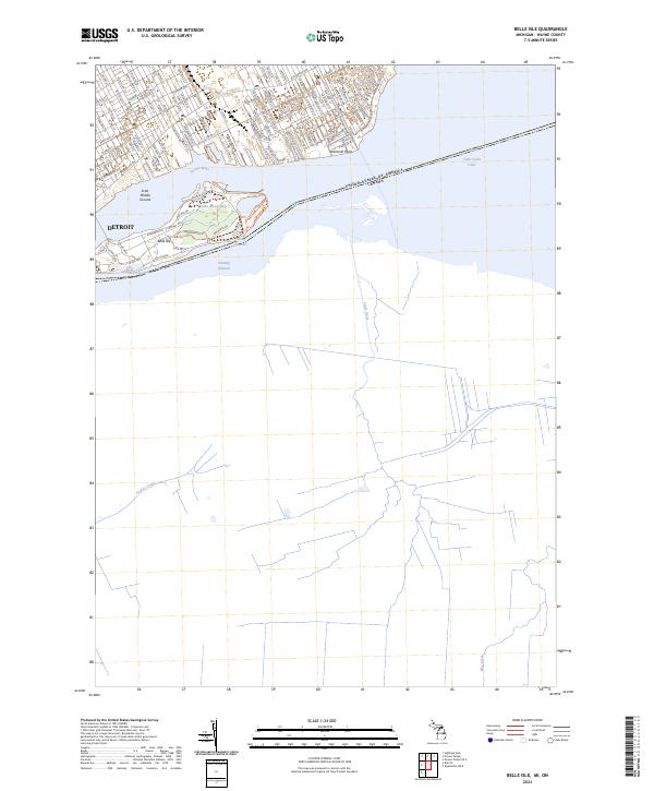 2023 Belle Isle2023 Print · USGSThe Detroit waterfront and its famous island park are captured in modern detail at this stage of the city's development. Genealogists and historians can trace neighborhood street grids like St Jean Ave or explore the landmarks of Belle Isle and Windmill Point.
 - 2023 Map of Grosse Pointe, 2023 Print
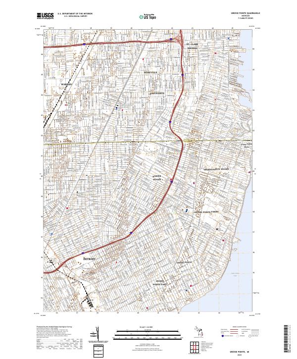 2023 Grosse Pointe2023 Print · USGSThe eastern suburbs of Detroit meet the waters of Lake Saint Clair in the early twenty-first century. Genealogists and local historians can trace the boundaries of Grosse Pointe and Harper Woods, while locating landmarks like Saint Paul Cem and the Milk River.
 - 2023 Map of Detroit, 2023 Print
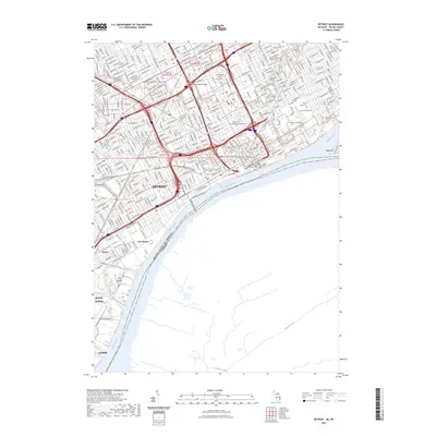 2023 Detroit2023 Print · USGSDetroit and its bustling riverfront are captured in this modern survey, detailing the city's complex urban grid and international border crossings. Researchers can trace historic sites like Fort Wayne and the sprawling Elmwood Cem alongside industrial landmarks like Zug Island.
 - 2023 Map of Inkster, 2023 Print
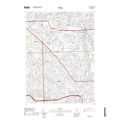
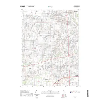 2023 Inkster2023 Print · USGSWestern Wayne County in the early 2020s shows a landscape defined by the winding branches of the Rouge River and the historic corridors of Michigan Avenue. Researchers can trace family sites near Detroit Memorial Park West Cem or locate the old footprints of Eloise and Sunnyside.
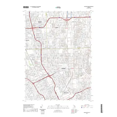
 - 2023 Map of Highland Park, 2023 Print
 2023 Highland Park2023 Print · USGSDetroit and its northern neighbors appear in this detailed modern record of one of America's most significant industrial landscapes. Genealogists and historians can trace the borders of Highland Park and Hamtramck or locate historic burials at Beth Olem Cem and Mount Olivet Cem.
 - 2023 Map of Royal Oak, 2023 Print
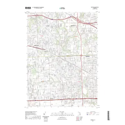
 2023 Royal Oak2023 Print · USGSThe northern Detroit suburbs and the southern edge of Oakland County are shown in this contemporary study of their dense residential and educational landscape. Researchers can trace historic cemeteries like Woodlawn Cem and campus boundaries for University of Detroit Mercy.
 - 2023 Map of Dearborn, 2023 Print
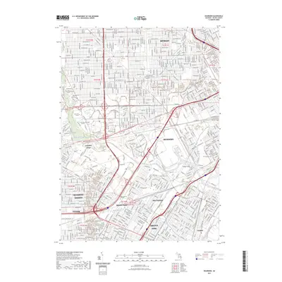 2023 Dearborn2023 Print · USGSMetro Detroit's industrial and cultural hub is shown in thorough detail during its modern era of growth. Researchers can locate established neighborhoods and institutions like Greenfield Village, Henry Ford College, and the Holy Cross Cemetery.
 - 2023 Map of Redford, 2023 Print
 2023 Redford2023 Print · USGSThe northwestern Detroit suburbs are meticulously detailed in this recent survey of the border between Oakland and Wayne counties. Researchers can trace the layout of historic communities like Clarenceville and Redford, along with local landmarks such as Holy Sepulchre Cem and the Specs Howard School of Media Arts.
End of results
Showing maps 1-8 of 8
Top cities near Detroit
- Sterling Heights historical maps
- Warren historical maps
- Clinton Township historical maps
- Livonia historical maps
- Dearborn historical maps
- Troy historical maps
See more
Top neighborhoods of Detroit
- Oak historical maps
- Delray Junction historical maps
- New Center historical maps
- Midtown historical maps
- Warrendale historical maps
- Northwest Detroit historical maps
See more
Frequently asked questions
- What are the different types of historical maps available for Detroit?
- What is the oldest map of Detroit?
- Where can I purchase historical maps of Detroit for my home or office?
- Where can I download high-res historical maps of Detroit?
- Are there historical topographic maps available for Detroit?
- Is there historical aerial imagery available for Detroit?
- Where are historical maps of Detroit sourced from?