Old Maps of Detroit, Michigan for Academic Research
Study the evolution of Detroit with 88 high-resolution historic maps. Whether you're teaching, researching, or modeling changes in land use, these maps provide essential visual documentation of urban, environmental, and geographic change.
- Analyze long-term change: Track patterns in development, transportation, and natural features.
- Ideal for environmental or urban studies: Support academic projects with primary historical map data.
- Use in the classroom or lab: Educators and researchers rely on these maps to bring historical context to life.
These maps are a powerful tool for teaching, research, and visualizing how Detroit has changed over the decades.
Detroit, MI maps
(88)- 1905 Map of Wayne
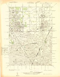
 1905 Wayne1905 Print · USGSWestern Wayne and southern Oakland counties are seen here at a pivotal moment when electric interurban railways first linked rural townships. Genealogists can trace family footprints in Northville, Plymouth, and Farmington, or locate vanished landmarks like Perrinville and the Wayne County Home.4 unique versions available
 - 1905 Map of Detroit
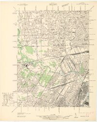
 1905 Detroit1905 Print · USGSDetroit and its surrounding townships are shown at a pivotal moment of expansion during the early 1900s. Genealogists and historians can trace the development of early suburbs like Highland Park and Royal Oak along major transit arteries like Grand River Ave. and the numerous electric railways.2 unique versions available
 - 1905 Map of Grosse Pointe
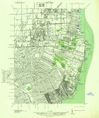
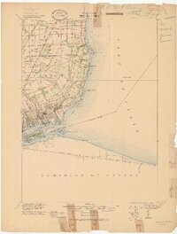 1905 Grosse Pointe1905 Print · USGSCoastal Wayne County at the turn of the century shows an era of transit-driven growth along Lake St Clair. Researchers can trace the early layout of Grosse Pointe Shores, the grounds of Belle Isle Park, and the route of the Grand Trunk R R.4 unique versions available
 - 1912 Map of Wayne
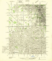
 1912 Wayne1912 Print · USGSWestern Wayne County in the early twentieth century shows a landscape being reshaped by the first concrete roads and a dense network of electric interurban railways. Trace the early development of Livonia, Redford, and Plymouth, or locate long-standing sites like Eloise and Perrinville.
 - 1918 Map of Detroit
 1918 Detroit1918 Print · USGSDetroit and its surrounding townships appear at the height of the early industrial era, captured just after the close of the Great War. Local researchers can trace the growth of the Ford Motor Co. empire near Navarre P.O. and explore the historic rail corridors of Hamtramck and Royal Oak.
 - 1918 Map of Grosse Pointe
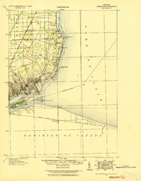 1918 Grosse Pointe1918 Print · USGSThe Lake St. Clair shoreline comes alive in this late-era survey of Wayne and Macomb counties, showing the region just as the Grosse Pointes were formalizing. Trace early electric transit via the Detroit and Port Huron Electric Line and locate vanished stops at Labadies or Claireview.
 - 1924 Map of Detroit
 1924 Detroit1924 Print · USGSDetroit and its industrial satellites thrive during the peak of the automotive era. Genealogists and historians can trace the early factory footprints of Dodge Bros. or locate old neighborhood landmarks like Navarre P. O. and Mt. Olivet Cemetery.
 - 1934 Map of Detroit
 1934 Detroit1934 Print · USGSThe Detroit riverfront and its rising industrial suburbs are captured here during the peak of the automotive boom. Genealogists and historians can trace the early footprints of the Ford Motor Co and local landmarks like Olivet Cemetery or the State Fair Grounds.
 - 1936 Map of Inkster
 1936 Inkster1936 Print · USGSWestern Wayne County was a landscape of institutions and early aviation in the years before the war. Researchers can trace the legacy of the Eloise Hospital and Infirmary, locate local landmarks like Wankin Mills, or find family roots near Perrinsville and St Marys Cem.
 - 1936 Map of Redford
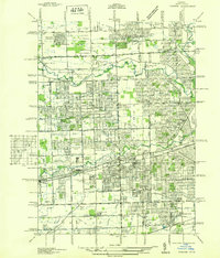
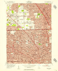
 1936 Redford1936 Print · USGSNorthwestern Detroit suburbs emerge from farm tracts during the mid-1930s, showing early neighborhoods and grid-road expansion. Genealogists can find numerous burial grounds like Grand Lawn Cem and landmarks such as Bell Br Community Ch and the Redford Post Office.
 - 1936 Map of Highland Park
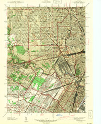
 1936 Highland Park1936 Print · USGSGreater Detroit and the enclaves of Highland Park and Hamtramck are captured here in the mid-1930s as urban growth pushes north. Researchers can pinpoint early neighborhoods, local schools like Henry Ford Sch, and the grounds of the Michigan State Fair.
 - 1936 Map of Dearborn
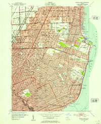
 1936 Dearborn1936 Print · USGSMid-century Dearborn and West Detroit are captured in 1936, showing a landscape defined by the rise of the automotive industry. Genealogists and historians can locate early neighborhood schools like Mackenzie HS and landmark sites like Ford Airport and Greenfield Village.
 - 1936 Map of Grosse Pointe
 1936 Grosse Pointe1936 Print · USGSThe Detroit lakeshore and its rising suburbs are captured here in the mid-1930s, showing a landscape of yacht clubs, golf courses, and dense street grids. Trace the growth of Grosse Pointe Shores and Roseville or locate landmarks like Jefferson Beach and the Erin Cem.
 - 1936 Map of Royal Oak
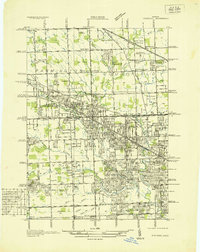
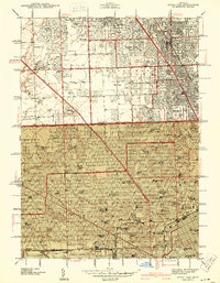
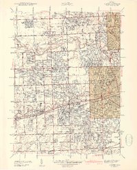
 1936 Royal Oak1936 Print · USGSOakland County was rapidly developing north of Detroit during the mid-1930s, as residential grids expanded over former farmland. Genealogists can locate family homes near Southfield Ch or trace the early layout of Lathrup and Huntington Woods.
 - 1937 Map of Detroit
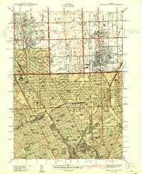
 1937 Detroit1937 Print · USGSDetroit at the peak of its industrial era shows a bustling riverfront and a dense grid of neighborhoods just before the war. Researchers can trace the rail-and-water economy through the Union Depot, Zug Island, and the international Ambassador Bridge.
 - 1940 Map of Highland Park
 1940 Highland Park1940 Print · USGSGreater Detroit was expanding rapidly just before the war, as residential grids replaced the agricultural lands of southern Macomb and Oakland Counties. Genealogists and historians can locate family landmarks like the Michigan State Fair Grounds and St Clements Cem.2 unique versions available
 - 1940 Map of Grosse Pointe
 1940 Grosse Pointe1940 Print · USGSCoastal Wayne County and the rising Detroit suburbs are captured here just before the war. Researchers can trace the development of the Pointes and find family landmarks like St Peters Ch, Jefferson Beach, and Gratiot Airport.
 - 1940 Map of Detroit
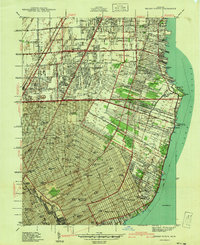
 1940 Detroit1940 Print · USGSDetroit and its Canadian neighbors thrive as a unified industrial corridor during the late thirties. Researchers can trace the massive rail-and-river network through the Detroit-Windsor Tunnel, Union Depot, and industrial sites like Zug Island.
 - 1941 Map of Royal Oak
 1941 Royal Oak1941 Print · USGSThe Detroit and Oakland County borderlands come into sharp focus in the late thirties as suburban neighborhoods began to fill the grid. Genealogists and local researchers can trace early residential blocks, parish schools like Gesu Sch, and prominent landmarks including the Detroit Zoological Park and Oakview Cem.2 unique versions available
 - 1942 Map of Redford
 1942 Redford1942 Print · USGSNorthwest of Detroit during the early war years, this survey captures the transition from township farmsteads to suburban hubs. Trace family roots and local landmarks through sites like the Redford PO, Burns Airport, and Grand Lawn Cem.2 unique versions available
 - 1942 Map of Dearborn
 1942 Dearborn1942 Print · USGSDearborn and the industrial Detroit fringe are captured here at the height of the early war years. Genealogists and historians can trace dozens of neighborhoods and schools, from Fordson High Sch to the grounds of Greenfield Village and Camp Legion.2 unique versions available
 - 1942 Map of Inkster
 1942 Inkster1942 Print · USGSWayne County at the onset of the 1940s shows a landscape of growing suburbs and vital transit hubs. Genealogists and local historians can trace the foundations of Garden City and Inkster or locate landmarks like Eloise Hospital and Nankin Mills.2 unique versions available
 - 1947 Map of Detroit
 1947 Detroit1947 Print · USGSPost-war Detroit and its Ontario neighbors are shown in meticulous detail during the city's industrial peak. Researchers can trace the mid-century urban fabric through dozens of local landmarks like Briggs Stadium, the Ambassador Bridge, and Wayne University.
 - 1952 Map of Grosse Pointe, 1953 Print
 1952 Grosse Pointe1953 Print · USGSThe Lake St. Clair shoreline and Detroit's northeast suburbs are captured here during the post-war population boom. Researchers can trace mid-century neighborhood growth and find dozens of local landmarks like the Grosse Pointe Yacht Club and Assumption Sch & Cem.2 unique versions available
 - 1952 Map of Royal Oak, 1954 Print
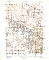
 1952 Royal Oak1954 Print · USGSNorth of Detroit in the early fifties, the post-war suburban boom is in full swing across Oakland County. Genealogists and local historians can trace family locations near Oakview Cemetery, Detroit Zoological Park, and dozens of neighborhood schools.2 unique versions available
Showing maps 1-25 of 88
Top cities near Detroit
- Sterling Heights historical maps
- Warren historical maps
- Clinton Township historical maps
- Livonia historical maps
- Dearborn historical maps
- Troy historical maps
See more
Top neighborhoods of Detroit
- Oak historical maps
- Delray Junction historical maps
- New Center historical maps
- Midtown historical maps
- Warrendale historical maps
- Northwest Detroit historical maps
See more
Frequently asked questions
- What are the different types of historical maps available for Detroit?
- What is the oldest map of Detroit?
- Where can I purchase historical maps of Detroit for my home or office?
- Where can I download high-res historical maps of Detroit?
- Are there historical topographic maps available for Detroit?
- Is there historical aerial imagery available for Detroit?
- Where are historical maps of Detroit sourced from?