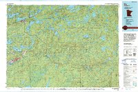
1990s Maps of Cook County, Minnesota
Explore 6 historic maps of Cook County from the 1990s. These maps offer a rare glimpse into what life looked like during the 1990s — showing old roads, neighborhoods, homes, and landmarks that have changed or disappeared over time.
Whether you're researching your family's past, planning a metal detecting trip, or studying how Cook County's landscape evolved across the 1990s, these high-resolution maps are a powerful tool for exploring the history of this region.
- Focus on a specific era: All maps on this page are from the 1990s, giving you a focused view of this time period.
- See what’s changed: Compare century-old streets, trails, and buildings to today's modern landscape using overlays and satellite layers.
- Research with precision: Use these maps for genealogy, historical research, land use analysis, or educational projects.
- View, download, or print: Maps are fully viewable online in high resolution, and can be downloaded or printed for your own records.
Start exploring Cook County's history through authentic maps from the 1990s. This is your window into the past.
Cook County, MN maps
(6)- 1990 Map of Outer Island, 1991 Print
 1990 Outer Island1991 Print · USGSThe northern Apostle Islands and the Lake Superior shoreline are captured here in the early 1990s. Researchers can trace remote maritime landmarks like the Outer Island Light and Devils Island or explore the coastal boundary of the Finland State Forest.
 - 1994 Map of Ely
 1994 Ely1994 Print · USGSEly and the surrounding Iron Range country are shown here in the mid-1990s, where mining operations meet the edge of the great northern wilderness. Researchers can trace the development of Babbitt, locate the Mine sites, or explore the vast lake networks of the Boundary Waters Canoe Area Wilderness.
 - 1999 Map of Grand Portage, 2003 Print
 1999 Grand Portage2003 Print · USGSThe northern reaches of the Arrowhead Region come into focus at the turn of the millennium, centered on the ancient fur trade corridor. Local researchers can trace the Grand Portage National Monument and locate landmarks like Pagan Cem or the Lookout Tower near the village of Grand Portage.
 - 1999 Map of Pigeon Point, 2003 Print
 1999 Pigeon Point2003 Print · USGSAlong the international border at the turn of the millennium, this map shows the rugged peninsula where the Pigeon River meets the lake. Researchers can trace the boundary through Grand Portage State Park and past islands like Susie Island.
 - 1999 Map of Mineral Center, 2003 Print
 1999 Mineral Center2003 Print · USGSThe North Shore wilderness at the turn of the millennium shows the intersection of tribal lands and national heritage. Trace family sites near Mineral Center or locate landmarks like the Mt Sophie Lookout Tower and the falls at Pigeon River.
 - 1999 Map of The Cascades, 2003 Print
 1999 The Cascades2003 Print · USGSThe international boundary between Minnesota and Ontario is traced here at the turn of the millennium. Genealogists and historians can locate the Site of Fort Charlotte and the rapids at The Cascades along the Pigeon River.
End of results
Showing maps 1-6 of 6
Top cities of Cook County
Frequently asked questions
- What are the different types of historical maps available for Cook County?
- What is the oldest map of Cook County?
- Where can I purchase historical maps of Cook County for my home or office?
- Where can I download high-res historical maps of Cook County?
- Are there historical topographic maps available for Cook County?
- Is there historical aerial imagery available for Cook County?
- Where are historical maps of Cook County sourced from?