1950s Maps of Cook County, Minnesota
Explore 31 historic maps of Cook County from the 1950s. These maps offer a rare glimpse into what life looked like during the 1950s — showing old roads, neighborhoods, homes, and landmarks that have changed or disappeared over time.
Whether you're researching your family's past, planning a metal detecting trip, or studying how Cook County's landscape evolved across the 1950s, these high-resolution maps are a powerful tool for exploring the history of this region.
- Focus on a specific era: All maps on this page are from the 1950s, giving you a focused view of this time period.
- See what’s changed: Compare century-old streets, trails, and buildings to today's modern landscape using overlays and satellite layers.
- Research with precision: Use these maps for genealogy, historical research, land use analysis, or educational projects.
- View, download, or print: Maps are fully viewable online in high resolution, and can be downloaded or printed for your own records.
Start exploring Cook County's history through authentic maps from the 1950s. This is your window into the past.
Cook County, MN maps
(31)- 1954 Map of Two Harbors, 1964 Print
 1954 Two Harbors1964 Print · USGSThe Minnesota North Shore and Superior National Forest are shown here in the mid-fifties, just as the taconite industry was reshaping the coast. Genealogists and historians can trace the rail lines of the Duluth Missabe and Iron Range or locate remote outposts like Sawbill Landing and Section Thirty.2 unique versions available
 - 1955 Map of Tofte, 1957 Print
 1955 Tofte1957 Print · USGSThe North Shore of Minnesota is captured here in the mid-fifties, centered on the lakeside settlement of Tofte. Researchers can trace early aviation and forestry sites like Gervais Landing Field, the Lookout Tower, and the prominent Carlton Peak.2 unique versions available
 - 1955 Map of Schroeder, 1957 Print
 1955 Schroeder1957 Print · USGSThe North Shore in the mid-1950s shows a landscape in transition as the taconite industry moves toward the coast. Researchers can trace the Erie Mining Company Railroad line down to Taconite Harbor or locate family roots near Schroeder and the Cross River.2 unique versions available
 - 1955 Map of Tofte, 1957 Print
 1955 Tofte1957 Print · USGSLake Superior's North Shore is captured here in the mid-fifties, just as heavy industry began reshaping the coastline. Trace the early footprints of Taconite Harbor, the Erie Mining Company Railroad, and landmarks like Carlton Peak.3 unique versions available
 - 1955 Map of Cramer, 1957 Print
 1955 Cramer1957 Print · USGSThe North Shore backcountry of Lake and Cook counties is shown here in the mid-fifties, dominated by dense state and national forests. Researchers can trace the Minnesota and Northern Railroad line to Cramer or locate high-ground landmarks like the Wanless Lookout Tower.3 unique versions available
 - 1956 Map of Little Marais, 1958 Print
 1956 Little Marais1958 Print · USGSThe North Shore's rugged transition from forest to lake is captured here in the mid-fifties, just as coastal infrastructure was modernizing. Trace the path of a highway Under Construction past Little Marais and the landmark Caribou Falls.3 unique versions available
 - 1956 Map of Finland, 1958 Print
 1956 Finland1958 Print · USGSThe North Shore of Lake Superior is captured here in the mid-fifties, showing the rugged intersection of the Crystal Bay Finland State Forest and the lake. Researchers can trace the era's military footprint at the Finland Air Force Station or locate family roots near the Finland Cem and Cramer Homestead Lake.2 unique versions available
 - 1957 Map of Two Harbors
 1957 Two Harbors1957 Print · USGSMinnesota's North Shore and the Arrowhead region are shown here in the mid-fifties as the taconite industry and cold war defense shaped the landscape. Researchers can trace the Duluth Missabe and Iron Range railroad, locate the Split Rock Light, and explore the iron-mining era at Taconite.
 - 1957 Map of Quetico, 1967 Print
 1957 Quetico1967 Print · USGSThe Ontario-Minnesota borderlands are captured here in the mid-fifties, showing the vast wilderness of the Boundary Waters before modern development. Genealogists and researchers can trace rail settlements along the Canadian National Railways including Atikokan, Sapawe, and Kashabowie.2 unique versions available
 - 1958 Map of Two Harbors
 1958 Two Harbors1958 Print · USGSThe North Shore and Arrowhead region of Minnesota are captured in the 1950s as iron ore shipping and wilderness preservation shaped the land. Researchers can trace the Duluth Missabe and Iron Range RR, find maritime landmarks like Split Rock Light, and locate remote settlements from Babbitt to Grand Marais.
 - 1958 Map of Deer Yard Lake, 1959 Print
 1958 Deer Yard Lake1959 Print · USGSThe North Shore of Minnesota meets the forested interior of Cook County in the late fifties, showcasing the transition from deep woods to the lakefront. Trace the path of Route 61 as it passes Black Point and the Cascade Lookout Tower or explore the rugged drainage of Indian Camp Creek.3 unique versions available
 - 1958 Map of Good Harbor Bay, 1959 Print
 1958 Good Harbor Bay1959 Print · USGSThe North Shore harbor of Grand Marais and the rugged shoreline of Lake Superior are captured here during the late fifties. Genealogists and local historians can locate the Poplar Grove Cem and the Town Hall, or trace the coastline around Terrace Point.4 unique versions available
 - 1958 Map of Hancock, 1967 Print
 1958 Hancock1967 Print · USGSThe Keweenaw Peninsula and Isle Royale are seen here during the mid-twentieth century as mining and maritime hubs. Trace the dense town layouts of Hancock and Calumet, or locate remote coastal markers like the Eagle Harbor Lighthouse and Rock of Ages Light.2 unique versions available
 - 1959 Map of Lutsen, 1960 Print
 1959 Lutsen1960 Print · USGSThe North Shore of Lake Superior comes alive in the late fifties, showing the coastal settlement of Lutsen as its recreation economy began to take shape. Researchers can trace the layout of early lakeside life through the Lutsen Cem, the Skiing Sta at Moose Mountain, and the winding course of the Poplar River.4 unique versions available
 - 1959 Map of Pigeon Point, 1961 Print
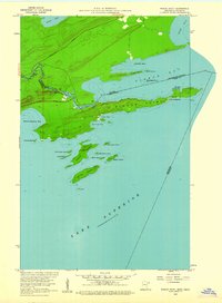 1959 Pigeon Point1961 Print · USGSThe tip of Northeast Minnesota meets the Canadian border in the late 1950s, showing a landscape of rocky peninsulas and island chains. You can trace the Pigeon River past Pigeon Falls and explore the remote islands of Susie and Lucille.3 unique versions available
 - 1959 Map of Northern Light Lake, 1961 Print
 1959 Northern Light Lake1961 Print · USGSNorthern Minnesota's wilderness is preserved in this late-fifties survey of Cook County's intricate waterways. Researchers can trace the winding Brule River and locate remote timber-era landmarks like Section Ten Lake and Redcoat Lake.4 unique versions available
 - 1959 Map of Pine Mountain, 1961 Print
 1959 Pine Mountain1961 Print · USGSCook County's wilderness interior is captured here in the late fifties, showing the legendary Gunflint Trail winding through a network of lakes. Search for historic sites like Gunflint Camp and the remote Lookout Tower overlooking Pine Mountain.3 unique versions available
 - 1959 Map of Mineral Center, 1961 Print
 1959 Mineral Center1961 Print · USGSCook County's rugged Arrowhead region is captured here in the late fifties, where the international border meets the Lake Superior coast. Trace the early layout of Mineral Center and Red Rock, or locate historic landmarks like Partridge Falls and Mt Sophie.4 unique versions available
 - 1959 Map of Pine Lake East, 1961 Print
 1959 Pine Lake East1961 Print · USGSNortheastern Cook County and the Canadian border are documented in the late fifties, showcasing the intricate water systems of the Arrowhead. Researchers can trace the Grand Portage terrain and wilderness landmarks like McFarland Lake, Devilfish Lake, and South Fowl Lake.4 unique versions available
 - 1959 Map of Lima Mountain, 1961 Print
 1959 Lima Mountain1961 Print · USGSNortheastern Minnesota's high wilderness is captured here in the late fifties, showcasing the intricate glacial lakes of the Superior National Forest. Researchers can trace the path of the Old Railroad Grade and locate the Lookout Tower atop Lima Mountain.3 unique versions available
 - 1959 Map of Munker Island, 1962 Print
 1959 Munker Island1962 Print · USGSThe wilderness of the Boundary Waters comes to life in this late 1950s survey of the Minnesota-Ontario border. Trace the end of the Gunflint Trail at Trails End and explore the island chains of Saganaga Lake and Sea Gull Lake.4 unique versions available
 - 1959 Map of Conners Island, 1962 Print
 1959 Conners Island1962 Print · USGSThe Boundary Waters wilderness at the end of the fifties comes alive in this survey of the international border between Minnesota and Ontario. Trace historic canoe routes and portages including the Gneiss Lake Portage, Island Pine Portage, and the rapids of the Granite River.3 unique versions available
 - 1959 Map of Tom Lake, 1962 Print
 1959 Tom Lake1962 Print · USGSNortheastern Minnesota at the end of the 1950s was a landscape of deep timber and glacial lakes. Researchers can trace the network of forest roads and waterways used by outdoorsmen and wardens, from the Devilfish Lookout Tower to the shores of Tom Lake.3 unique versions available
 - 1959 Map of Ogishkemuncie Lake, 1962 Print
 1959 Ogishkemuncie Lake1962 Print · USGSThe Minnesota wilderness at the end of the 1950s is defined here by the intricate island chains and deep waters of the Boundary Waters region. Outdoor historians and researchers can trace portage routes and depth contours for Ogishkemuncie Lake, Jasper Lake, and Kekekabic Lake.4 unique versions available
 - 1959 Map of Hungry Jack Lake, 1962 Print
 1959 Hungry Jack Lake1962 Print · USGSNortheastern Minnesota at the edge of the international boundary is captured here during the late fifties. You can trace early wilderness travel routes along the Gunflint Trail and locate recreation sites like Flour Lake Campground and the Bearskin Lookout Tower.4 unique versions available
Showing maps 1-25 of 31
Top cities of Cook County
Frequently asked questions
- What are the different types of historical maps available for Cook County?
- What is the oldest map of Cook County?
- Where can I purchase historical maps of Cook County for my home or office?
- Where can I download high-res historical maps of Cook County?
- Are there historical topographic maps available for Cook County?
- Is there historical aerial imagery available for Cook County?
- Where are historical maps of Cook County sourced from?