1960s Maps of Cook County, Minnesota
Explore 27 historic maps of Cook County from the 1960s. These maps offer a rare glimpse into what life looked like during the 1960s — showing old roads, neighborhoods, homes, and landmarks that have changed or disappeared over time.
Whether you're researching your family's past, planning a metal detecting trip, or studying how Cook County's landscape evolved across the 1960s, these high-resolution maps are a powerful tool for exploring the history of this region.
- Focus on a specific era: All maps on this page are from the 1960s, giving you a focused view of this time period.
- See what’s changed: Compare century-old streets, trails, and buildings to today's modern landscape using overlays and satellite layers.
- Research with precision: Use these maps for genealogy, historical research, land use analysis, or educational projects.
- View, download, or print: Maps are fully viewable online in high resolution, and can be downloaded or printed for your own records.
Start exploring Cook County's history through authentic maps from the 1960s. This is your window into the past.
Cook County, MN maps
(27)- 1960 Map of Hancock
 1960 Hancock1960 Print · USGSThe Keweenaw Peninsula and Isle Royale are captured in detail during the late 1950s. Researchers can trace copper-mining era settlements like Calumet and Laurium, or locate remote maritime landmarks such as the Isle Royale Lighthouse.
 - 1960 Map of The Cascades, 1961 Print
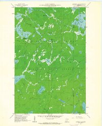
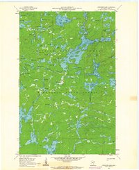
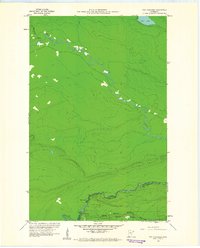 1960 The Cascades1961 Print · USGSThe northern borderlands of Cook County come to life in the early 1960s, showing the intersection of international boundaries and historic trade routes. Local historians can trace the Site of Fort Charlotte and the river rapids at The Cascades along the Pigeon River.3 unique versions available
 - 1960 Map of Farquhar Peak, 1961 Print
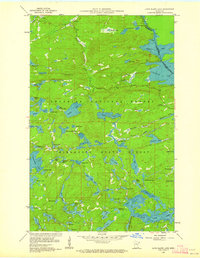
 1960 Farquhar Peak1961 Print · USGSThe northern wilderness of Cook County and the Canadian border are captured here in the early sixties. Researchers can trace the path of the Pigeon River along the international line and locate the Hovland Lookout Tower standing near Farquhar Peak.4 unique versions available
 - 1960 Map of South Fowl Lake, 1961 Print
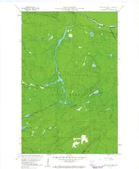
 1960 South Fowl Lake1961 Print · USGSThe international boundary at the dawn of the 1960s reveals a remote landscape where the Pigeon River and South Fowl Lake meet. Trace the historic waterways of Grand Portage State Forest and the winding course of the Arrow River.4 unique versions available
 - 1960 Map of Hovland, 1961 Print
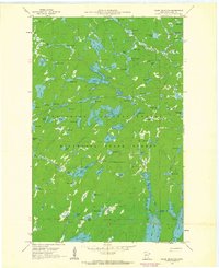
 1960 Hovland1961 Print · USGSNorth Shore life in the early sixties centers on the small coastal community of Hovland along the edge of the Grand Portage State Forest. Researchers can trace old family sites near the local Cem and the mouths of the Flute Reed River and Carlson Creek.4 unique versions available
 - 1960 Map of Grand Marais, 1961 Print
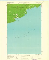
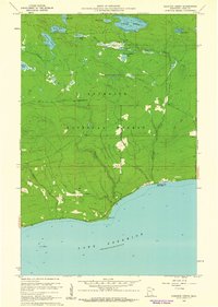
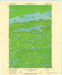
 1960 Grand Marais1961 Print · USGSGrand Marais and the Cook County shoreline are captured here in the early sixties as the harbor town anchored the gateway to the North Woods. Genealogists and local historians can trace the foundations of Chippewa City, the Maple Hill School, and the start of the historic Gunflint Trail.3 unique versions available
 - 1960 Map of Kadunce Creek, 1961 Print
 1960 Kadunce Creek1961 Print · USGSThe North Shore of Lake Superior comes into focus in the early sixties, showing the rugged intersection of the Superior National Forest and the lake. Researchers can trace the development of Kadunce Creek State Park and locate numerous inland waters like Mink Lake and Section Fifteen Lake.4 unique versions available
 - 1960 Map of Tait Lake, 1962 Print
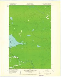
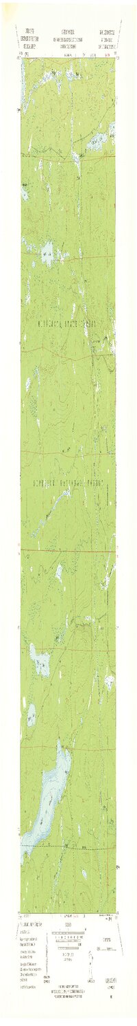
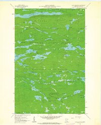
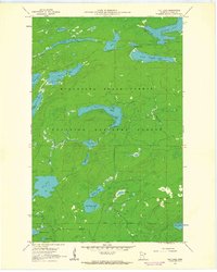 1960 Tait Lake1962 Print · USGSThe wilderness of Cook County is captured here in the early sixties, showing the vast interconnected waters of the Minnesota State Forest. Trace the remote reaches of Tait Lake and find old landmarks like the Campground at Lichen Lake or the secluded Mistletoe Lake.5 unique versions available
 - 1960 Map of Devil Track Lake, 1962 Print
 1960 Devil Track Lake1962 Print · USGSCook County's wilderness and aviation hubs are captured here in the early sixties, showing the region as it transitioned into a modern recreational destination. Researchers can locate the Sky Port Seaplane Base, trace the Little Devil Track River, and explore landmarks like Murphy Mountain and the Devil Lake Campground.3 unique versions available
 - 1960 Map of Lake Polly, 1962 Print
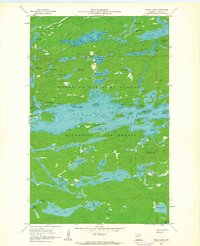
 1960 Lake Polly1962 Print · USGSThe northern wilderness of the Arrowhead region is captured here in the early 1960s, showing a complex network of glacial lakes and portage routes. Researchers can trace the courses of the Kawishiwi River and Louse River past landmarks like Adams Lake and Malberg Lake.4 unique versions available
 - 1960 Map of Mark Lake, 1962 Print
 1960 Mark Lake1962 Print · USGSCook County's deep woods and glacial lakes are captured here in the early sixties, showing a wilderness landscape shaped by forestry and water. Map collectors and historians can trace the path of the Old Railroad or locate sites near Pike Lake and the Cascade River Campground.3 unique versions available
 - 1960 Map of South Lake, 1962 Print
 1960 South Lake1962 Print · USGSThe Minnesota-Ontario borderlands at the dawn of the 1960s reveal a landscape of vast interconnected waterways and historical portages. Trace the path of the old Railroad Grade or locate remote sites like the Iron Lake Campground and Height of Land Portage.4 unique versions available
 - 1960 Map of Kawishiwi Lake, 1962 Print
 1960 Kawishiwi Lake1962 Print · USGSThe Superior National Forest at the start of the 1960s was a dense wilderness of interconnected waterways and glacial basins. Outdoor enthusiasts and local historians can trace the primitive layout of the Kawishiwi Lake Campground or follow the remote reaches of Phoebe Lake and Coffee Lake.3 unique versions available
 - 1960 Map of Sawbill Camp, 1962 Print
 1960 Sawbill Camp1962 Print · USGSThe northern lake country of Cook County is shown here during a period of transition in the early sixties. Researchers can trace historical timber corridors via the Old Railroad Grade and find early recreational landmarks like Sawbill Camp and Baker Lake Campground.4 unique versions available
 - 1960 Map of Eagle Mountain, 1962 Print
 1960 Eagle Mountain1962 Print · USGSThe Misquah Hills and the summit of Eagle Mountain are documented here in the early sixties before the modern wilderness management era. Trace the path of the Old Railroad Grade and remote water bodies like Winchell Lake and Brule Lake.3 unique versions available
 - 1960 Map of Brule Lake, 1962 Print
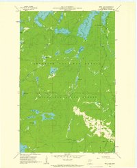
 1960 Brule Lake1962 Print · USGSBrule Lake and the surrounding Cook County wilderness are captured in the early sixties during a period of transition for forest management. Outdoorsmen and historians can trace old access routes and survey the locations of the Brule Lake Lookout Tower, Fishbox Island, and the Misquah Hills.5 unique versions available
 - 1960 Map of Marr Island, 1962 Print
 1960 Marr Island1962 Print · USGSThe North Shore of Cook County comes alive in the early sixties as it transitions from wild forest to a settled coastal corridor. Researchers can find land details like the Cem and Arrowhead Park, or trace the winding Brule River to its mouth at Lake Superior.4 unique versions available
 - 1960 Map of Beth Lake, 1962 Print
 1960 Beth Lake1962 Print · USGSThe wilderness of Cook County is captured here in the early sixties, showing the transition between state and national forests. Outdoor historians and genealogists can trace the early road network and remote sites like Sawbill Campground, Beth Lake, and the upper reaches of the Temperance River.3 unique versions available
 - 1960 Map of Cherokee Lake, 1962 Print
 1960 Cherokee Lake1962 Print · USGSThe wilderness of Cook County is captured here in the early sixties, showing the vast water networks of the Superior National Forest. Trace the primitive shorelines and drainage patterns of Frost Lake, Town Lake, and the Frost River.3 unique versions available
 - 1960 Map of Gunflint Lake, 1962 Print
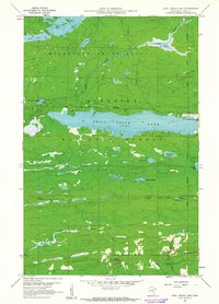
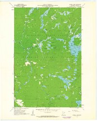
 1960 Gunflint Lake1962 Print · USGSThe international border between Cook County and Ontario is captured here at the start of the 1960s, showing a remote wilderness of lakes and early trails. Trace the historic Old Railroad Grade and the Gunflint Trail as they pass through the Superior National Forest.3 unique versions available
 - 1960 Map of Kelso Mountain, 1963 Print
 1960 Kelso Mountain1963 Print · USGSCook County's glacial interior is revealed in the early 1960s as a roadless expanse of lakes and forests. Researchers can trace the hydrography of the Frost River or locate the remote Lookout Tower atop Kelso Mountain.5 unique versions available
 - 1960 Map of Long Island Lake, 1963 Print
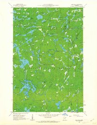
 1960 Long Island Lake1963 Print · USGSBoundary waters and deep northern forests characterize Cook County in the early sixties, as this survey follows the international border. Wilderness travelers and historians can trace the historic Gunflint Trail and locate remote outposts like the Gunflint Lookout Tower and Forest Service Guard Station.4 unique versions available
 - 1961 Map of Hancock
 1961 Hancock1961 Print · USGSThe Keweenaw Peninsula and Isle Royale are shown here at the start of the 1960s, featuring the region's historic copper mining and maritime infrastructure. Genealogists and researchers can trace local families through settlements like Atlantic Mine and Painesdale, or locate remote landmarks including Rock of Ages Light and Eagle Harbor.
 - 1964 Map of Two Harbors
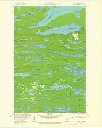
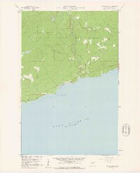
 1964 Two Harbors1964 Print · USGSThe North Shore of Lake Superior is captured here during the mid-1950s, a time of significant industrial mining growth and emerging tourism. Genealogists and historians can trace the rail lines of the Duluth Missabe and Iron Range and locate landmarks like Split Rock Light and the U S Air Force Radar Station.
 - 1966 Map of Hancock, 1987 Print
 1966 Hancock1987 Print · USGSThe Keweenaw Peninsula and Isle Royale are captured in the mid-1960s during a pivotal era for Michigan’s Copper Country. Trace the industrial footprint of the SOO LINE through Calumet or locate historic maritime landmarks like Fort Wilkins and Rock of Ages Light.
Showing maps 1-25 of 27
Top cities of Cook County
Frequently asked questions
- What are the different types of historical maps available for Cook County?
- What is the oldest map of Cook County?
- Where can I purchase historical maps of Cook County for my home or office?
- Where can I download high-res historical maps of Cook County?
- Are there historical topographic maps available for Cook County?
- Is there historical aerial imagery available for Cook County?
- Where are historical maps of Cook County sourced from?