Old Maps of Elmendorf Christian Community, Minnesota for Academic Research
Study the evolution of Elmendorf Christian Community with 9 high-resolution historic maps. Whether you're teaching, researching, or modeling changes in land use, these maps provide essential visual documentation of urban, environmental, and geographic change.
- Analyze long-term change: Track patterns in development, transportation, and natural features.
- Ideal for environmental or urban studies: Support academic projects with primary historical map data.
- Use in the classroom or lab: Educators and researchers rely on these maps to bring historical context to life.
These maps are a powerful tool for teaching, research, and visualizing how Elmendorf Christian Community has changed over the decades.
Elmendorf Christian Community, MN maps
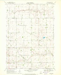
(9)- 1954 Map of Fairmont, 1967 Print
 1954 Fairmont1967 Print · USGSThe prairie landscape of southern Minnesota and northern Iowa comes alive in this mid-century survey of the Coteau des Prairies. Genealogists and historians can trace the rail-connected growth of Fairmont and Blue Earth or locate family roots near St Kilian Ch and Union Slough National Wildlife Refuge.3 unique versions available
 - 1958 Map of Fairmont
 1958 Fairmont1958 Print · USGSThe borderlands of southern Minnesota and northern Iowa come alive in the mid-1950s, showing a landscape defined by glacial lakes and rail-line commerce. Researchers can trace historic landmarks like Lakeside Laboratory, Gridley Station, and the Bancroft Wildlife Refuge across the prairie.
 - 1970 Map of Bergen, 1972 Print
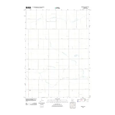
 1970 Bergen1972 Print · USGSSouthern Minnesota farmland is captured here in the early seventies, showing a landscape defined by township grids and river forks. Genealogists and local historians can locate Bergen, the Hauger Cem, and the community Townhall among the sections of Kimball and Belmont.
 - 1985 Map of Fairmont, 1991 Print
 1985 Fairmont1991 Print · USGSSouthern Minnesota in the mid-eighties shows a robust network of prairie towns and rail-connected agricultural hubs. Genealogists can trace family footprints across Rolling Green and Manyaska or locate old homesteads near Fox Lake and the Chicago & North Western line.
 - 2010 Map of Bergen, 2010 Print
 2010 Bergen2010 Print · USGSCovers Elmendorf Christian Community, including Bergen, Jackson County, and other nearby areas
 - 2013 Map of Bergen, 2013 Print
 2013 Bergen2013 Print · USGSCovers Elmendorf Christian Community, including Bergen, Jackson County, and other nearby areas
 - 2016 Map of Bergen, 2016 Print
 2016 Bergen2016 Print · USGSCovers Elmendorf Christian Community, including Bergen, Jackson County, and other nearby areas
 - 2019 Map of Bergen, 2019 Print
 2019 Bergen2019 Print · USGSCovers Elmendorf Christian Community, including Bergen, Jackson County, and other nearby areas
 - 2022 Map of Bergen, 2022 Print
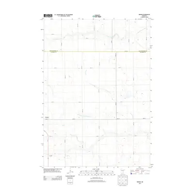
 2022 Bergen2022 Print · USGSJackson County prairie land at the start of the 2020s reveals a blend of traditional agriculture and natural waterways. Researchers can locate Bergen and Hauges Cem or trace the winding paths of the S Fork Watonwan River and Elm Cr.
End of results
Showing maps 1-9 of 9
Top cities near Elmendorf Christian Community
- Windom historical maps
- Jackson historical maps
- Mountain Lake historical maps
- Sherburn historical maps
- Trimont historical maps
- Butterfield historical maps
See more
Frequently asked questions
- What are the different types of historical maps available for Elmendorf Christian Community?
- What is the oldest map of Elmendorf Christian Community?
- Where can I purchase historical maps of Elmendorf Christian Community for my home or office?
- Where can I download high-res historical maps of Elmendorf Christian Community?
- Are there historical topographic maps available for Elmendorf Christian Community?
- Is there historical aerial imagery available for Elmendorf Christian Community?
- Where are historical maps of Elmendorf Christian Community sourced from?