Old Maps of Penasse, Minnesota for Academic Research
Study the evolution of Penasse with 9 high-resolution historic maps. Whether you're teaching, researching, or modeling changes in land use, these maps provide essential visual documentation of urban, environmental, and geographic change.
- Analyze long-term change: Track patterns in development, transportation, and natural features.
- Ideal for environmental or urban studies: Support academic projects with primary historical map data.
- Use in the classroom or lab: Educators and researchers rely on these maps to bring historical context to life.
These maps are a powerful tool for teaching, research, and visualizing how Penasse has changed over the decades.
Penasse, MN maps
(9)- 1918 Map of Oak Island
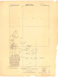 1918 Oak Island1918 Print · USGSThe international border at Lake of the Woods is captured here during the late First World War era. Genealogists and historians can trace the early footprint of Oak Island Fishery and coastal landmarks like Sugar Point and Magnusons Island.
 - 1963 Map of Kenora, 1968 Print
 1963 Kenora1968 Print · USGSThe Lake of the Woods borderlands in the early sixties reveal a complex web of remote peninsulas and rail-linked settlements. Trace the path of the Canadian Pacific Railway through Kenora or locate island outposts like Falcon Island and Big Island.2 unique versions available
 - 1967 Map of Flag Island, 1969 Print
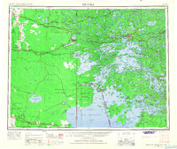
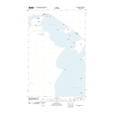
 1967 Flag Island1969 Print · USGSThe northernmost point of the contiguous United States is captured here during the late sixties, where the forest meets the water of the borderlands. Researchers can locate the settlement of Penasse, the historic Fort St Charles, and seasonal routes like the Winter Trail.
 - 1985 Map of Oak Island
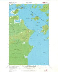
 1985 Oak Island1985 Print · USGSThe northernmost tip of Minnesota is captured in the mid-1980s, where the international border winds through the islands of the Lake of the Woods. Researchers can trace the bounds of the Red Lake Indian Res and explore remote landmarks like Garden Island and Penasse Island.2 unique versions available
 - 2011 Map of Flag Island, 2011 Print
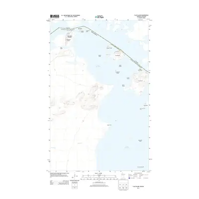
 2011 Flag Island2011 Print · USGSCovers Penasse, including Unorganized Kenora District, Kenora District, and other nearby areas
 - 2013 Map of Flag Island, 2013 Print
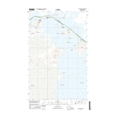
 2013 Flag Island2013 Print · USGSCovers Penasse, including Unorganized Kenora District, Kenora District, and other nearby areas
 - 2016 Map of Flag Island, 2016 Print
 2016 Flag Island2016 Print · USGSCovers Penasse, including Unorganized Kenora District, Kenora District, and other nearby areas
 - 2019 Map of Flag Island, 2019 Print
 2019 Flag Island2019 Print · USGSCovers Penasse, including Unorganized Kenora District, Kenora District, and other nearby areas
 - 2022 Map of Flag Island, 2022 Print
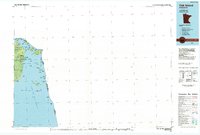
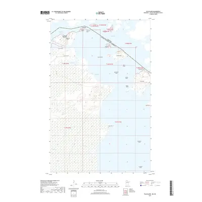
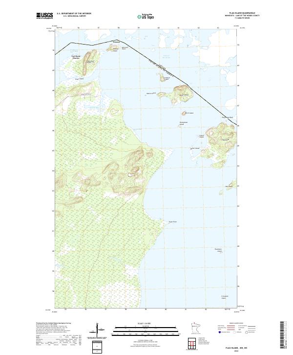 2022 Flag Island2022 Print · USGSThe northernmost point of the contiguous United States comes into focus in this recent study of the Northwest Angle borderlands. Researchers can trace the international boundary near Penasse, Fort Saint Charles, and the reefs surrounding Flag Island.
End of results
Showing maps 1-9 of 9
Top cities near Penasse
Frequently asked questions
- What are the different types of historical maps available for Penasse?
- What is the oldest map of Penasse?
- Where can I purchase historical maps of Penasse for my home or office?
- Where can I download high-res historical maps of Penasse?
- Are there historical topographic maps available for Penasse?
- Is there historical aerial imagery available for Penasse?
- Where are historical maps of Penasse sourced from?