1900s (20th Century) Maps of Martin County, Minnesota
Explore 22 historic maps of Martin County from the 1900s (20th Century). These maps offer a rare glimpse into what life looked like during the 1900s — showing old roads, neighborhoods, homes, and landmarks that have changed or disappeared over time.
Whether you're researching your family's past, planning a metal detecting trip, or studying how Martin County's landscape evolved across the 1900s, these high-resolution maps are a powerful tool for exploring the history of this region.
- Focus on a specific era: All maps on this page are from the 1900s, giving you a focused view of this time period.
- See what’s changed: Compare century-old streets, trails, and buildings to today's modern landscape using overlays and satellite layers.
- Research with precision: Use these maps for genealogy, historical research, land use analysis, or educational projects.
- View, download, or print: Maps are fully viewable online in high resolution, and can be downloaded or printed for your own records.
Start exploring Martin County's history through authentic maps from the 1900s. This is your window into the past.
Martin County, MN maps
(22)- 1954 Map of Fairmont, 1967 Print
 1954 Fairmont1967 Print · USGSThe prairie landscape of southern Minnesota and northern Iowa comes alive in this mid-century survey of the Coteau des Prairies. Genealogists and historians can trace the rail-connected growth of Fairmont and Blue Earth or locate family roots near St Kilian Ch and Union Slough National Wildlife Refuge.3 unique versions available
 - 1958 Map of Fairmont
 1958 Fairmont1958 Print · USGSThe borderlands of southern Minnesota and northern Iowa come alive in the mid-1950s, showing a landscape defined by glacial lakes and rail-line commerce. Researchers can trace historic landmarks like Lakeside Laboratory, Gridley Station, and the Bancroft Wildlife Refuge across the prairie.
 - 1967 Map of Truman, 1968 Print
 1967 Truman1968 Print · USGSIn the mid-1960s, the agricultural landscape around Truman was a busy corridor for the Chicago and North Western railway. Genealogists can trace family history through several rural cemeteries, including Ridge Lawn and Westford, while others may locate the historic Horicon Church.
 - 1967 Map of Pilot Grove, 1968 Print
 1967 Pilot Grove1968 Print · USGSFaribault County agriculture and water management are on full display in this late-sixties survey of the Minnesota-Iowa border. Genealogists and researchers can locate the Pilot Grove Cemetery, the local Townhall, and the winding West Branch Blue Earth River.
 - 1967 Map of East Chain, 1968 Print
 1967 East Chain1968 Print · USGSSouthern Martin County at the Minnesota-Iowa border reveals a landscape of prairie drainage and rural community in the late sixties. Genealogists and local historians can trace family locations near East Chain Ch, St Pauls Ch, or the Evangelical Cem.
 - 1967 Map of Wilmert Lake, 1968 Print
 1967 Wilmert Lake1968 Print · USGSThe Minnesota-Iowa borderlands are captured here in the late sixties, showcasing the intricate chain of lakes and agricultural drainage networks. Genealogists can trace family locations near Oakwood Cem, Center Chain Cem, or the Amber Lake Park area.2 unique versions available
 - 1967 Map of Truman SE, 1968 Print
 1967 Truman SE1968 Print · USGSMartin County and its neighbors show a highly managed agricultural landscape in the late sixties, shaped by an extensive system of judicial ditches. Genealogists and local historians can locate Nashville Center, trace family roots at Brainard Ch, and find the local Townhall.
 - 1967 Map of Winnebago, 1968 Print
 1967 Winnebago1968 Print · USGSFaribault County in the late sixties reveals a landscape shaped by the Blue Earth River and the meeting of major rail lines. Genealogists and local historians can trace the locations of Basey Ch and several burial grounds like Rose Hill Cem and Riverside Cem.2 unique versions available
 - 1967 Map of Granada, 1968 Print
 1967 Granada1968 Print · USGSMartin County farmland is captured here in the late sixties, just as modern highway planning was beginning to reshape the prairie. Genealogists and local historians can trace the paths of the Milwaukee Road, locate Imogene, or find the Center Creek Cem.
 - 1967 Map of Huntley, 1969 Print
 1967 Huntley1969 Print · USGSFaribault County is captured in the late sixties as a thriving rail and agricultural hub at the crossroads of two major Midwestern lines. Researchers can trace family roots at West Verona Cem or follow the routes of the Chicago and North Western through Guckeen.2 unique versions available
 - 1967 Map of Fairmont, 1969 Print
 1967 Fairmont1969 Print · USGSFairmont and the surrounding Martin County prairies are captured in the late sixties, showing a landscape defined by its chain of lakes and deep rail roots. Researchers can trace the mid-century city footprint through Lincoln Sch, Lakeside Cemetery, and the junction of the CHICAGO AND NORTH WESTERN railroad.3 unique versions available
 - 1970 Map of St James SE, 1972 Print
 1970 St James SE1972 Print · USGSMartin County agriculture and rural life take center stage in the early seventies, showing a landscape defined by prairie drainage and small townships. Researchers can locate the North Star Cem, the Waverly Ch, and various water bodies like Round Lake and Fox Lake.
 - 1970 Map of Ceylon, 1972 Print
 1970 Ceylon1972 Print · USGSSouthern Minnesota and the Iowa borderlands are captured here in the early 1970s, showing a prairie landscape shaped by drainage and rail. Researchers can trace family sites at Lone Cedar Cem or follow the path of the Chicago and North Western railroad through Ceylon.
 - 1970 Map of Trimont, 1972 Print
 1970 Trimont1972 Print · USGSThe rail-and-water landscape of Martin and Watonwan Counties is captured here in the early seventies. Genealogists and local historians can trace family roots through the grain-and-rail economy of Trimont, the small-town streets of Odin, and the Cedar Lake Cem.
 - 1970 Map of Mountain Lake SE, 1972 Print
 1970 Mountain Lake SE1972 Print · USGSSouthern Minnesota farm country is captured here in the early seventies as a network of creek-fed townships across four county lines. Genealogists and local historians can trace legacy landmarks like St Olaf Ch Cem, Cedar Hill Cem, and the waters of Fish Lake.
 - 1970 Map of Welcome, 1972 Print
 1970 Welcome1972 Print · USGSWelcome is captured in the early 1970s as a bustling rail crossroads in Martin County during a period of agricultural expansion. Genealogists and local historians can trace the paths of the Milwaukee Road, locate the Emmanuel Cem, or find early civic sites like the Townhall.
 - 1970 Map of Dunnell, 1972 Print
 1970 Dunnell1972 Print · USGSDunnell and the surrounding farmlands of Martin and Emmet counties are captured here in the early 1970s. Researchers can trace family ties through the Lake Fremont Cem, the Chicago and North Western rail corridor, and the grid of Judicial Ditch No 105.
 - 1970 Map of Wilbert, 1972 Print
 1970 Wilbert1972 Print · USGSThe Minnesota-Iowa borderlands come to life in the early seventies, showcasing a landscape of glacial lakes and prairie townships. Researchers can locate the Wilbert Townhall, trace family plots at Tenhassen Cem, and explore the shoreline of Okamanpeedan Lake.
 - 1970 Map of Sherburn, 1972 Print
 1970 Sherburn1972 Print · USGSMartin County agriculture and rail transit meet in the early seventies as the interstate highway system begins its expansion. Trace the growth of Sherburn and Welcome or locate ancestral sites like Elm Creek Cem and the Emmanuel Ch.
 - 1970 Map of Alpha, 1972 Print
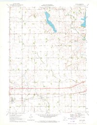 1970 Alpha1972 Print · USGSThe village of Alpha and its surrounding prairie landscape are captured here in the early 1970s, showcasing a rural economy built on rail and water management. Researchers can trace the Chicago Milwaukee St Paul and Pacific line and family-scale operations like the numerous Gravel Pits near Watkins Lake.
 - 1985 Map of Fairmont, 1991 Print
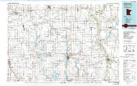 1985 Fairmont1991 Print · USGSSouthern Minnesota in the mid-eighties shows a robust network of prairie towns and rail-connected agricultural hubs. Genealogists can trace family footprints across Rolling Green and Manyaska or locate old homesteads near Fox Lake and the Chicago & North Western line.
 - 1992 Map of Fairmont, 1995 Print
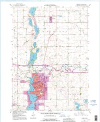 1992 Fairmont1995 Print · USGSFairmont and the surrounding Martin County prairies are captured here in the early nineties, showcasing the city's unique lakefront development. Researchers can trace local heritage through landmarks like Lakeside Cemetery, Lincoln Sch, and the rail-side community of Northrop.
End of results
Showing maps 1-22 of 22
Top cities of Martin County
- Fairmont historical maps
- Truman historical maps
- Sherburn historical maps
- Trimont historical maps
- Welcome historical maps
- Ceylon historical maps
See more
Frequently asked questions
- What are the different types of historical maps available for Martin County?
- What is the oldest map of Martin County?
- Where can I purchase historical maps of Martin County for my home or office?
- Where can I download high-res historical maps of Martin County?
- Are there historical topographic maps available for Martin County?
- Is there historical aerial imagery available for Martin County?
- Where are historical maps of Martin County sourced from?