1900s (20th Century) Maps of Mille Lacs County, Minnesota
Explore 31 historic maps of Mille Lacs County from the 1900s (20th Century). These maps offer a rare glimpse into what life looked like during the 1900s — showing old roads, neighborhoods, homes, and landmarks that have changed or disappeared over time.
Whether you're researching your family's past, planning a metal detecting trip, or studying how Mille Lacs County's landscape evolved across the 1900s, these high-resolution maps are a powerful tool for exploring the history of this region.
- Focus on a specific era: All maps on this page are from the 1900s, giving you a focused view of this time period.
- See what’s changed: Compare century-old streets, trails, and buildings to today's modern landscape using overlays and satellite layers.
- Research with precision: Use these maps for genealogy, historical research, land use analysis, or educational projects.
- View, download, or print: Maps are fully viewable online in high resolution, and can be downloaded or printed for your own records.
Start exploring Mille Lacs County's history through authentic maps from the 1900s. This is your window into the past.
Mille Lacs County, MN maps
(31)- 1953 Map of Duluth, 1964 Print
 1953 Duluth1964 Print · USGSNortheastern Minnesota and northwestern Wisconsin are shown here during a period of industrial maturity and expanding conservation. Genealogists and historians can trace rail-connected towns like McGrath and Wahkon, or locate heritage sites within the Fond du Lac Indian Reservation.2 unique versions available
 - 1953 Map of Stillwater, 1980 Print
 1953 Stillwater1980 Print · USGSThe Twin Cities and the St. Croix Valley are captured in this mid-century survey as the interstate era began to transform the Upper Midwest. Genealogists and historians can trace the rail-and-river geography of Stillwater, locate landmarks in Anoka, or explore the sprawling St Croix State Park.
 - 1955 Map of Stillwater, 1965 Print
 1955 Stillwater1965 Print · USGSThe Upper St. Croix Valley and the growing Twin Cities area are shown here during the mid-fifties, before the interstate era transformed the regional commute. You can trace the lines of the Northern Pacific RR through towns like Rush City or locate the Saint Croix Indian Reservation.
 - 1958 Map of Stillwater
 1958 Stillwater1958 Print · USGSThe Upper Mississippi and St. Croix River valleys appear in the mid-fifties as the Twin Cities expanded north. Genealogists can locate family landmarks like Oak Park Cem, Saint Michael Church, and the Soo Line RR rail corridors.2 unique versions available
 - 1958 Map of Duluth
 1958 Duluth1958 Print · USGSNortheastern Minnesota and the Wisconsin borderlands are shown in detail during the late 1950s, centered on the bustling rail yards and ports of Duluth. You can trace the historic routes of the Soo Line and Duluth Missabe & Iron Range through small towns like McGrath, Bruno, and Wrenshall.
 - 1965 Map of Stillwater
 1965 Stillwater1965 Print · USGSThe Twin Cities and the St. Croix Valley are mapped here during a period of significant post-war growth and industrial transit. Genealogists and historians can trace rail lines like the Northern Pacific RR through towns such as Rush City, Amery, and Balsam Lake.
 - 1968 Map of Onamia NW, 1970 Print
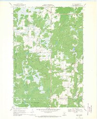
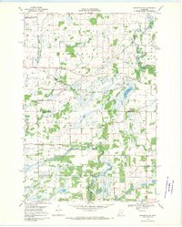
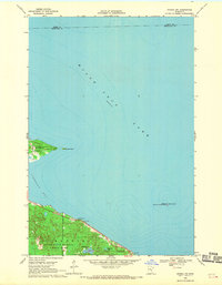 1968 Onamia NW1970 Print · USGSThe southwestern reaches of Mille Lacs Lake are captured here in the late sixties, showcasing a landscape defined by conservation and recreation. Researchers can trace the early boundaries of Mille Lacs Kathio State Park and locate offshore landmarks like Spirit Island.2 unique versions available
 - 1968 Map of Ramey NE, 1970 Print
 1968 Ramey NE1970 Print · USGSNear the border of Morrison and Mille Lacs counties in the late sixties, this survey shows a landscape of wetlands and winding brooks. Genealogists and local historians can locate School No 1228, the local Townhall, and early extraction sites like a Sandpit and Gravel Pit.
 - 1968 Map of Milaca NE, 1970 Print
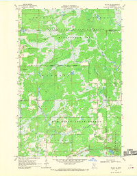 1968 Milaca NE1970 Print · USGSMille Lacs and Kanabec counties are shown in the late sixties as a network of conservation lands and rural outposts. Researchers can trace the locations of the North Fork Sch, the Mille Lacs Lookout Tower, and a local Townhall.
 - 1968 Map of Ann Lake, 1970 Print
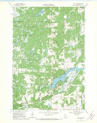 1968 Ann Lake1970 Print · USGSKanabec County conservation lands are mapped here in the late sixties, highlighting the extensive wetlands and forests of central Minnesota. Researchers can trace the boundaries of the Rum River State Forest or locate early access points like the Boat Ramp at Ann Lake.
 - 1968 Map of Onamia, 1970 Print
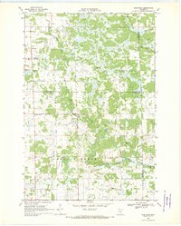
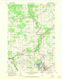
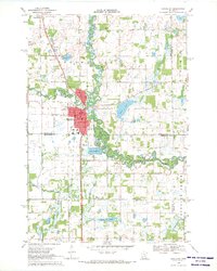
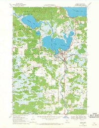 1968 Onamia1970 Print · USGSThe southern shore of Mille Lacs Lake comes into focus during the late 1960s, showing the intersection of industry, faith, and conservation. Genealogists and local historians can trace the foundations of Onamia through the Crosier Seminary, Holy Cross Church, and several local cemeteries.2 unique versions available
 - 1968 Map of Isle SW, 1970 Print
 1968 Isle SW1970 Print · USGSMille Lacs and Kanabec counties are captured in the late sixties as conservation and local industry shaped the land. Researchers can find old resource landmarks like the Isle Harbor Lookout Tower, small-scale extraction sites such as the Quarry, and the winding Knife River.2 unique versions available
 - 1968 Map of Wahkon North, 1970 Print
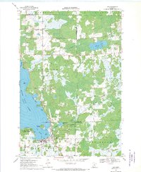
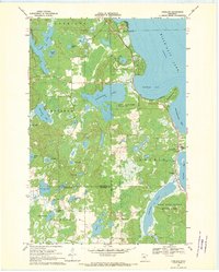
 1968 Wahkon North1970 Print · USGSThe southern shores of Mille Lacs Lake are captured here in the late sixties, showing the transition between conservation lands and local settlements. Researchers can trace the layout of Wahkon, the trails of Father Hennepin State Park, and landmarks like Hennepin Island.2 unique versions available
 - 1968 Map of Rum River, 1970 Print
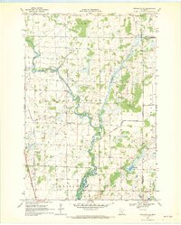
 1968 Rum River1970 Print · USGSCentral Minnesota's river-cut wetlands are captured here in the late sixties at the convergence of three counties. Genealogists and local historians can trace rural civic life through landmarks like Granite Ledge Sch, Lakin Ch, and the local Townhall.
 - 1968 Map of Santiago, 1970 Print
 1968 Santiago1970 Print · USGSSherburne and Benton counties were characterized by quiet agricultural townships and spreading wildlife preserves during the late sixties. Genealogists and local historians can trace the foundations of Santiago and Glendorado, locating Oak Hill Cem and numerous schoolhouses.
 - 1968 Map of Isle, 1970 Print
 1968 Isle1970 Print · USGSThe southeast corner of Mille Lacs Lake thrived in the late sixties as a crossroads of rail travel and lakeside recreation. Genealogists and local historians can trace the foundations of Isle, find remote country stops like Opstead, and locate family burial sites at Holden Cem and Redtop Cem.
 - 1968 Map of Princeton SW, 1970 Print
 1968 Princeton SW1970 Print · USGSMille Lacs and Sherburne counties were a mosaic of wetlands and wildlife management areas in the late sixties. Researchers can trace rural landmarks and drainage networks, including the Greenbush Cem, the St Francis River, and the Townhall near Battle Brook.2 unique versions available
 - 1968 Map of Milaca, 1970 Print
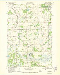
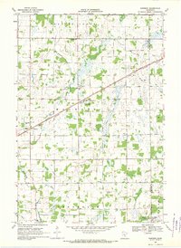
 1968 Milaca1970 Print · USGSMilaca and the surrounding Mille Lacs County countryside are captured here in the late sixties as the region's river-driven geography met modern infrastructure. Local researchers can pinpoint the Great Northern rail line, Chase Brook Cem, and old School No 1155.
 - 1968 Map of Princeton, 1970 Print
 1968 Princeton1970 Print · USGSPrinceton and the surrounding Minnesota lake country are captured here in the late sixties as the town established its modern footprint. Trace local family history and rural development through landmarks like Brickton, Ebenezer Cem, and the Great Northern rail line.2 unique versions available
 - 1968 Map of Page, 1970 Print
 1968 Page1970 Print · USGSThe Rum River valley in the late sixties reveals a quiet landscape of riverside settlements and managed timberlands. Genealogists and local researchers can trace family lands near Page or locate the old Gravel Pits and Wayside Park along the river's winding path.2 unique versions available
 - 1968 Map of Ronneby, 1970 Print
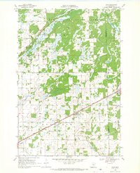
 1968 Ronneby1970 Print · USGSBenton and Mille Lacs counties are mapped here in the late sixties as the agricultural and rail-driven landscape matured. Trace family history through landmarks like School No 126, Maywood Cem, and the path of the Great Northern railroad.
 - 1968 Map of Vineland, 1970 Print
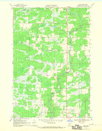
 1968 Vineland1970 Print · USGSThe southwestern shores of Mille Lacs Lake are captured here in the late sixties, centered on the settlement of Vineland. Researchers can trace local history through the Alliance Mission, Lakewood Cem, and the boundaries of Mille Lacs Kathio State Park.
 - 1968 Map of Princeton NE, 1970 Print
 1968 Princeton NE1970 Print · USGSMille Lacs County in the late sixties reveals a landscape of river bends and reclaimed wetlands shaped by early twentieth-century drainage projects. Genealogists can trace family connections at Wendell Hill Cem or Zion Ch and locate the historic School No 1172.
 - 1968 Map of Bock, 1970 Print
 1968 Bock1970 Print · USGSIn the late sixties, the rural landscape of Borgholm was anchored by the village of Bock and the Great Northern railway. Researchers can trace historical footprints through landmarks like Borgholm Cem, School No 1156, and several local Townhalls near Bogus Brook.2 unique versions available
 - 1968 Map of Foreston, 1970 Print
 1968 Foreston1970 Print · USGSMille Lacs County agriculture and industry meet in the late sixties along the West Branch Rum River. Researchers can trace rural lineages through sites like St Louis Cem, School No 1146, and the Great Northern rail stops.2 unique versions available
Showing maps 1-25 of 31
Top cities of Mille Lacs County
- Milaca historical maps
- Onamia historical maps
- Isle historical maps
- Foreston historical maps
- Wahkon historical maps
- Pease historical maps
See more
Frequently asked questions
- What are the different types of historical maps available for Mille Lacs County?
- What is the oldest map of Mille Lacs County?
- Where can I purchase historical maps of Mille Lacs County for my home or office?
- Where can I download high-res historical maps of Mille Lacs County?
- Are there historical topographic maps available for Mille Lacs County?
- Is there historical aerial imagery available for Mille Lacs County?
- Where are historical maps of Mille Lacs County sourced from?