Old Maps of Round Lake, Minnesota for Genealogy
Trace your family roots with 9 historic maps of Round Lake. These high-res maps reveal old neighborhoods, homesites, landmarks, and streets — helping you uncover where your ancestors lived and how the area evolved over time.
- Explore historic neighborhoods: Identify where your relatives may have lived in the 1800s or 1900s.
- Compare maps over time: Trace the changes in streets, buildings, and landmarks for multi-generational research.
- Perfect for genealogy & ancestry research: Used by family historians and researchers to map out lineage and migration.
These maps are an incredible resource for exploring your personal connection to Round Lake's past.
Round Lake, MN maps
(9)- 1954 Map of Fairmont, 1967 Print
 1954 Fairmont1967 Print · USGSThe prairie landscape of southern Minnesota and northern Iowa comes alive in this mid-century survey of the Coteau des Prairies. Genealogists and historians can trace the rail-connected growth of Fairmont and Blue Earth or locate family roots near St Kilian Ch and Union Slough National Wildlife Refuge.3 unique versions available
 - 1958 Map of Fairmont
 1958 Fairmont1958 Print · USGSThe borderlands of southern Minnesota and northern Iowa come alive in the mid-1950s, showing a landscape defined by glacial lakes and rail-line commerce. Researchers can trace historic landmarks like Lakeside Laboratory, Gridley Station, and the Bancroft Wildlife Refuge across the prairie.
 - 1960 Map of Round Lake, 1962 Print
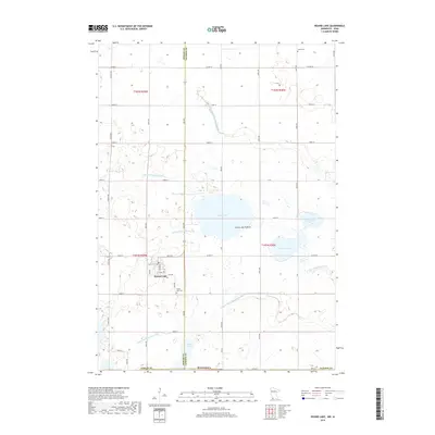
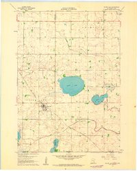 1960 Round Lake1962 Print · USGSNear the Minnesota and Iowa border in the early sixties, this prairie landscape shows a mix of rail-side commerce and engineered wetlands. Trace the path of the Chicago Rock Island and Pacific through the village of Round Lake or locate rural landmarks like Grace Ch and Townhall.
 - 1985 Map of Worthington
 1985 Worthington1985 Print · USGSSouthwestern Minnesota and northwestern Iowa are captured in the mid-1980s, showcasing the high-water mark of the region's agricultural and rail-line infrastructure. Researchers can trace the path of the Chicago and North Western through prairie towns like Adrian, Wilmont, and Lakefield.2 unique versions available
 - 2010 Map of Round Lake, 2010 Print
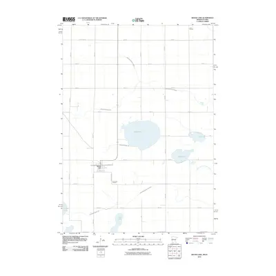 2010 Round Lake2010 Print · USGSCovers Round Lake, including Nobles County, Dickinson County, and other nearby areas
 - 2013 Map of Round Lake, 2013 Print
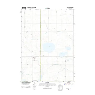 2013 Round Lake2013 Print · USGSCovers Round Lake, including Nobles County, Dickinson County, and other nearby areas
 - 2016 Map of Round Lake, 2016 Print
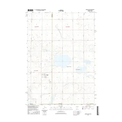 2016 Round Lake2016 Print · USGSCovers Round Lake, including Nobles County, Dickinson County, and other nearby areas
 - 2019 Map of Round Lake, 2019 Print
 2019 Round Lake2019 Print · USGSCovers Round Lake, including Nobles County, Dickinson County, and other nearby areas
 - 2022 Map of Round Lake, 2022 Print
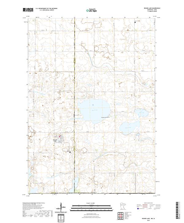 2022 Round Lake2022 Print · USGSThe town of Round Lake and the surrounding Minnesota prairie are captured here in a 2022 survey of the Coteau des Prairies landscape. Researchers can trace family history at Round Lake Cem and Grace Cem or explore the intricate network of Judicial Ditch Number Thirteen and local lakes.
End of results
Showing maps 1-9 of 9
Top cities near Round Lake
- Worthington historical maps
- Lake Park historical maps
- Brewster historical maps
- Ocheyedan historical maps
- Sioux Valley historical maps
- Rost historical maps
See more
Frequently asked questions
- What are the different types of historical maps available for Round Lake?
- What is the oldest map of Round Lake?
- Where can I purchase historical maps of Round Lake for my home or office?
- Where can I download high-res historical maps of Round Lake?
- Are there historical topographic maps available for Round Lake?
- Is there historical aerial imagery available for Round Lake?
- Where are historical maps of Round Lake sourced from?