
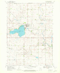
1960 Map of Round Lake
USGS Topo · Published 1962About this map
The borderlands of southern Minnesota and northern Iowa are defined by a complex landscape of glacial prairie potholes and early water management in this 1960 survey. The village of Round Lake serves as a central hub, situated along the Chicago Rock Island and Pacific railroad line. This rail corridor cuts diagonally across the prairie, passing by the Townhall and connecting the local grain-growing region to broader markets.
Find a feature on this map
23 named features on this map. Tap any name to fly to it.
Don’t see what you’re looking for? This feature index may not catch every label — zoom into the map to look around manually.
Map Details
Editions of this 1960 Round Lake Map
This is the sole edition of this map. No revisions or reprints were ever made.
Other maps of this area

1954 · Fairmont
USGS Topo · 1:250,000

1958 · Fairmont
USGS Topo · 1:250,000

1960 · Brewster
USGS Topo · 1:24,000

1960 · Okabena
USGS Topo · 1:24,000

1960 · Worthington North
USGS Topo · 1:24,000

1960 · Worthington South
USGS Topo · 1:24,000

1960 · Sioux Valley
USGS Topo · 1:24,000

1970 · Harris
USGS Topo · 1:24,000
1970 · Lake Park
USGS Topo · 1:24,000

1972 · Ocheyedan
USGS Topo · 1:24,000