2020s Maps of Red Lake County, Minnesota
Explore 14 historic maps of Red Lake County from the 2020s. These maps offer a rare glimpse into what life looked like during the 2020s — showing old roads, neighborhoods, homes, and landmarks that have changed or disappeared over time.
Whether you're researching your family's past, planning a metal detecting trip, or studying how Red Lake County's landscape evolved across the 2020s, these high-resolution maps are a powerful tool for exploring the history of this region.
- Focus on a specific era: All maps on this page are from the 2020s, giving you a focused view of this time period.
- See what’s changed: Compare century-old streets, trails, and buildings to today's modern landscape using overlays and satellite layers.
- Research with precision: Use these maps for genealogy, historical research, land use analysis, or educational projects.
- View, download, or print: Maps are fully viewable online in high resolution, and can be downloaded or printed for your own records.
Start exploring Red Lake County's history through authentic maps from the 2020s. This is your window into the past.
Red Lake County, MN maps
(14)- 2022 Map of Gentilly, 2022 Print
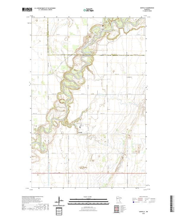 2022 Gentilly2022 Print · USGSNorthwestern Minnesota's prairie rivers and rural townships come into focus here during the early twenty-first century. Genealogists and local historians can trace the bends of the Red Lake River and locate landmarks like Saint Peters Cem and Huot Cem.
 - 2022 Map of Red Lake Falls, 2022 Print
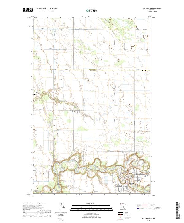 2022 Red Lake Falls2022 Print · USGSThe confluence of the Red Lake and Clearwater Rivers defines this northern Minnesota landscape in the early 2020s. Genealogists and local historians can locate the Red Lake County Courthouse, the Immanuel Lutheran Cem, and the settlement of Wylie.
 - 2022 Map of Dorothy, 2022 Print
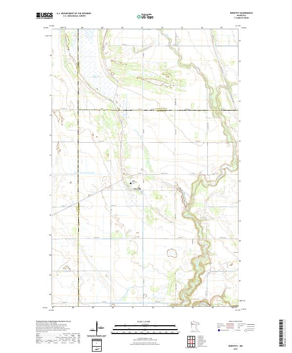 2022 Dorothy2022 Print · USGSRed Lake County and its neighbors come alive in this contemporary record of a persistent prairie landscape. Family historians can locate Saint Dorothy's Cem near Dorothy or trace the historic Pembina Trl across the agricultural plains.
 - 2022 Map of Marcoux Corners, 2022 Print
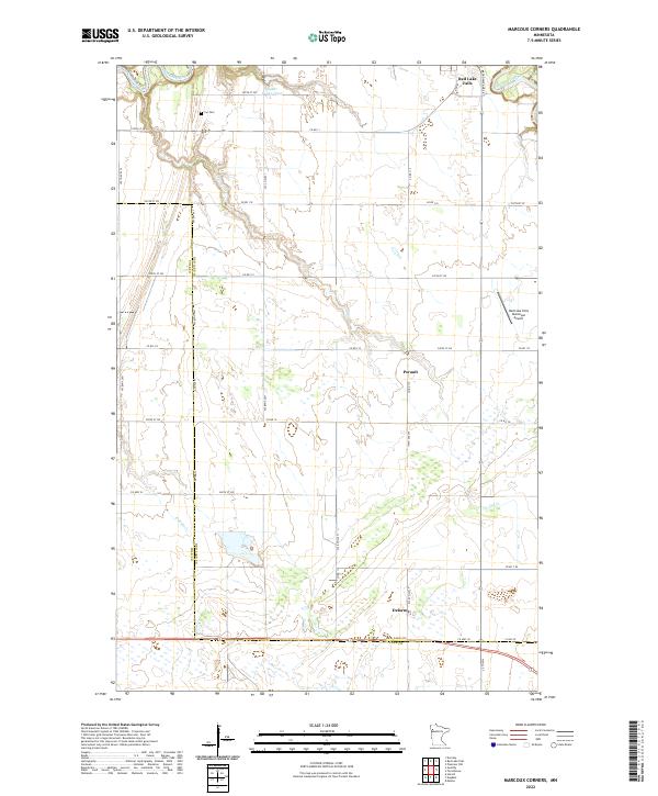 2022 Marcoux Corners2022 Print · USGSNorthern Minnesota’s river valleys and rural crossroads are captured here during the early twenty-first century. Genealogists can trace the Cyr Cem and the small settlements of Delorme and Perault along the county line.
 - 2022 Map of Plummer, 2022 Print
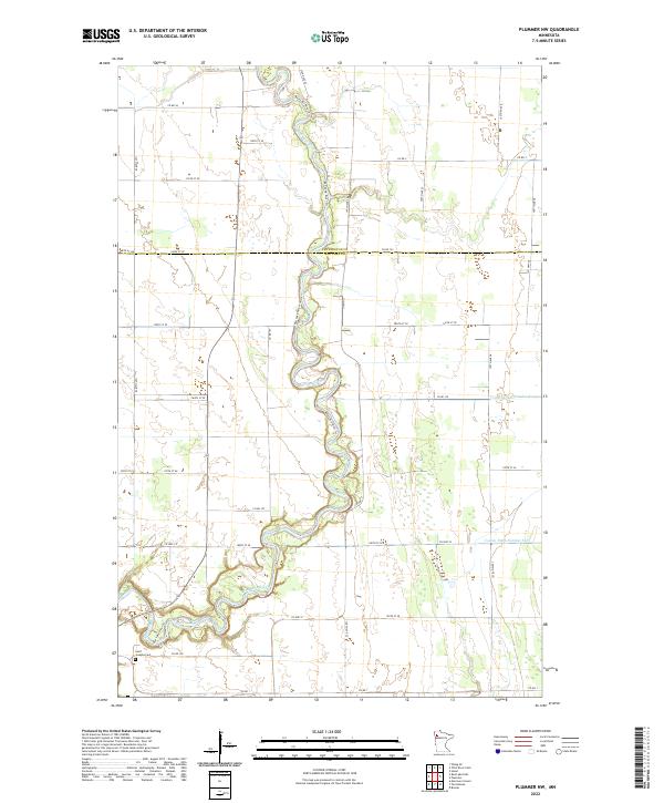
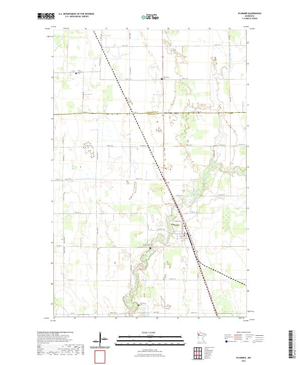 2022 Plummer2022 Print · USGSThe village of Plummer and the Clearwater River valley are shown here in the early twenty-first century. Genealogists can locate several local burial grounds including Clara Lutheran Cem, Emardville Cem, and Saint Vincent De Paul Cem.
 - 2022 Map of Roland, 2022 Print
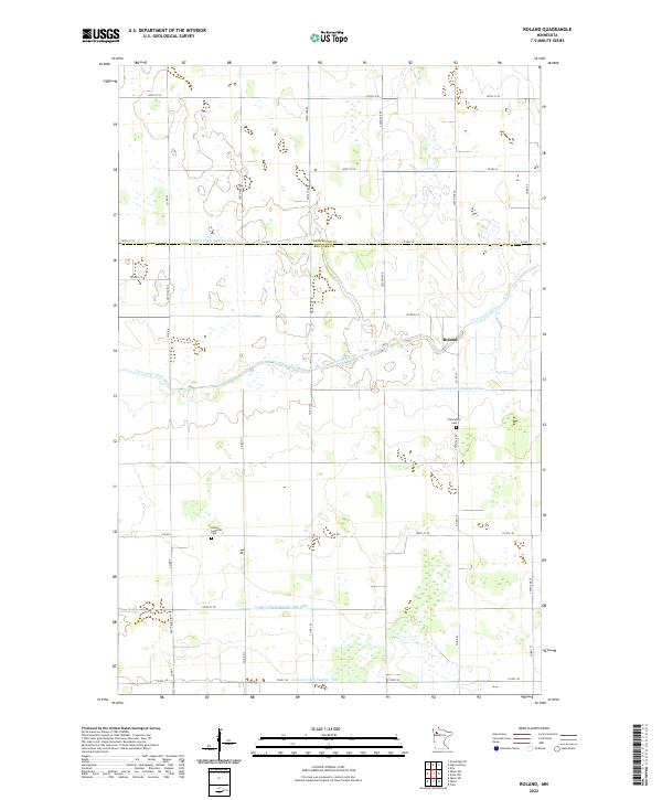 2022 Roland2022 Print · USGSRed Lake and Pennington Counties are captured in this recent survey, showcasing a landscape of river-bend settlements and extensive agricultural drainage. Genealogists and local historians can locate Salem Lutheran Cem, the settlement of Roland, and the winding Clearwater River.
 - 2022 Map of Oklee, 2022 Print
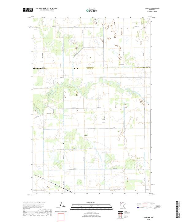
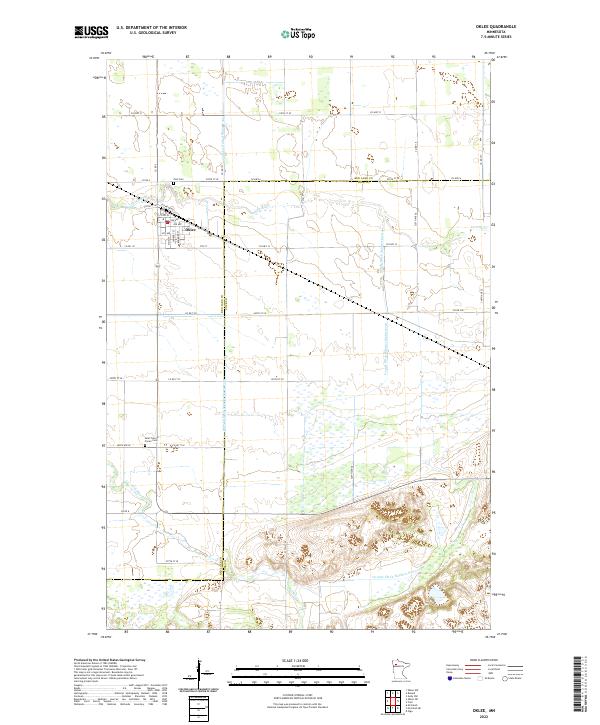 2022 Oklee2022 Print · USGSThe town of Oklee and the surrounding agricultural plains are captured here in the early 2020s. Genealogists can locate family landmarks like Zion Cem and Saint Francis Xavier Cem amidst the waters of Lost River and Hill River.
 - 2022 Map of Oklee SW, 2022 Print
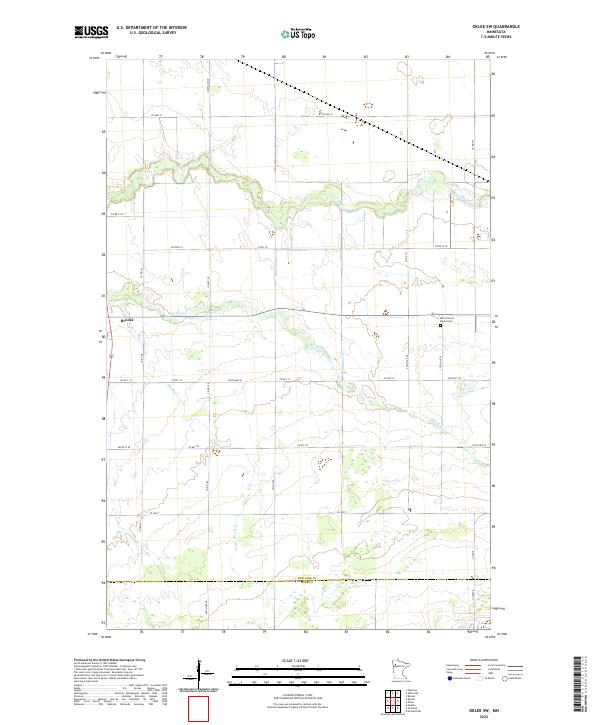 2022 Oklee SW2022 Print · USGSRed Lake County in the early twenty-first century is a landscape of prairie rivers and rural crossroads. Researchers can trace family history at Saint Francis Xavier Cem or follow the waters of the Lost River and Brooks Cr.
 - 2022 Map of Oklee NW, 2022 Print
 2022 Oklee NW2022 Print · USGSRed Lake and Pennington counties are shown in the early twenty-first century, revealing an intricate landscape of agricultural drainage and rural settlement. Genealogists can locate family sites near Finnish Cem or Ebenezer Cem and trace the path of the Clearwater River.
 - 2022 Map of Trail, 2022 Print
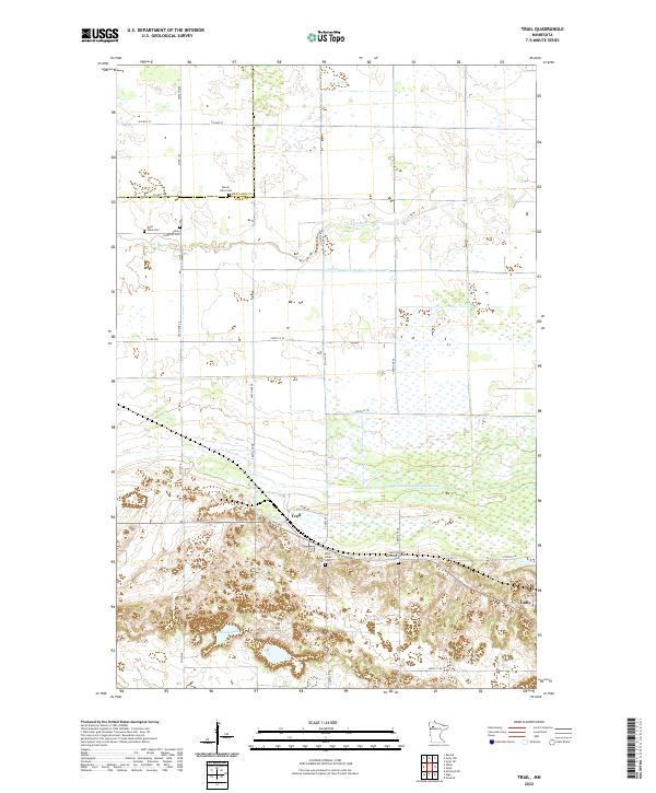 2022 Trail2022 Print · USGSThe rural landscapes around Trail and Gully are captured in this modern survey, showing a world defined by the Lost River and an intricate ditch network. Genealogists can trace family heritage through local landmarks like Sand Valley Cem and Valley Lutheran Cem.
 - 2022 Map of Gully NW, 2022 Print
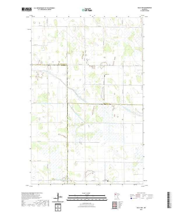 2022 Gully NW2022 Print · USGSThe borderlands of Pennington, Red Lake, and Polk Counties are captured here in the early 2020s. Genealogists and local historians can locate rural landmarks like Nazareth Cem and trace the course of the Clearwater River.
 - 2022 Map of Terrebonne, 2022 Print
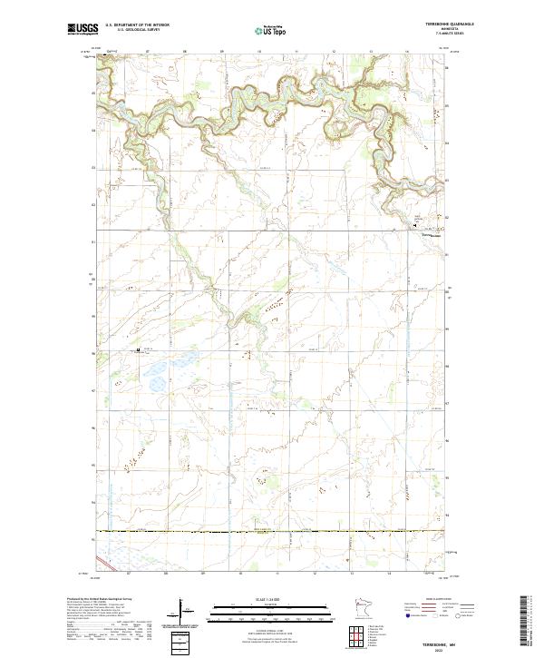 2022 Terrebonne2022 Print · USGSNorthwestern Minnesota's river valley and drainage systems are recorded here in the early twenty-first century. Genealogists and local historians can trace burial sites at Saint Anthony Cem and Evergreen Cem or follow the path of the Clearwater River and Terrebonne Cr.
 - 2022 Map of Plummer NW, 2022 Print
 2022 Plummer NW2022 Print · USGSRed Lake County's agricultural heartland is documented here in the early twenty-first century, centered on the winding Red Lake River. Researchers can trace local land patterns and genealogy through landmarks like Saint Josephs Cem and the complex network of rural routes including CO HWY 2.
 - 2022 Map of Brooks, 2022 Print
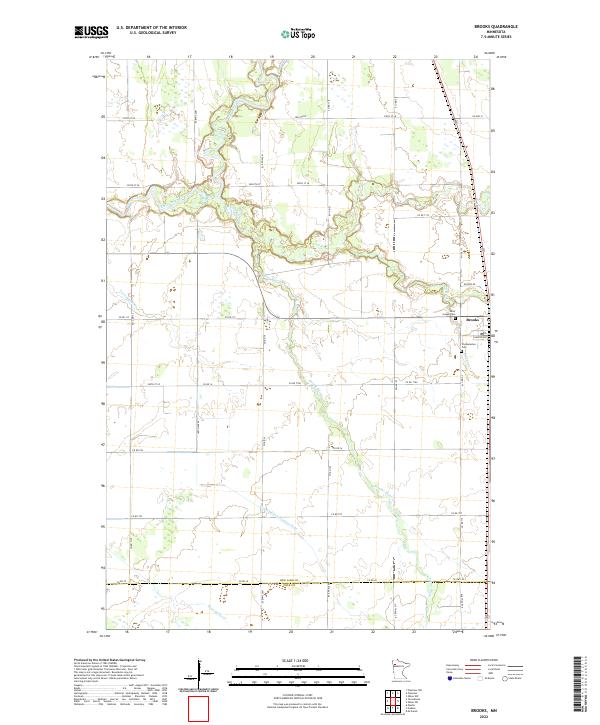 2022 Brooks2022 Print · USGSRed Lake County is captured here in the early twenty-first century, showing a landscape of fertile plains and managed waterways. Researchers can locate Brooks and its surrounding historic sites, including Saint Joseph Cem and the winding Lost River.
End of results
Showing maps 1-14 of 14
Top cities of Red Lake County
- Red Lake Falls historical maps
- Oklee historical maps
- Plummer historical maps
- Garnes historical maps
- Terrebonne historical maps
- Brooks historical maps
See more
Frequently asked questions
- What are the different types of historical maps available for Red Lake County?
- What is the oldest map of Red Lake County?
- Where can I purchase historical maps of Red Lake County for my home or office?
- Where can I download high-res historical maps of Red Lake County?
- Are there historical topographic maps available for Red Lake County?
- Is there historical aerial imagery available for Red Lake County?
- Where are historical maps of Red Lake County sourced from?