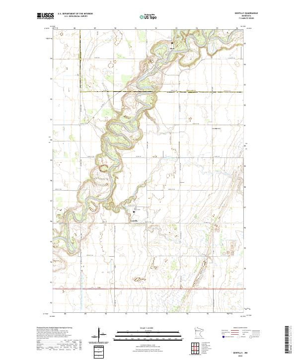
2022 Map of Gentilly
USGS Topo · Published 2022About this map
Red Lake River meanders sharply through the landscape of northwestern Minnesota, defining the northern geography of this quadrangle near the settlement of Huot. The waterway is joined by several tributaries, including the Black River and Kripple Cr, while the southern portion of the map is dominated by the course of the Gentilly River and the rural community of Gentilly. The region's reliance on managed drainage is evident in large-scale infrastructure like County Ditch Number One Hundred Fiftyeight, which cuts through the southern townships. Local history is anchored by sites like Saint Peters Cem and Huot Cem, which mark the presence of early prairie settlements. The intricate river bends and section-line roads like Co HWY 17 and Co RD 212 reflect a rural economy long tied to the fertile plains at the border of Red Lake and Polk Counties.
Find a feature on this map
23 named features on this map. Tap any name to fly to it.
Don’t see what you’re looking for? This feature index may not catch every label — zoom into the map to look around manually.
Map Details
Editions of this 2022 Gentilly Map
This is the sole edition of this map. No revisions or reprints were ever made.
Other maps of this area

1918 · Red Lake Falls
USGS Topo · 1:62,500

1919 · Beltrami
USGS Topo · 1:62,500

1952 · Red Lake Falls
USGS Topo · 1:62,500

1952 · Grand Forks
USGS Topo · 1:250,000

1953 · Crookston
USGS Topo · 1:62,500

1956 · Grand Forks
USGS Topo · 1:250,000

1964 · Greenview
USGS Topo · 1:24,000

1965 · Dugdale
USGS Topo · 1:24,000

1965 · Harold
USGS Topo · 1:24,000

1966 · Grand Forks
USGS Topo · 1:250,000