Old Maps of Saint Louis County, Minnesota
Explore 233 old maps of Saint Louis County, spanning from 1895 to today. These high-resolution historic maps reveal how streets, neighborhoods, landmarks, and natural features evolved over time — perfect for genealogy, metal detecting, research, and local history exploration.
What you can do with these maps:
- See how Saint Louis County changed over time: Compare historical maps to modern-day views to trace roads, homesites, rail lines & more.
- View detailed metadata: Each map includes creators, publishers, year, scale, and archive source.
- Overlay maps with satellite & LiDAR: Visualize the past alongside modern tools to explore terrain & human change.
- Trusted historical sources: Maps sourced from the USGS, Library of Congress, and other archives.
- Access maps your way: View online, download high-res files, or order prints for personal or research use.
Start exploring old maps of Saint Louis County to uncover forgotten places, hidden landmarks, and the deep history beneath your feet.
Saint Louis County, MN maps
(233)- 1895 Map of Duluth
 1895 Duluth1895 Print · USGSCovers Saint Louis County, including Duluth, Hermantown, and other nearby areas5 unique versions available
 - 1915 Map of Superior
 1915 Superior1915 Print · USGSCovers Saint Louis County, including Duluth, Superior, and other nearby areas2 unique versions available
 - 1917 Map of Superior
 1917 Superior1917 Print · USGSCovers Saint Louis County, including Duluth, Superior, and other nearby areas3 unique versions available
 - 1933 Map of Ely, 1961 Print
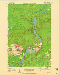
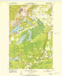
 1933 Ely1961 Print · USGSCovers Saint Louis County, including Ely, Winton, and other nearby areas
 - 1939 Map of Ely
 1939 Ely1939 Print · USGSCovers Saint Louis County, including Ely, Winton, and other nearby areas3 unique versions available
 - 1949 Map of Aurora, 1956 Print
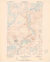
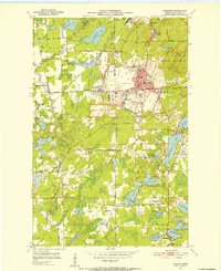
 1949 Aurora1956 Print · USGSCovers Saint Louis County, including Hoyt Lakes, Aurora, and other nearby areas
 - 1949 Map of Isaac Lake, 1958 Print
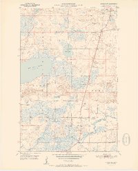
 1949 Isaac Lake1958 Print · USGSCovers Saint Louis County, including Hoyt Lakes, Babbitt, and other nearby areas4 unique versions available
 - 1949 Map of Allen, 1958 Print
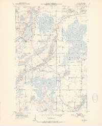
 1949 Allen1958 Print · USGSCovers Saint Louis County, including Hoyt Lakes, Babbitt, and other nearby areas
 - 1949 Map of Embarrass, 1959 Print
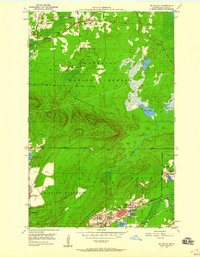
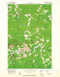
 1949 Embarrass1959 Print · USGSCovers Saint Louis County, including Hoyt Lakes, Embarrass, and other nearby areas4 unique versions available
 - 1950 Map of Isaac Lake
 1950 Isaac Lake1950 Print · USGSCovers Saint Louis County, including Hoyt Lakes, Babbitt, and other nearby areas2 unique versions available
 - 1950 Map of Embarrass
 1950 Embarrass1950 Print · USGSCovers Saint Louis County, including Hoyt Lakes, Embarrass, and other nearby areas
 - 1950 Map of Allen
 1950 Allen1950 Print · USGSCovers Saint Louis County, including Hoyt Lakes, Babbitt, and other nearby areas2 unique versions available
 - 1950 Map of Aurora
 1950 Aurora1950 Print · USGSCovers Saint Louis County, including Hoyt Lakes, Aurora, and other nearby areas2 unique versions available
 - 1950 Map of Biwabik, 1959 Print
 1950 Biwabik1959 Print · USGSCovers Saint Louis County, including Aurora, Biwabik, and other nearby areas5 unique versions available
 - 1950 Map of Mc Kinley, 1960 Print
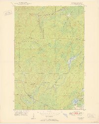
 1950 Mc Kinley1960 Print · USGSCovers Saint Louis County, including Virginia, Gilbert, and other nearby areas4 unique versions available
 - 1950 Map of Biwabik NW, 1963 Print
 1950 Biwabik NW1963 Print · USGSCovers Saint Louis County, including United States, Minnesota, and other nearby areas5 unique versions available
 - 1950 Map of Biwabik NE, 1963 Print
 1950 Biwabik NE1963 Print · USGSCovers Saint Louis County, including Wahlsten, Salo Corner, and other nearby areas4 unique versions available
 - 1951 Map of Biwabik
 1951 Biwabik1951 Print · USGSCovers Saint Louis County, including Aurora, Biwabik, and other nearby areas2 unique versions available
 - 1951 Map of Mc Kinley
 1951 Mc Kinley1951 Print · USGSCovers Saint Louis County, including Virginia, Gilbert, and other nearby areas2 unique versions available
 - 1951 Map of Biwabik NE
 1951 Biwabik NE1951 Print · USGSCovers Saint Louis County, including Wahlsten, Salo Corner, and other nearby areas2 unique versions available
 - 1951 Map of Biwabik NW
 1951 Biwabik NW1951 Print · USGSCovers Saint Louis County, including United States, Minnesota, and other nearby areas2 unique versions available
 - 1951 Map of Palo, 1952 Print
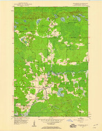
 1951 Palo1952 Print · USGSCovers Saint Louis County, including White Township, Palo, and other nearby areas6 unique versions available
 - 1951 Map of Gilbert, 1952 Print
 1951 Gilbert1952 Print · USGSCovers Saint Louis County, including Virginia, Gilbert, and other nearby areas4 unique versions available
 - 1951 Map of Eveleth, 1952 Print
 1951 Eveleth1952 Print · USGSCovers Saint Louis County, including Virginia, Eveleth, and other nearby areas5 unique versions available
 - 1951 Map of Virginia, 1952 Print
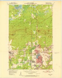 1951 Virginia1952 Print · USGSCovers Saint Louis County, including Virginia, Mountain Iron, and other nearby areas9 unique versions available
Showing maps 1-25 of 233
Top cities of Saint Louis County
- Duluth historical maps
- Hibbing historical maps
- Hermantown historical maps
- Virginia historical maps
- Chisholm historical maps
- Eveleth historical maps
See more
Frequently asked questions
- What are the different types of historical maps available for Saint Louis County?
- What is the oldest map of Saint Louis County?
- Where can I purchase historical maps of Saint Louis County for my home or office?
- Where can I download high-res historical maps of Saint Louis County?
- Are there historical topographic maps available for Saint Louis County?
- Is there historical aerial imagery available for Saint Louis County?
- Where are historical maps of Saint Louis County sourced from?