Old Maps of Wadena County, Minnesota for Genealogy
Trace your family roots with 140 historic maps of Wadena County. These high-res maps reveal old neighborhoods, homesites, landmarks, and streets — helping you uncover where your ancestors lived and how the area evolved over time.
- Explore historic neighborhoods: Identify where your relatives may have lived in the 1800s or 1900s.
- Compare maps over time: Trace the changes in streets, buildings, and landmarks for multi-generational research.
- Perfect for genealogy & ancestry research: Used by family historians and researchers to map out lineage and migration.
These maps are an incredible resource for exploring your personal connection to Wadena County's past.
Wadena County, MN maps
(140)- 1953 Map of Brainerd, 1966 Print
 1953 Brainerd1966 Print · USGSCentral Minnesota's lake country and iron ranges are detailed in the mid-fifties, showing the intersection of industry and wilderness. Researchers can locate specific local landmarks like the Crow Wing County Courthouse or trace the early paths of the Soo Line Railroad and the Cuyuna Range Iron Mines.3 unique versions available
 - 1957 Map of Brainerd
 1957 Brainerd1957 Print · USGSNorth-central Minnesota's lake-rich landscape is captured in the mid-1950s as a crossroads of rail, river, and forest. Genealogists and historians can trace the paths of the Great Northern and Soo Line railroads through hubs like Brainerd, Wadena, and Detroit Lakes.
 - 1958 Map of Brainerd
 1958 Brainerd1958 Print · USGSCentral Minnesota in the late fifties is a landscape of dense lake chains, rail hubs, and sprawling state forests. Genealogists and local historians can trace old property alignments near the Mississippi River or locate family sites in Brainerd, Little Falls, and Detroit Lakes.
 - 1963 Map of Motley, 1964 Print
 1963 Motley1964 Print · USGSThe confluence of the Crow Wing and Long Prairie Rivers defines this pocket of central Minnesota in the early sixties. Genealogists and local historians can trace the footprint of Motley and Philbrook, along with sites like School No 1212 and St James Cem.2 unique versions available
 - 1965 Map of Brainerd
 1965 Brainerd1965 Print · USGSNorth-central Minnesota in the mid-fifties presents a complex landscape of sprawling lake systems and established rail corridors. Genealogists and historians can trace the growth of timber towns along the Northern Pacific RR and explore early borders of the White Earth Indian Reservation or Tamarac National Wildlife Refuge.
 - 1966 Map of Staples NE, 1967 Print
 1966 Staples NE1967 Print · USGSWadena County at the height of the mid-sixties reveals a river-laced landscape where the Crow Wing River divides local townships. Genealogists can locate Montrose Cem and Covenant Ch, while aviation enthusiasts can trace the early layout of the Staples Municipal Airport.2 unique versions available
 - 1966 Map of Motley NW, 1967 Print
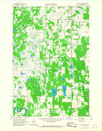 1966 Motley NW1967 Print · USGSCentral Minnesota's lake country is captured here in the mid-1960s, showing a remote landscape of glacial wetlands and small settlements. Researchers can locate community landmarks like Esterly, Meadow Brook Sch, and the Swan Valley Cem among the many lakes.
 - 1966 Map of Staples, 1967 Print
 1966 Staples1967 Print · USGSMid-century Staples thrives as a railroad and educational center on the Todd County line during the late sixties. Genealogists can locate family landmarks from the Evergreen Cemetery to rural schoolhouses like Riverside School and School No 2289.
 - 1966 Map of Aldrich North, 1967 Print
 1966 Aldrich North1967 Print · USGSWadena County was a landscape of river confluences and rail-side settlements in the mid-1960s. Researchers can trace rural life through landmarks like Mother of Sorrows Cem, the Drive-in Theater at Verndale, and the Wing River Tabernacle.
 - 1966 Map of Aldrich South, 1968 Print
 1966 Aldrich South1968 Print · USGSTodd and Wadena Counties are captured here in the mid-1960s, showing a landscape of river-bottom wetlands and structured township grids. Genealogists and local historians can locate rural landmarks like Balsamlund Ch, the Maple Leaf Sch, and the Northern Pacific line through Aldrich.
 - 1969 Map of Sebeka SW, 1971 Print
 1969 Sebeka SW1971 Print · USGSOtter Tail County remains a landscape of wetlands and watercourses in the late sixties. Researchers can find family history sites like Hay Creek Cem and Pioneer Cem alongside the winding Leaf River.
 - 1969 Map of Menahga, 1971 Print
 1969 Menahga1971 Print · USGSNorth-central Minnesota's lake country is captured in the late sixties, showing the transition of the Burlington Northern line through the region. Genealogists and researchers can trace the developed landscape of Menahga, the site of Pine Haven Ch, and the waters of Blueberry Lake.2 unique versions available
 - 1969 Map of Park Rapids SW, 1971 Print
 1969 Park Rapids SW1971 Print · USGSBecker, Hubbard, and Wadena Counties meet in this late 1960s landscape dominated by the Shell River and Straight River. Genealogists and local historians can trace family ties at Green Valley Cemetery or Alajoki Cemetery.
 - 1969 Map of Sebeka, 1971 Print
 1969 Sebeka1971 Print · USGSWadena County in the late sixties shows the railroad-driven growth of Menahga and Sebeka along the Burlington Northern line. Genealogists can locate several local burial grounds including Mantyla Cemetery and the rural Meadow Church.
 - 1969 Map of Sebeka NW, 1971 Print
 1969 Sebeka NW1971 Print · USGSThe tri-county borderlands of Minnesota are preserved here in the late sixties, showing a landscape of small townships and drainage networks. Genealogists can locate family-named landmarks and rural institutions like Runeberg Ch, White Oak Sch, and Grace Cem.
 - 1969 Map of Bertha, 1971 Print
 1969 Bertha1971 Print · USGSCentral Minnesota's rural landscape is captured here in the late sixties, where the Burlington Northern line connects the towns of Hewitt and Bertha. Genealogists can trace family roots at several local burial sites, including Mount Nebo Cem and Peace Cem.
 - 1969 Map of Wrightstown, 1971 Print
 1969 Wrightstown1971 Print · USGSWrightstown and the surrounding prairies of Otter Tail County are captured here in the late sixties during a period of steady rural life. Genealogists and local researchers can pinpoint the Oak Ridge Cemetery, Union Corner Church, and the winding course of South Bluff Creek.
 - 1969 Map of Wadena, 1971 Print
 1969 Wadena1971 Print · USGSThe Leaf River valley and the growing hub of Wadena are captured here in the late sixties as the region transitioned through the mid-century. Genealogists and local historians can trace the foundations of the community through sites like the Alliance Ch, Compton Cem, and the Burlington Northern rail corridor.
 - 1969 Map of Verndale, 1971 Print
 1969 Verndale1971 Print · USGSWadena and Aldrich townships are shown here in the late sixties, where the rail and river networks meet. Genealogists can trace family roots at St Fredericks Cem and Leaf River Cem or locate vanished landmarks like the Drive-in Theater.
 - 1969 Map of Blue Grass, 1971 Print
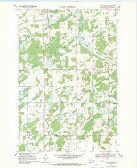 1969 Blue Grass1971 Print · USGSWadena County's agricultural heartland is documented here in the late sixties, where the railroad meets the river at Sebeka. Researchers can pinpoint vanished country schools and churches like School No 2441, Zion Ch, and the grounds of St Huberts Cem.
 - 1969 Map of Nimrod SW, 1972 Print
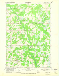 1969 Nimrod SW1972 Print · USGSWadena County's rural townships are mapped here during the late sixties as the winding Redeye River cuts through the landscape. Genealogists and local historians can locate specific landmarks like North Germany Cem, School No 2422, and the Wing River Union Cem.2 unique versions available
 - 1969 Map of Nimrod, 1972 Print
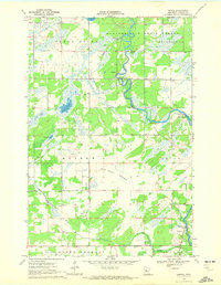 1969 Nimrod1972 Print · USGSNimrod and the surrounding Wadena County townships appear here during the late sixties as the river economy transitioned to recreation. Researchers can trace family history at the Finnish Cem or explore the river landscapes of Butterfield Rapids and the Kossila Oxbow.
 - 1969 Map of Burgen Lake, 1972 Print
 1969 Burgen Lake1972 Print · USGSThe Crow Wing River corridor in the late sixties reveals a landscape of protected timberlands and winding waterways. Researchers can trace the boundaries of Huntersville and Orton, locating sites like Huntersville Cem and the riverfront Frames Landing Campground.2 unique versions available
 - 1969 Map of Oylen, 1972 Print
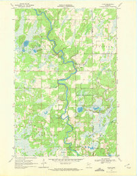 1969 Oylen1972 Print · USGSWadena County's riverfront and forest lands are captured in detail during the late sixties as the local conservation landscape took shape. Genealogists and historians can locate the Lyons Cem, the Indian Mounds, and the small community of Oylen along the Crow Wing River.
 - 1970 Map of Huntersville, 1972 Print
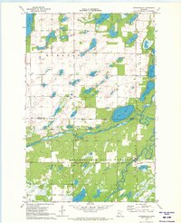 1970 Huntersville1972 Print · USGSThe Hubbard and Wadena County line in the early 1970s is a landscape of glacial lakes and dense woods. Researchers can trace local burial sites like Hubbard Cem, explore the winding Shell River, and locate the settlement of Huntersville near the state forest.
Showing maps 1-25 of 140
Top cities of Wadena County
- Wadena historical maps
- Menahga historical maps
- Sebeka historical maps
- Verndale historical maps
- Nimrod historical maps
- Aldrich historical maps
Frequently asked questions
- What are the different types of historical maps available for Wadena County?
- What is the oldest map of Wadena County?
- Where can I purchase historical maps of Wadena County for my home or office?
- Where can I download high-res historical maps of Wadena County?
- Are there historical topographic maps available for Wadena County?
- Is there historical aerial imagery available for Wadena County?
- Where are historical maps of Wadena County sourced from?