Old Maps of Wilkin County, Minnesota for Academic Research
Study the evolution of Wilkin County with 157 high-resolution historic maps. Whether you're teaching, researching, or modeling changes in land use, these maps provide essential visual documentation of urban, environmental, and geographic change.
- Analyze long-term change: Track patterns in development, transportation, and natural features.
- Ideal for environmental or urban studies: Support academic projects with primary historical map data.
- Use in the classroom or lab: Educators and researchers rely on these maps to bring historical context to life.
These maps are a powerful tool for teaching, research, and visualizing how Wilkin County has changed over the decades.
Wilkin County, MN maps
(157)- 1895 Map of Fargo, 1954 Print
 1895 Fargo1954 Print · USGSThe Red River Valley thrived as a rail and agricultural frontier during the 1890s, where North Dakota and Minnesota meet. Genealogists can trace family roots through pioneer settlements and rail stops like Kurtz (Elmer Sta.), Wild Rice, and Christine.3 unique versions available
 - 1897 Map of Fargo
 1897 Fargo1897 Print · USGSThe Red River Valley at the close of the nineteenth century was a bustling intersection of rail lines and river commerce. Genealogists and historians can trace the early footprints of Fargo and Moorhead, or find smaller depots like Kurtz (Elmer Sta.) and Wild Rice.12 unique versions available
 - 1904 Map of Wahpeton
 1904 Wahpeton1904 Print · USGSThe Red River Valley at the start of the century was a landscape of burgeoning rail towns and river commerce along the Minnesota border. Genealogists can trace early homesteads and transport hubs between Wahpeton and Breckenridge, or follow the rail lines through Hankinson and Abercrombie.2 unique versions available
 - 1919 Map of Rothsay
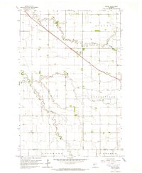
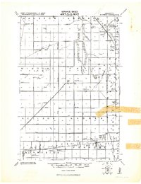 1919 Rothsay1919 Print · USGSRailroad-driven growth on the Wilkin and Otter Tail border is captured here at the end of the Great War. Genealogists can locate family-run grain operations like the Everdell elevator-slender or local landmarks such as the Foxhome Sch. Ho. Cupola and Manston School.
 - 1919 Map of Barnesville, 1943 Print
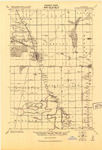 1919 Barnesville1943 Print · USGSThe Red River Valley's agricultural and rail infrastructure is meticulously detailed in this early twentieth-century military survey. Genealogists and historians can locate numerous rural schoolhouses and industrial landmarks like the Barnesville tall Elevator and the Lawndale Elevator.
 - 1951 Map of Rothsay, 1953 Print
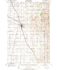
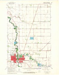
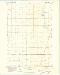
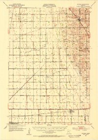 1951 Rothsay1953 Print · USGSWilkin and Otter Tail Counties appear here in the early fifties, showing a landscape of productive prairie townships and busy rail corridors. Researchers can locate numerous country schools and cemeteries like German Cem or the settlement at Everdell.3 unique versions available
 - 1951 Map of Campbell, 1953 Print
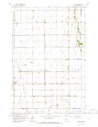
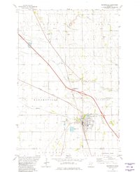
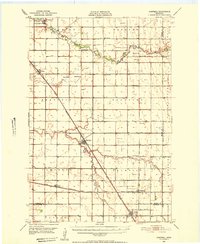 1951 Campbell1953 Print · USGSWilkin County's prairie townships are captured here in the early fifties as the rail-driven economy shaped the Red River Valley borderlands. Genealogists and researchers can trace local landmarks like Sticklestad Ch, Vukku Ch Cem, and the community of Campbell.
 - 1952 Map of Barnesville, 1954 Print
 1952 Barnesville1954 Print · USGSThe Barnesville area in the early fifties shows a thriving rail-and-farm landscape at the Clay and Wilkin county border. Genealogists and historians can trace numerous rural schoolhouses, the Little Bethany Ch, and the site of the Braton Sch (Abandoned).
 - 1953 Map of Fargo, 1965 Print
 1953 Fargo1965 Print · USGSThe Red River Valley in the mid-fifties was a bustling rail and agricultural corridor during a period of steady prairie growth. Genealogists and historians can trace the intricate rail networks of the Great Northern and Soo Line connecting local hubs like Casselton and Wahpeton.2 unique versions available
 - 1956 Map of Fargo
 1956 Fargo1956 Print · USGSThe Red River Valley's agricultural heartland is documented here in the mid-fifties as the rail-and-road network expanded across the plains. Genealogists can trace family roots through numerous small railroad towns and local landmarks like Casselton, Sheyenne Valley Church, and Sisseton Indian Res.
 - 1959 Map of Hickson, 1960 Print
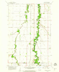 1959 Hickson1960 Print · USGSThe Red River Valley's rich agricultural borderlands are captured here in the late fifties, showcasing the intricate meanders of the Red River of the North. Genealogists can locate rural landmarks like St Benedict, Hickson, and the North Pleasant Cem.3 unique versions available
 - 1959 Map of Christine, 1960 Print
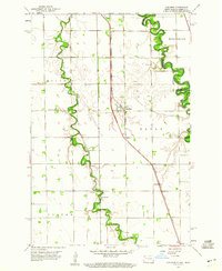 1959 Christine1960 Print · USGSThe Red River Valley landscape of the late fifties is captured here as a network of rail-side settlements and winding river loops. Genealogists can locate family landmarks like South Pleasant Cem, Richland Ch, and the small siding at Lithia.2 unique versions available
 - 1964 Map of Dwight, 1966 Print
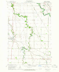 1964 Dwight1966 Print · USGSThe Red River Valley landscape in the mid-1960s highlights the agricultural and spiritual roots of the North Dakota borderlands. Researchers can trace family history at St Josephs Cemetery or locate local landmarks like the Carmelite Monastery and Brushvale.3 unique versions available
 - 1964 Map of Baker, 1966 Print
 1964 Baker1966 Print · USGSClay County's agricultural heartland is documented here in the mid-sixties, centered on the rail-side settlement of Baker. Researchers can trace the path of the Great Northern railroad and the winding courses of Whisky Creek and the South Branch Buffalo River.3 unique versions available
 - 1964 Map of Wahpeton, 1966 Print
 1964 Wahpeton1966 Print · USGSThe Red River valley thrived as a vital rail and educational hub in the mid-sixties, where North Dakota and Minnesota met at the water's edge. Genealogists and researchers can trace the Wahpeton Indian Sch, the St Marys Cem, and several historic Great Northern rail lines.3 unique versions available
 - 1964 Map of Comstock, 1966 Print
 1964 Comstock1966 Print · USGSThe Red River Valley prairie in the mid-sixties shows a landscape shaped by the Great Northern rail line and complex drainage. Genealogists can locate the Comstock Cem and the small siding at Rustad along the Iron Horse route.
 - 1966 Map of Wolverton SE, 1967 Print
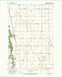
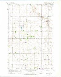 1966 Wolverton SE1967 Print · USGSWilkin County's prairie townships were meticulously organized by drainage and aviation in the mid-1960s. Genealogists and local historians can locate farmstead footprints and landmarks like Deerhorn Cem, the Deerhorn River, and the regional Landing Field.
 - 1966 Map of Wolverton, 1967 Print
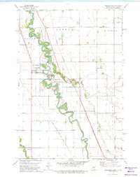
 1966 Wolverton1967 Print · USGSThe Red River valley at the Minnesota-North Dakota border is captured here in the mid-sixties, showing a landscape defined by rail and river. Researchers can trace the Great Northern rail corridor through Wolverton or locate family sites near Schmitt Cem and Wolverton Cem.
 - 1973 Map of Abercrombie, 1975 Print
 1973 Abercrombie1975 Print · USGSThe Red River valley in the early 1970s shows a landscape defined by sharp river bends and competing rail lines. Genealogists can locate St Johns Ch and St Thomas Cem, or explore the grounds of Fort Abercrombie State Park.
 - 1973 Map of South of Wahpeton, 1975 Print
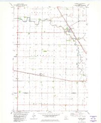
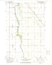 1973 South of Wahpeton1975 Print · USGSWilkin County and the North Dakota border come into focus in the early seventies along the winding Bois De Sioux River. Genealogists and local historians can trace family locations near the Bohemian National Cem or the rail stop at Tyler.
 - 1973 Map of Fairmount, 1975 Print
 1973 Fairmount1975 Print · USGSFairmount and the surrounding prairie of the Red River Valley are seen here in the early seventies as a vital rail hub on the North Dakota-Minnesota border. Researchers can trace the paths of the Soo Line, locate the Fairmount Cem, and explore old rural sites like Childs.
 - 1973 Map of Wahpeton NE, 1975 Print
 1973 Wahpeton NE1975 Print · USGSWilkin County in the early 1970s shows a landscape of precision drainage and prairie conservation. Genealogists and local historians can trace family farmsteads near Mitchell Cem, Christ Ch, and the small settlement of Meadows.
 - 1981 Map of Barnesville
 1981 Barnesville1981 Print · USGSThe Clay and Wilkin county line near Barnesville was a hub of rail activity and prairie agriculture in the early 1980s. Researchers can locate family landmarks like Rosemound Cem, St Marys Ch, and the waters of Blue Eagle Lake.
 - 1981 Map of Lawndale
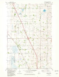 1981 Lawndale1981 Print · USGSWilkin and Otter Tail Counties are shown in the early eighties as a landscape of prairie agriculture and managed wetlands. Researchers can trace the Burlington Northern rail line through Lawndale and locate the Little Bethany Ch and Prairie View Cem.
 - 1981 Map of Campbell
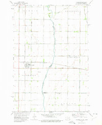
 1981 Campbell1981 Print · USGSWilkin and Traverse counties are captured here in the early eighties as a hub of rail-dependent agriculture and intricate water management. Researchers can trace the dual rail lines serving Campbell and Tenney or locate the Cem along the winding Rabbit River.
Showing maps 1-25 of 157
Top cities of Wilkin County
- Breckenridge historical maps
- Campbell historical maps
- Foxhome historical maps
- Wolverton historical maps
- Kent historical maps
- Nashua historical maps
See more
Frequently asked questions
- What are the different types of historical maps available for Wilkin County?
- What is the oldest map of Wilkin County?
- Where can I purchase historical maps of Wilkin County for my home or office?
- Where can I download high-res historical maps of Wilkin County?
- Are there historical topographic maps available for Wilkin County?
- Is there historical aerial imagery available for Wilkin County?
- Where are historical maps of Wilkin County sourced from?