Old Maps of Claiborne County, Mississippi for Metal Detecting
Plan your next treasure hunt with 129 historic maps of Claiborne County. Find old homesites, ghost towns, trails, and gathering spots that may be lost to time — perfect for identifying promising metal detecting locations.
- Locate forgotten sites: Uncover places like long-lost settlements, abandoned rail lines, or gathering spots.
- Plan better hunts: Use map overlays combined with LiDAR or satellite views to narrow in on historically rich areas.
- Made for detectorists: Thousands of hobbyists use these maps to discover relics, coins, and hidden history.
Use these historic maps to boost your research and find new opportunities beneath the surface of Claiborne County.
Claiborne County, MS maps
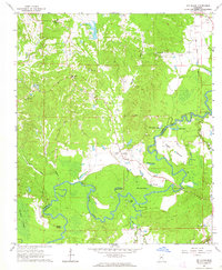
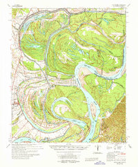
(129)- 1909 Map of Lake Bruen
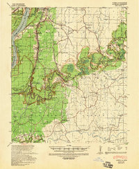
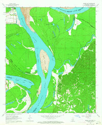
 1909 Lake Bruen1909 Print · USGSTensas Parish life in the early 1900s centered on the massive Mississippi oxbow and the fertile soils of the delta. Researchers can trace historic family holdings like Bellevue and Panola or locate local landmarks including Zion Baptist Church and the St Joseph Station.
 - 1939 Map of Yokena, 1942 Print
 1939 Yokena1942 Print · USGSThe Mississippi riverfront south of Vicksburg was a complex landscape of engineering and rural community just before the Second World War. Researchers can trace the Yazoo and Mississippi Valley RR and find local landmarks like Rocky Springs and the Hardscrabble Sch.2 unique versions available
 - 1939 Map of Lorman, 1942 Print
 1939 Lorman1942 Print · USGSThe Mississippi River borderlands thrive with plantation life and early educational institutions during the late nineteen-thirties. You can trace family roots through numerous cemetery-school-church complexes like Richland Sch Ch & Cem and the grounds of Alcorn A & M College.
 - 1953 Map of Natchez, 1966 Print
 1953 Natchez1966 Print · USGSSouthwest Mississippi and the Louisiana border country come alive in this mid-century survey of the river valley and forest lands. Researchers can trace the rail lines of the Illinois Central RR and locate rural hubs like Gloster and Ferriday.3 unique versions available
 - 1955 Map of Jackson
 1955 Jackson1955 Print · USGSThe Lower Mississippi Valley at the middle of the century reveals a landscape of deep river meanders and growing rail hubs. Genealogists and historians can trace the mid-century footprints of Vicksburg National Military Park, old river landings at Port Gibson, and the rail corridors of the Illinois Central Railroad.3 unique versions available
 - 1956 Map of Natchez
 1956 Natchez1956 Print · USGSThe Mississippi River borderlands and the Pine Hills come alive in this mid-fifties study of the Natchez region. Genealogists and historians can trace rail-era towns along the Illinois Central RR and explore the oxbows of Lake Bruin and Lake Concordia.
 - 1958 Map of St. Joseph, 1960 Print
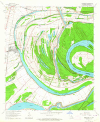
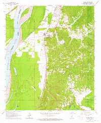
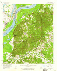 1958 St. Joseph1960 Print · USGSThe Mississippi River borderlands in the late fifties reveal a landscape of plantation ruins and rising hills between Tensas Parish and Claiborne County. Genealogists can trace family footprints at St Joseph, the Windsor Ruins, and rural landmarks like Alcorn Sch and Mt Zion Ch.4 unique versions available
 - 1959 Map of Natchez
 1959 Natchez1959 Print · USGSSouthwestern Mississippi and eastern Louisiana are captured in the late fifties, showing a landscape defined by the winding Mississippi River and the timbered Homochitto National Forest. Researchers can trace the sprawling Illinois Central RR and find rural landmarks like Union Church and Camp Van Dorn (Abandoned).
 - 1961 Map of Jackson
 1961 Jackson1961 Print · USGSThe Lower Mississippi Delta and the state capital area are captured here during the post-war era of infrastructure expansion. Researchers can trace the complex river oxbows and rail lines connecting Vicksburg, Yazoo City, and the Illinois Central Railroad network.
 - 1962 Map of Jackson
 1962 Jackson1962 Print · USGSThe Mississippi Delta and the state capital region are mapped here in the early sixties, showing a landscape defined by the great river and the growing city of JACKSON. Genealogists can trace family roots through numerous landmarks like Cedar Hill Cem, rural stops on the Illinois Central RR, and historic sites like Champion Hill.2 unique versions available
 - 1962 Map of Utica West, 1964 Print
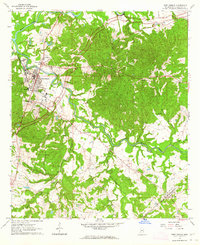
 1962 Utica West1964 Print · USGSThe Old Indian Treaty Boundary still defines the landscape of Hinds and Copiah counties in the early sixties as rural life centered on the Illinois Central railroad. Researchers can trace family history through dozens of rural landmarks like Reedtown, Seven Star Ch, and Fatherree Cem.
 - 1963 Map of Carlisle, 1964 Print
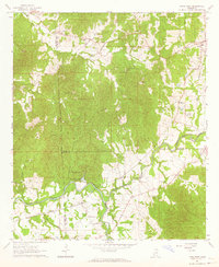
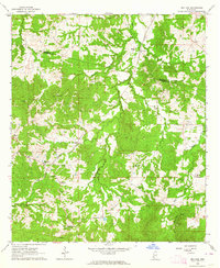
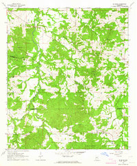
 1963 Carlisle1964 Print · USGSClaiborne County in the early sixties remains a landscape of deep creek bottoms and timbered ridges along the Natchez Trace Parkway. Genealogists and local historians can trace the Illinois Central line through Carlisle, or locate rural landmarks like Rocky Springs and Bethel Green Ch.2 unique versions available
 - 1963 Map of Grand Gulf, 1964 Print
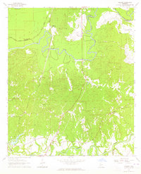
 1963 Grand Gulf1964 Print · USGSThe Mississippi River borderlands in the early 1960s reveal a landscape of shifting channels and Civil War memory. Genealogists and historians can trace the Old Railroad grade near Grand Gulf or locate local landmarks like Spring Hill Ch and Point Pleasant.3 unique versions available
 - 1963 Map of Port Gibson, 1964 Print
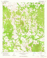
 1963 Port Gibson1964 Print · USGSPort Gibson and its surrounding Claiborne County landscape are shown here in the early sixties, as the historic town transitioned into the modern era. Researchers can trace the grounds of the Chamberlain-Hunt Academy, find family names at Wintergreen Cem, or locate rural landmarks like Mercy Seat Ch.2 unique versions available
 - 1963 Map of Dentville NW, 1964 Print
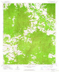 1963 Dentville NW1964 Print · USGSThe rural borderlands of Claiborne and Copiah Counties are captured here in the early sixties, centered on the winding Bayou Pierre. Genealogists and historians can trace the Old Indian Treaty Boundary and locate numerous family landmarks like Meadows Store, Little Zion Church, and the Bethel Cemeteries.
 - 1963 Map of Willows, 1964 Print
 1963 Willows1964 Print · USGSThe Big Black River basin in the early sixties was a landscape of winding bayous and small rail-stop communities. Researchers can trace family history through sites like Allen (Nanachehaw) and Ingleside, or locate rural landmarks like Shiloh Ch Cem and the Warner YMCA Camp.3 unique versions available
 - 1963 Map of Red Lick, 1964 Print
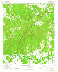
 1963 Red Lick1964 Print · USGSThe rural communities of Jefferson County are captured in the early sixties as the Illinois Central railroad connected the countryside. Genealogists can trace family footprints at Homeless Cem, Mizpah Ch, and the crossroads at Tillman.2 unique versions available
 - 1963 Map of Newellton, 1964 Print
 1963 Newellton1964 Print · USGSThe riverfront of Tensas Parish in the early sixties was a landscape of dramatic oxbows and deep agricultural roots. Researchers can trace family history through local landmarks like Newellton Cem, St Matthew Ch, and the small settlement at Balmoral.2 unique versions available
 - 1963 Map of Yokena, 1964 Print
 1963 Yokena1964 Print · USGSWarren County in the early 1960s reveals a landscape shaped by the Mississippi River and the busy Illinois Central rail line. Researchers can trace family sites at Glass Cem and Sadler Cem or locate old landmarks like Morning Star Ch.4 unique versions available
 - 1963 Map of Hermanville, 1964 Print
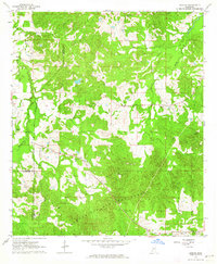
 1963 Hermanville1964 Print · USGSClaiborne County settlements and rural parishes are captured here in the early sixties, showing the rail-and-river network of the time. Researchers can locate family landmarks such as Holly Grove Ch, Jones Cem, and the historic Barland community.2 unique versions available
 - 1963 Map of Big Black, 1964 Print
 1963 Big Black1964 Print · USGSThe Big Black River bottomlands of Warren and Claiborne counties are captured here in the early sixties, showing a landscape shaped by shifting waters. Researchers can trace rural life through landmarks like Rose Hill Ch, the Indian Treaty Boundary, and Fishers Bridge.2 unique versions available
 - 1963 Map of McBride, 1964 Print
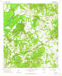
 1963 McBride1964 Print · USGSThe rural borderlands of Claiborne and Jefferson counties are captured here in the early sixties, showing a landscape of ridge-top churches and creek-bottom timber. Researchers can trace family history through landmarks like Sarepta Ch, Blue Hill, and the Antioch Cem.2 unique versions available
 - 1963 Map of Barlow, 1964 Print
 1963 Barlow1964 Print · USGSSouthwestern Mississippi's rural interior is captured in the early 1960s, showing a landscape defined by forest and frontier history. Researchers can find old family landmarks and the Old Indian Treaty Boundary alongside Barlow, Hawkins Cem, and Mt Zion Ch.
 - 1963 Map of Cayuga, 1964 Print
 1963 Cayuga1964 Print · USGSThe rural stretches of Hinds and Claiborne Counties are captured here in the early sixties, as the modern Natchez Trace Parkway bypasses quiet communities. Researchers can locate family landmarks like Bethesda Cem, Hubbard Sch, and the Indian Mound near the Big Black River.3 unique versions available
 - 1965 Map of Davis Island
 1965 Davis Island1965 Print · USGSThe Mississippi River and its intricate floodplains define this mid-1960s survey of the Louisiana and Mississippi border. Genealogists and historians can trace family locations near Newellton, Somerset Cem, and the historic Grand Gulf Mil Mon.3 unique versions available
Showing maps 1-25 of 129
Top cities of Claiborne County
Frequently asked questions
- What are the different types of historical maps available for Claiborne County?
- What is the oldest map of Claiborne County?
- Where can I purchase historical maps of Claiborne County for my home or office?
- Where can I download high-res historical maps of Claiborne County?
- Are there historical topographic maps available for Claiborne County?
- Is there historical aerial imagery available for Claiborne County?
- Where are historical maps of Claiborne County sourced from?