1980s Maps of Hancock County, Mississippi
Explore 10 historic maps of Hancock County from the 1980s. These maps offer a rare glimpse into what life looked like during the 1980s — showing old roads, neighborhoods, homes, and landmarks that have changed or disappeared over time.
Whether you're researching your family's past, planning a metal detecting trip, or studying how Hancock County's landscape evolved across the 1980s, these high-resolution maps are a powerful tool for exploring the history of this region.
- Focus on a specific era: All maps on this page are from the 1980s, giving you a focused view of this time period.
- See what’s changed: Compare century-old streets, trails, and buildings to today's modern landscape using overlays and satellite layers.
- Research with precision: Use these maps for genealogy, historical research, land use analysis, or educational projects.
- View, download, or print: Maps are fully viewable online in high resolution, and can be downloaded or printed for your own records.
Start exploring Hancock County's history through authentic maps from the 1980s. This is your window into the past.
Hancock County, MS maps
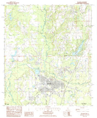
(10)- 1982 Map of Gulfport, 1983 Print
 1982 Gulfport1983 Print · USGSThe Gulf Coast between Louisiana and Mississippi appears in the early eighties as a landscape of marshland and maritime industry. Researchers can trace the path of the Louisville and Nashville RR through towns like Waveland and De Lisle, or locate the sprawling National Space Technology Laboratories.2 unique versions available
 - 1982 Map of Necaise, 1983 Print
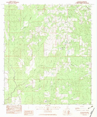 1982 Necaise1983 Print · USGSHancock County’s inland piney woods and creek bottoms are captured here in the early eighties as rural life centered around the Necaise community. Researchers can locate family landmarks like Shiloh Ch and Necaise Cem or trace the path of Bacon Bayou.
 - 1982 Map of Savannah, 1983 Print
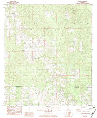 1982 Savannah1983 Print · USGSPearl River and Hancock counties meet in this early 1980s survey of the Mississippi Piney Woods. Researchers can trace rural lineages through local landmarks like Steep Hollow Cem, Anner Cem, and the small settlement at Savannah.
 - 1982 Map of Silver Run, 1983 Print
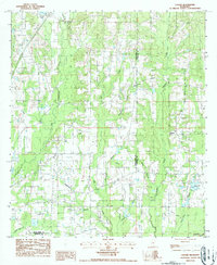
 1982 Silver Run1983 Print · USGSSouth Mississippi timber and river country comes alive in this early eighties survey, covering the intersection of four counties. Genealogists can locate family landmarks like Ladner Cem and rural centers such as Silver Run or the Old Barth Community Ch.
 - 1982 Map of Sellers, 1983 Print
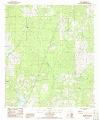
 1982 Sellers1983 Print · USGSThe rural piney woods of Harrison and Hancock counties are documented here in the early 1980s as they surround the winding Wolf River. Researchers can locate numerous family landmarks and rural congregations like Wolf River Cem, Bethel Memorial Ch, and the Salmon Scout Reservation.2 unique versions available
 - 1984 Map of Bogalusa
 1984 Bogalusa1984 Print · USGSThe Pearl River basin on the Louisiana-Mississippi border comes into focus in the mid-1980s, showcasing a landscape of river-bottom swamps and timberlands. Local researchers can trace the growth of Bogalusa and Picayune or find rural landmarks like Macedonia Ch and Wheat Swamp.
 - 1984 Map of Mobile
 1984 Mobile1984 Print · USGSThe Gulf Coast at the height of the mid-eighties shows a landscape of rapid industrial growth and military significance. Researchers can trace the sprawling rail lines of the Illinois Central Gulf RR, locate the NASA Test Facility, or study the barrier island chain from Cat Island to Petit Bois Island.3 unique versions available
 - 1985 Map of Picayune
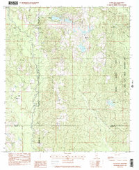
 1985 Picayune1985 Print · USGSPicayune and the surrounding Pearl River County countryside are captured here in the mid-1980s as the area balanced city growth with its deep-seated timber and river heritage. Genealogists and local historians can trace family locations near Carriere, Ozona, and the residential developments of Hide-A-Way Lake.2 unique versions available
 - 1986 Map of Millard
 1986 Millard1986 Print · USGSThe railroad corridor between Millard and Tyler is captured here in the mid-eighties, showing the rural character of the Mississippi piney woods. Researchers can trace the meandering Hobolochitto Creek, locate the shores of Anchor Lake, or find the old Gravel Pit.
 - 1986 Map of Caesar
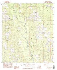
 1986 Caesar1986 Print · USGSPearl River and Hancock counties meet in this 1980s rural landscape of winding creeks and quiet piney woods settlements. Genealogists can trace family footprints near Caesar and Leetown or locate old burial sites marked as Cemeteries along Hobolochitto Creek.
End of results
Showing maps 1-10 of 10
Top cities of Hancock County
- Diamondhead historical maps
- Bay Saint Louis historical maps
- Waveland historical maps
- Pearlington historical maps
Frequently asked questions
- What are the different types of historical maps available for Hancock County?
- What is the oldest map of Hancock County?
- Where can I purchase historical maps of Hancock County for my home or office?
- Where can I download high-res historical maps of Hancock County?
- Are there historical topographic maps available for Hancock County?
- Is there historical aerial imagery available for Hancock County?
- Where are historical maps of Hancock County sourced from?