1990s Maps of Hancock County, Mississippi
Explore 13 historic maps of Hancock County from the 1990s. These maps offer a rare glimpse into what life looked like during the 1990s — showing old roads, neighborhoods, homes, and landmarks that have changed or disappeared over time.
Whether you're researching your family's past, planning a metal detecting trip, or studying how Hancock County's landscape evolved across the 1990s, these high-resolution maps are a powerful tool for exploring the history of this region.
- Focus on a specific era: All maps on this page are from the 1990s, giving you a focused view of this time period.
- See what’s changed: Compare century-old streets, trails, and buildings to today's modern landscape using overlays and satellite layers.
- Research with precision: Use these maps for genealogy, historical research, land use analysis, or educational projects.
- View, download, or print: Maps are fully viewable online in high resolution, and can be downloaded or printed for your own records.
Start exploring Hancock County's history through authentic maps from the 1990s. This is your window into the past.
Hancock County, MS maps
(13)- 1993 Map of English Lookout, 1995 Print
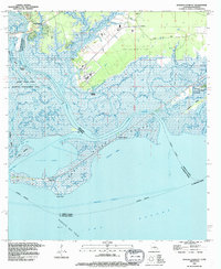 1993 English Lookout1995 Print · USGSThe coastal marshlands of the Mississippi-Louisiana border come alive in the 1990s as the river meets the gulf. Local historians can trace old waterfront sites at Jackson Landing and English Lookout or explore the development of the Ansley Gas Field.2 unique versions available
 - 1993 Map of Haaswood, 1995 Print
 1993 Haaswood1995 Print · USGSThe Pearl River delta meets the growing outskirts of Slidell during the 1990s in this detailed look at the Louisiana-Mississippi border. Researchers can trace old family names and settlements like Gainesville, Logtown, and Napoleon alongside the sprawling John C Stennis Space Center.2 unique versions available
 - 1993 Map of Logtown, 1995 Print
 1993 Logtown1995 Print · USGSNear the Louisiana border in the early nineties, this survey documents the interplay between federal aerospace development and old river settlements. Genealogists can locate family landmarks such as Logtown Cem, Pearlington, and the Charles Murphy Sch.
 - 1993 Map of Nicholson, 1995 Print
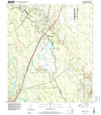
 1993 Nicholson1995 Print · USGSNicholson and the surrounding river lowlands are captured here in the early nineties as the NASA buffer zone meets the Pearl River basin. Genealogists can locate family sites like Old Palestine Ch, Cedar Grove Cem, and Corinth Ch among the many bayous.
 - 1993 Map of Bay St. Louis, 1995 Print
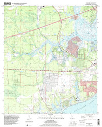
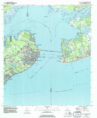 1993 Bay St. Louis1995 Print · USGSThe Mississippi Gulf Coast is captured here in the early nineties, showing the developed waterfronts of Bay St Louis and Pass Christian. Genealogists can trace local landmarks like St Stanislaus College, Trinity Ch, and the Garden Of Memory Cemetery.
 - 1994 Map of Bogalusa
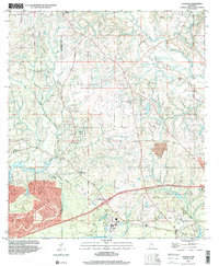
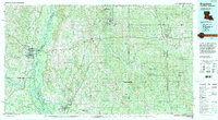 1994 Bogalusa1994 Print · USGSThe timber country and river bottoms of the Louisiana-Mississippi borderlands come alive in the mid-nineties. Genealogists and researchers can trace the rail-and-river geography of Bogalusa, the winding Pearl River, and family settlements like McNeill and Varnado.2 unique versions available
 - 1994 Map of Saint Joe Pass, 1995 Print
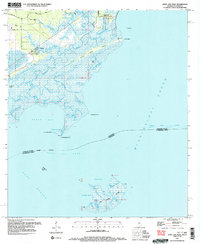 1994 Saint Joe Pass1995 Print · USGSCoastal Hancock County and the watery border with Louisiana appear here in the mid-1990s as a maze of marsh and bayous. You can trace family roots at the Bayou Caddy Cem or explore the remote reaches of Half Moon Island and Ansley.2 unique versions available
 - 1996 Map of Dead Tiger Creek, 1999 Print
 1996 Dead Tiger Creek1999 Print · USGSCoastal Hancock County is captured in the mid-nineties as the modern aerospace era meets the region's traditional bayous and backwoods. Researchers can find old landmarks like Flattop Sch (Abandoned), the Harmony Ch, and family-named waters like Sam Farve Bay.
 - 1997 Map of Waveland, 1999 Print
 1997 Waveland1999 Print · USGSMississippi's Gulf Coast is shown at the end of the century as residential communities grew alongside intricate tidal bayous. Researchers can trace land grants like the George Mares Claim or locate Holy Cross Boys Camp and Clermont Harbor.
 - 1997 Map of Picayune, 1999 Print
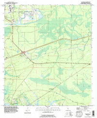
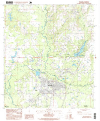 1997 Picayune1999 Print · USGSPicayune and the surrounding Pearl River County pine woods are captured here during a period of steady growth in the late nineties. Local researchers can trace the development of Carriere and Ozona, or locate landmarks like Hide-A-Way Lake and the Municipal Airport.
 - 1997 Map of Dedeaux, 2000 Print
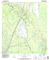
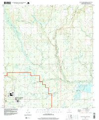
 1997 Dedeaux2000 Print · USGSHarrison and Hancock Counties come together at the turn of the millennium in this detailed view of the coastal bayous and river systems. Researchers can trace rural lineages through the locations of St Joseph Cem, Little Bethel Ch, and the old settlement of Dedeaux.
 - 1998 Map of Haaswood, 2000 Print
 1998 Haaswood2000 Print · USGSThe Pearl River basin near the Louisiana-Mississippi border comes to life in this late-nineties survey, showing the expansion of Slidell alongside the high-tech John C Stennis Space Center (NASA). Genealogists and historians can trace riverside settlements like Gainesville and Napoleon or locate the Hartzell Mt Zion Ch.
 - 1998 Map of Nicholson, 2000 Print
 1998 Nicholson2000 Print · USGSThe Pearl River delta comes into focus in the late nineties as a landscape of industrial gravel pits and aerospace boundaries. Genealogists and researchers can trace family sites like Cedar Grove Cem and Santa Rosa or locate landmarks like Jackson Landing.2 unique versions available
End of results
Showing maps 1-13 of 13
Top cities of Hancock County
- Diamondhead historical maps
- Bay Saint Louis historical maps
- Waveland historical maps
- Pearlington historical maps
Frequently asked questions
- What are the different types of historical maps available for Hancock County?
- What is the oldest map of Hancock County?
- Where can I purchase historical maps of Hancock County for my home or office?
- Where can I download high-res historical maps of Hancock County?
- Are there historical topographic maps available for Hancock County?
- Is there historical aerial imagery available for Hancock County?
- Where are historical maps of Hancock County sourced from?