Old Maps of Hancock County, Mississippi for Metal Detecting
Plan your next treasure hunt with 142 historic maps of Hancock County. Find old homesites, ghost towns, trails, and gathering spots that may be lost to time — perfect for identifying promising metal detecting locations.
- Locate forgotten sites: Uncover places like long-lost settlements, abandoned rail lines, or gathering spots.
- Plan better hunts: Use map overlays combined with LiDAR or satellite views to narrow in on historically rich areas.
- Made for detectorists: Thousands of hobbyists use these maps to discover relics, coins, and hidden history.
Use these historic maps to boost your research and find new opportunities beneath the surface of Hancock County.
Hancock County, MS maps
(142)- 1893 Map of Rigolets
 1893 Rigolets1893 Print · USGSCoastal Louisiana and Mississippi meet at the turn of the century along a labyrinth of marshlands and railroad trestles. Researchers can trace the early path of the Louisville and Nashville Railroad past Ft. Pike and through the Little Lake region.5 unique versions available
 - 1893 Map of Toulme
 1893 Toulme1893 Print · USGSThe coastal marshlands of Hancock County are captured in the late 1890s, where the rail line meets the sound. Genealogists and maritime historians can trace the lonely locations of the St. Joseph Island Light, the settlement at Toulme, and the intricate reaches of Heron Bay.4 unique versions available
 - 1914 Map of Nicholson, 1957 Print
 1914 Nicholson1957 Print · USGSThe Pearl River swamp along the Louisiana-Mississippi border was a landscape of timber and tides during the early twentieth century. Genealogists can locate family-named settlements like Logtown and Gainsville or trace the early paths of the 3 Notch Road.2 unique versions available
 - 1921 Map of Nicholson
 1921 Nicholson1921 Print · USGSThe borderlands of Mississippi and Louisiana are captured here in the early 1920s, showing a river-driven landscape of timber and rail. Researchers can trace the riverfront communities of Gainsville and Logtown alongside the historic 3 Notch Road.
 - 1935 Map of English Lookout
 1935 English Lookout1935 Print · USGSThe coastal marshlands at the Louisiana-Mississippi line are captured in the mid-1930s as the rail line bridges the delta. Trace the historic route of the Louisville and Nashville railroad through English Lookout and across the waters of Little Lake.
 - 1935 Map of Grand Island Pass
 1935 Grand Island Pass1935 Print · USGSThe maritime boundary between Mississippi and Louisiana is captured here in the mid-1930s, centering on the tidal marshes of Grand Island. Researchers can trace the winding paths of Gauthier Bayou and West Bayou through the coastal wetlands.2 unique versions available
 - 1936 Map of Rigolets, 1949 Print
 1936 Rigolets1949 Print · USGSCoastal Louisiana and Mississippi meet in the mid-1930s where the Pearl River delta fragments into a maze of islands and bayous. Researchers can trace the early path of Highway No 90, the defenses at Fort Pike, and settlements like Pearlington or Baldwin Lodge.
 - 1941 Map of Honey Island
 1941 Honey Island1941 Print · USGSThe lower Pearl River basin at the start of the 1940s reveals a dense network of swamp bayous and rail sidings. Genealogists and historians can trace the paths of Highway No 11 and the Southern railroad through Benton and past Honey Island.
 - 1949 Map of Grand Island Pass
 1949 Grand Island Pass1949 Print · USGSThe coastal boundary of Louisiana and Mississippi is captured here in the late 1940s, just before significant coastal changes reshaped the marsh. Researchers can trace the mid-century shoreline of Grand Island and locate the Lake Borgne L. H. at the edge of the Mississippi Sound.
 - 1950 Map of Haaswood
 1950 Haaswood1950 Print · USGSThe Pearl River bottomlands at the turn of the 1950s showcase a maze of islands and bayous along the Louisiana and Mississippi state line. Researchers can locate community anchors like Indian Village Sch, Hartsell Ch, and the riverside settlement of Logtown.
 - 1953 Map of Mobile, 1968 Print
 1953 Mobile1968 Print · USGSThe Gulf Coast comes alive in this mid-century survey, from the streets of Mobile to the marshes of New Orleans. Trace family roots in coastal towns like Pass Christian and Bayou La Batre or locate military landmarks including Keesler AFB.3 unique versions available
 - 1954 Map of Haaswood
 1954 Haaswood1954 Print · USGSSt. Tammany Parish at the mid-century is a maze of river bends and marshy bayous along the state line. Genealogists and historians can trace local landmarks like Indian Village Sch, Hartsell Ch, and the rail stop at Haaswood.
 - 1954 Map of English Lookout
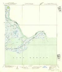 1954 English Lookout1954 Print · USGSCoastal St. Tammany Parish comes alive in the mid-1950s, showing the intersection of heavy rail and the Mississippi delta. You can trace the Louisville and Nashville R R through English Lookout and explore bayous like Grassy Bayou and Kopman Bayou.
 - 1955 Map of Savannah, 1956 Print
 1955 Savannah1956 Print · USGSCoastal Mississippi's piney woods and river bottoms come alive in the mid-fifties, showing the intersection of four counties. Genealogists can locate family landmarks like Necaise Cem, Riceville, and Steep Hollow Ch among the timber of the De Soto National Forest.3 unique versions available
 - 1955 Map of Nicholson, 1956 Print
 1955 Nicholson1956 Print · USGSThe Pearl River bottomlands at the Mississippi-Louisiana border come to life in the mid-fifties, showing a landscape defined by braided bayous and timbered wetlands. Researchers can locate family landmarks like Turtleskin Cem and Oak Ridge Ch or trace the early footprint of Nicholson.5 unique versions available
 - 1956 Map of Bay St. Louis, 1958 Print
 1956 Bay St. Louis1958 Print · USGSThe Mississippi Gulf Coast is captured here in the mid-fifties, showing the vital rail and road links across St Louis Bay. Researchers can locate family landmarks like the Widow Morin Claim or historic institutions such as St Stanislaus College.5 unique versions available
 - 1956 Map of Vidalia, 1960 Print
 1956 Vidalia1960 Print · USGSCoastal Harrison County and the bayou country come into focus during the mid-fifties as rural settlements like Vidalia and De Lisle remained centered on timber and tide. Genealogists can trace family landmarks like Sand Hill Cem, St Joseph Ch, and St Stephens Sch.5 unique versions available
 - 1956 Map of Grand Island Pass, 1960 Print
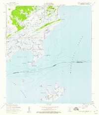 1956 Grand Island Pass1960 Print · USGSCoastal Hancock County and the Mississippi Sound marshes are captured here in the mid-fifties, showing the transition from historic land claims to small shore settlements. Genealogists can locate family landmarks like St Anns Ch, the Bayou Caddy Cem, and the old Nashville and Louisville Road.4 unique versions available
 - 1956 Map of Waveland, 1960 Print
 1956 Waveland1960 Print · USGSThe Mississippi coast in the mid-fifties reveals a landscape of emerging shoreline communities and intricate bayous. Trace family history and land use through the Waveland townsite, Holy Cross Boys Camp, and the George Mares Claim.5 unique versions available
 - 1956 Map of English Lookout, 1960 Print
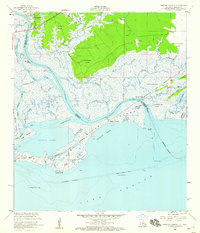 1956 English Lookout1960 Print · USGSCoastal marshes and river bayous dominate this mid-century survey of the Mississippi-Louisiana border. Genealogists and historians can trace early land boundaries like the Nancy Collins Claim and transport history along the Old Railroad Grade and the Louisville and Nashville line.2 unique versions available
 - 1956 Map of Rigolets, 1966 Print
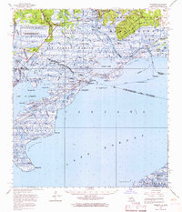 1956 Rigolets1966 Print · USGSThe coastal marshes of the Louisiana-Mississippi border come alive in this mid-century survey of the Pearl River delta. Researchers can trace the path of the L & N RR through Pearlington and locate the historic defenses at Fort Pike.
 - 1957 Map of Mobile
 1957 Mobile1957 Print · USGSThe Gulf Coast in the mid-1950s reveals a bustling corridor of rail-and-river commerce connecting Alabama to Louisiana. Genealogists and historians can trace old settlements and military hubs from Keesler Afb to the coastal reaches of Ship Island and Bogalusa.3 unique versions available
 - 1957 Map of Dead Tiger Creek, 1959 Print
 1957 Dead Tiger Creek1959 Print · USGSHancock County's lowland forests and bayous are meticulously mapped during the late fifties, showing a rural landscape shaped by water. Researchers can trace the locations of the Harmony Ch, the Bienville Ch, and the Flattop Sch (Abandoned).4 unique versions available
 - 1958 Map of Logtown, 1959 Print
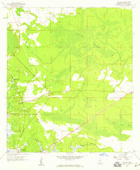 1958 Logtown1959 Print · USGSCoastal Hancock County in the late fifties was a network of river-bound settlements and lowland marshes. Genealogists and historians can trace the foundations of Logtown and Pearlington through landmarks like The Point Cem and Mt Zion Ch.4 unique versions available
 - 1958 Map of Picayune, 1959 Print
 1958 Picayune1959 Print · USGSPicayune and the surrounding Pearl River County countryside are captured here in the late fifties as the timber and rail economy shaped the landscape. Genealogists and local historians can trace rural family sites like Thigpen Cem, the Lee Sch, and the small settlement at Ozona.2 unique versions available
Showing maps 1-25 of 142
Top cities of Hancock County
- Diamondhead historical maps
- Bay Saint Louis historical maps
- Waveland historical maps
- Pearlington historical maps
Frequently asked questions
- What are the different types of historical maps available for Hancock County?
- What is the oldest map of Hancock County?
- Where can I purchase historical maps of Hancock County for my home or office?
- Where can I download high-res historical maps of Hancock County?
- Are there historical topographic maps available for Hancock County?
- Is there historical aerial imagery available for Hancock County?
- Where are historical maps of Hancock County sourced from?