Old Maps of Humphreys County, Mississippi for Hiking & Exploration
Hike through history with 108 historic maps of Humphreys County. Explore old trails, ghost towns, and forgotten backroads — perfect for outdoor adventurers and local explorers.
- Rediscover forgotten places: Map out old mining camps, roads, and footpaths that no longer exist on modern maps.
- Layer with modern tools: Combine with LiDAR or satellite views to plan hikes through historical terrain.
- Made for exploration: Popular among hikers, overlanders, and local history lovers.
Use these maps to find adventure and explore the hidden past of Humphreys County.
Humphreys County, MS maps
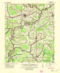
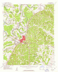
(108)- 1940 Map of Auter, 1941 Print
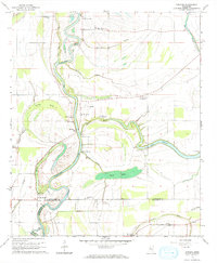
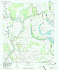
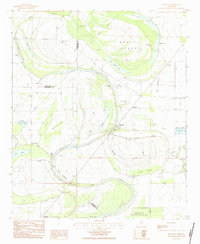
 1940 Auter1941 Print · USGSThe Mississippi Delta in the early 1940s is captured here as a world of river landings and plantation agriculture along the Big Sunflower River. Genealogists and researchers can trace family landmarks at Hard Cash, Midnight, and Daybreak Plantation.
 - 1940 Map of Baird, 1942 Print
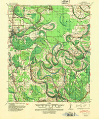
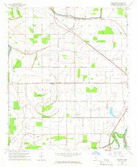
 1940 Baird1942 Print · USGSThe Mississippi Delta's intricate river and rail economy is on full display during the early 1940s. Genealogists and historians can trace family roots through specific landmarks like Price School, Heard Ferry, and the many small settlements like Baird and Inverness.
 - 1940 Map of Mileston, 1953 Print
 1940 Mileston1953 Print · USGSThe Mississippi Delta's winding waterways and rail-linked settlements are captured here just before the mid-century. Genealogists can trace family roots through communities like Mileston and Silver City, or locate specific landmarks like the Good Hope Ch and ancient Indian Mounds.
 - 1953 Map of Greenwood, 1966 Print
 1953 Greenwood1966 Print · USGSThe Mississippi Delta in the mid-fifties is captured here as a thriving network of river towns, railroads, and oxbow lakes. Researchers can trace the legacy of the Illinois Central Railroad and locate landmarks like the State Penal Farm and Greenville Air Force Base.5 unique versions available
 - 1954 Map of Mileston
 1954 Mileston1954 Print · USGSThe Yazoo River Delta in the mid-1950s reveals a landscape shaped by massive flood control projects and deep-rooted river communities. Genealogists can trace family footprints through numerous rural landmarks like Holly Grove Ch & Cem, Jaketown, and the remote settlement of Pluto.
 - 1955 Map of Jackson
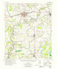
 1955 Jackson1955 Print · USGSThe Lower Mississippi Valley at the middle of the century reveals a landscape of deep river meanders and growing rail hubs. Genealogists and historians can trace the mid-century footprints of Vicksburg National Military Park, old river landings at Port Gibson, and the rail corridors of the Illinois Central Railroad.3 unique versions available
 - 1956 Map of Greenwood
 1956 Greenwood1956 Print · USGSThe Mississippi Delta in the mid-fifties is captured here during a period of significant military and agricultural activity. Researchers can trace the rail lines of the Illinois Central RR, find the Greenville Air Force Base, or locate the State Penal Farm.
 - 1961 Map of Jackson
 1961 Jackson1961 Print · USGSThe Lower Mississippi Delta and the state capital area are captured here during the post-war era of infrastructure expansion. Researchers can trace the complex river oxbows and rail lines connecting Vicksburg, Yazoo City, and the Illinois Central Railroad network.
 - 1961 Map of Bayland
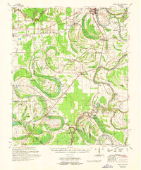
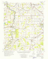
 1961 Bayland1961 Print · USGSThe Mississippi Delta's intricate water network and rural communities are captured here in the early sixties. Genealogists and historians can trace family locations through Huddleston Cem, Indian Mounds, and the Humphreys Co Training School.3 unique versions available
 - 1961 Map of Mossy Lake, 1962 Print
 1961 Mossy Lake1962 Print · USGSLeflore County's intricate Delta wetlands and river bends are captured here in the early sixties, showing a landscape of scattered settlements and rural churches. Researchers can trace the Columbus and Greenville rail line through Itta Bena or locate local landmarks like McIntyre Cem and the Indian Mound.3 unique versions available
 - 1961 Map of Valley, 1963 Print
 1961 Valley1963 Print · USGSYazoo City and its rural surroundings are captured in the early sixties as the Delta's agricultural and industrial patterns evolved. Researchers can trace family roots through dozens of local landmarks including Cedar Falls Sch, Bells Chapel, and Coopers Cem.2 unique versions available
 - 1962 Map of Jackson
 1962 Jackson1962 Print · USGSThe Mississippi Delta and the state capital region are mapped here in the early sixties, showing a landscape defined by the great river and the growing city of JACKSON. Genealogists can trace family roots through numerous landmarks like Cedar Hill Cem, rural stops on the Illinois Central RR, and historic sites like Champion Hill.2 unique versions available
 - 1965 Map of Richey, 1966 Print
 1965 Richey1966 Print · USGSSharkey County and the surrounding Delta lands are captured here in the mid-1960s as the river economy remained central to local life. Genealogists can locate family landmarks like Short Jerusalem Ch and the river crossings at Murphy Ferry or Bommers Ferry.
 - 1965 Map of Midnight, 1966 Print
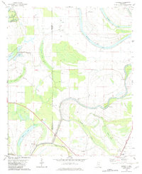
 1965 Midnight1966 Print · USGSHumphreys County in the mid-sixties reveals a Delta landscape shaped by the Illinois Central railroad and a network of bayous. Genealogists and historians can locate rural landmarks like Midnight, the Riven Oak Sch, and Bellewood Cem among the cotton fields and drainage ditches.
 - 1965 Map of Inverness, 1966 Print
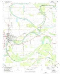
 1965 Inverness1966 Print · USGSThe rail-and-bayou landscape of Sunflower County in the mid-1960s centers on the towns of Inverness and Isola. Genealogists and local historians can locate many rural landmarks like Hickory Grove Cem, Bowles, and the St Lawrence Ch.
 - 1965 Map of Kinlock, 1966 Print
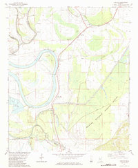
 1965 Kinlock1966 Print · USGSThe Mississippi Delta's river-driven landscape is captured here in the mid-sixties, centering on the curves of the Big Sunflower River. Genealogists and historians can trace family-named estates like Waco Plantation and local landmarks like Big Morning Star Ch.
 - 1965 Map of Bellewood, 1966 Print
 1965 Bellewood1966 Print · USGSMid-century Humphreys County is captured here during a time of significant agricultural development in the Mississippi Delta. Genealogists and local historians can trace rural communities through landmarks like Hard Cash, Mount Carmel Sch, and Shiloh Ch.2 unique versions available
 - 1965 Map of Midnight NW, 1966 Print
 1965 Midnight NW1966 Print · USGSHumphreys and Washington Counties are shown in the mid-1960s as a landscape of alluvial waterways and delta farmland. Genealogists and historians can trace local landmarks like Pilgrim Rest Cem, Sunflower Chapel, and an ancient Indian Mound along the Big Sunflower River.
 - 1967 Map of Baird
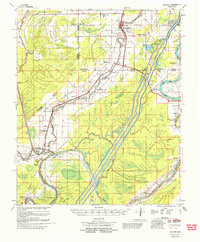
 1967 Baird1967 Print · USGSThe Mississippi Delta's rail-and-river economy is on full display in the late 1960s, centered on the crossing of major lines at Indianola. Locate ancestral sites like Woodburn Plantation or country churches including Union Star Ch and Indian Bayou Ch.
 - 1967 Map of Auter
 1967 Auter1967 Print · USGSHumphreys County and the surrounding Delta flatlands are captured here in the late sixties as the agricultural economy relied on both rail and river. Trace family roots at Midnight or Silver City, and find old landmarks like River Oak Sch and Pilgrim Rest Cem.
 - 1982 Map of Silver City
 1982 Silver City1982 Print · USGSThe Delta lowlands of Humphreys County appear in the early eighties as a landscape shaped by the winding Yazoo River. Researchers can trace rural lineages through numerous country churches like Burns Chapel and find old footprints along the Old Railroad Grade near Silver City.
 - 1982 Map of Marcella
 1982 Marcella1982 Print · USGSThe Mississippi Delta's intricate network of bayous and brakes is captured here in the early eighties. Genealogists and historians can trace the Old Indian Treaty Boundary and locate community landmarks like Annie York Ch and Marcella.2 unique versions available
 - 1982 Map of Belzoni, 1983 Print
 1982 Belzoni1983 Print · USGSThe Yazoo River floodplain in the early 1980s reveals a landscape of delta settlements and agricultural airstrips. Genealogists can trace family roots through numerous sites like Carson Cem, Watson Chapel, and Mt Zion Cem Ch.
 - 1982 Map of Thornton, 1984 Print
 1982 Thornton1984 Print · USGSThe Mississippi Delta river-and-rail corridor is documented here in the early 1980s. Genealogists can trace rural communities through local landmarks like Mileston Sch, Quofaloma, and the Sweet Kingdom Ch near Bee Lake.
 - 1983 Map of Swiftown, 1984 Print
 1983 Swiftown1984 Print · USGSThe Mississippi Delta's intricate oxbows and swamp lands are captured here in the early 1980s, centered on the community of Swiftown. Researchers can trace old property lines along the Indian Treaty Boundary or locate family sites at Graves Cem and White Rock Ch.
Showing maps 1-25 of 108
Top cities of Humphreys County
Frequently asked questions
- What are the different types of historical maps available for Humphreys County?
- What is the oldest map of Humphreys County?
- Where can I purchase historical maps of Humphreys County for my home or office?
- Where can I download high-res historical maps of Humphreys County?
- Are there historical topographic maps available for Humphreys County?
- Is there historical aerial imagery available for Humphreys County?
- Where are historical maps of Humphreys County sourced from?