1980s Maps of Madison County, Mississippi
Explore 24 historic maps of Madison County from the 1980s. These maps offer a rare glimpse into what life looked like during the 1980s — showing old roads, neighborhoods, homes, and landmarks that have changed or disappeared over time.
Whether you're researching your family's past, planning a metal detecting trip, or studying how Madison County's landscape evolved across the 1980s, these high-resolution maps are a powerful tool for exploring the history of this region.
- Focus on a specific era: All maps on this page are from the 1980s, giving you a focused view of this time period.
- See what’s changed: Compare century-old streets, trails, and buildings to today's modern landscape using overlays and satellite layers.
- Research with precision: Use these maps for genealogy, historical research, land use analysis, or educational projects.
- View, download, or print: Maps are fully viewable online in high resolution, and can be downloaded or printed for your own records.
Start exploring Madison County's history through authentic maps from the 1980s. This is your window into the past.
Madison County, MS maps
(24)- 1980 Map of Brownsville
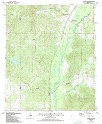
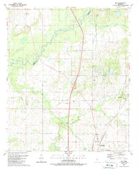
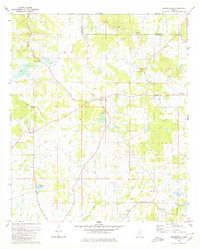 1980 Brownsville1980 Print · USGSHinds and Madison counties meet here in the late seventies, showing a quiet rural network of family cemeteries and country churches. Genealogists can trace local history through sites like Lula Cem, Hill of Zion Ch, and the settlement of Orangeville.
 - 1980 Map of Ridgeland
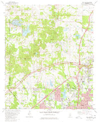 1980 Ridgeland1980 Print · USGSThe northern reaches of the Mississippi capital region are captured here in 1980, as the area around Ridgeland and Tougaloo continues to develop. Researchers can locate historic institutions such as Tougaloo College and find rural landmarks like Ridley Ridge Ch and the Natchez Trace Parkway.3 unique versions available
 - 1980 Map of Pocahontas
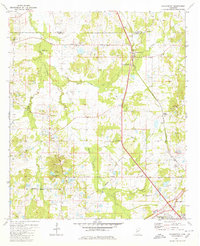 1980 Pocahontas1980 Print · USGSThe Hinds and Madison county line area in the early eighties shows a landscape of traditional church communities and modern parkways. Trace the history of Pocahontas Mounds or locate family sites like Tinnin Cem and Shady Grove Ch.3 unique versions available
 - 1980 Map of Madison
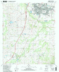
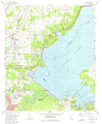 1980 Madison1980 Print · USGSThe outskirts of Jackson and the newly developed Madison area are captured in the late 1970s as suburban life began to flourish near the Ross Barnett Reservoir. Genealogists and local historians can trace family markers at Jessamine Cem or explore the corridor of the Natchez Trace Parkway.
 - 1982 Map of Goshen Springs, 1983 Print
 1982 Goshen Springs1983 Print · USGSRankin County in the early eighties shows the evolving shoreline of the Ross R Barnett Reservoir alongside traditional rural centers. Genealogists can trace family landmarks like Pisgah Sch, Pilgram Branch Ch, and the settlements of Fannin and Sandhill.
 - 1984 Map of Yazoo City
 1984 Yazoo City1984 Print · USGSThe Mississippi Delta and loess bluffs meet in the mid-eighties as the Yazoo River snakes through a dense network of wildlife areas and rail lines. Researchers can trace rural life and drainage history through small communities like Holly Bluff, Mechanicsburg, and Satartia.2 unique versions available
 - 1984 Map of Forest
 1984 Forest1984 Print · USGSCentral Mississippi in the mid-eighties centers on the timberlands and rail corridors of the Bienville National Forest. Genealogists and historians can trace old settlements like Conehatta and Hillsboro or follow the Illinois Central Gulf line through Morton and Newton.2 unique versions available
 - 1984 Map of Carthage
 1984 Carthage1984 Print · USGSLeake and Neshoba counties in the mid-1980s showcase a transition from the Government Hills to the dense Bienville National Forest. Genealogists and researchers can trace the historic Natchez Trace Parkway and local settlements like Plattsburg and Williamsville.
 - 1984 Map of Jackson
 1984 Jackson1984 Print · USGSCentral Mississippi in the mid-eighties shows a landscape defined by the growing suburbs of Jackson and the riverfront legacy of Vicksburg. Researchers can trace the Natchez Trace Parkway or locate local landmarks like Utica College and Mississippi State Hospital.
 - 1988 Map of Coxs Ferry, 1989 Print
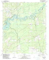
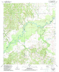 1988 Coxs Ferry1989 Print · USGSThe Big Black River basin in the late eighties reveals a landscape where Yazoo, Madison, and Hinds Counties meet. Genealogists can trace family-named sites like Cox Cem and Clayton Cem or explore rural centers such as Nevada and Hall Chapel.
 - 1988 Map of Charlton, 1989 Print
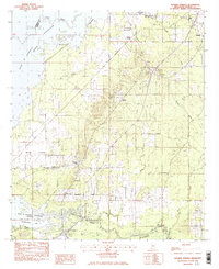
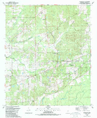
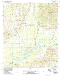
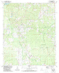
 1988 Charlton1989 Print · USGSMadison County in the late 1980s reveals a quiet landscape of rural crossroads and growing residential pockets. Researchers can locate historic community centers like Livingston and Stokes, or trace family sites at Jackson Cem and Damascus Ch.
 - 1988 Map of Sharon, 1989 Print
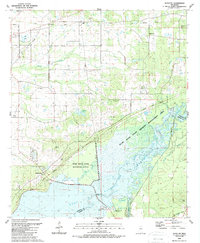
 1988 Sharon1989 Print · USGSThe community of Sharon and its surrounding Madison County farmland are captured here in the late 1980s. Genealogists can trace family footprints through numerous local landmarks like Sims Chapel, St Mark Ch, and Hassley Herron Lake.
 - 1988 Map of Thomastown, 1989 Print
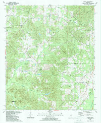
 1988 Thomastown1989 Print · USGSLeake and Madison counties are captured in the late eighties as the Natchez Trace Parkway bisects this river-carved landscape. Genealogists can locate family landmarks like the Thomastown Christian Cem and rural congregations including Wake Forest Ch and Saint Ann.
 - 1988 Map of Flora, 1989 Print
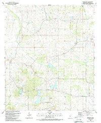
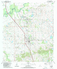 1988 Flora1989 Print · USGSMadison County and the town of Flora are captured here in the late 1980s as the area balanced industrial growth with its rural heritage. Researchers can trace family roots through several landmarks including Vernon Cem, Smith Chapel, and the well-known Petrified Forest.
 - 1988 Map of Farmhaven, 1989 Print
 1988 Farmhaven1989 Print · USGSMadison County's rural landscape is captured here in the late eighties, featuring the historic route of the Natchez Trace Parkway. Genealogists and historians can trace family roots through numerous small burial grounds and churches like Lottville Cem, St Elizabeth Cem, and Clarks Chapel.
 - 1988 Map of Bentonia, 1989 Print
 1988 Bentonia1989 Print · USGSIn the late eighties, the Yazoo County countryside remained a patchwork of small communities and active oil fields. Genealogists can locate rural landmarks like Pleasant Grove Ch, Central Holmes Cem, and Andrew Chapel near the Big Black River.
 - 1988 Map of Sharon SE, 1989 Print
 1988 Sharon SE1989 Print · USGSThe borderlands of Madison, Rankin, and Scott Counties are captured in the late eighties as the Pearl River basin remained a mosaic of oxbow lakes and wetlands. Trace family roots at Sand Hill Ch, Lone Pine Ch, or Pisgah Cem while exploring the corridor of the Old Natzhez Trace Parkway.
 - 1989 Map of Ofahoma
 1989 Ofahoma1989 Print · USGSCentral Mississippi in the late eighties shows a landscape shaped by the Pearl River floodplains and the high Government Hills. Trace the paths of local life through the Natchez Trace Parkway or find family landmarks like Tribulation Ch and Good Hope.
 - 1989 Map of Shoccoe
 1989 Shoccoe1989 Print · USGSThe Pearl River bottomlands and the reservoir shoreline come into focus in the late eighties as conservation areas expand. Local historians can trace old community landmarks like Zion Chapel, the Old Railroad Grade, and Madisonville along the historic Natchez Trace Parkway.
 - 1989 Map of Joseph
 1989 Joseph1989 Print · USGSAttala and Leake counties are documented here in the late eighties, just as the modern survey of their rural townships was finalized. Researchers can locate many family-named landmarks and old church sites like Ellington Ch, Zemuly, and Bolatusha Cem.
 - 1989 Map of Way
 1989 Way1989 Print · USGSMississippi's river borderlands appear in detail in the late 1980s, centered on the Big Black River. Genealogists can trace family burial sites like Knott Cem and rural centers including Cobbville, Way, and Thornton Chapel.
 - 1989 Map of Canton
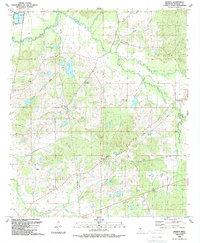
 1989 Canton1989 Print · USGSMadison County's central landscape is captured here in the late eighties, showing a community defined by its schools and rural parishes. Genealogists can trace family names at Harvey Chapel, Old Madison Ch and Sch, and the Mt Able Cem.
 - 1989 Map of Ludlow
 1989 Ludlow1989 Print · USGSIn the late 1980s, the Mississippi timberlands near Ludlow remained a landscape of forest reserves and family burial grounds. Local historians can trace early transportation routes like the Old RR Grade or locate sites like Mt Zion Ch and Pearson Cem.
 - 1989 Map of Berryville
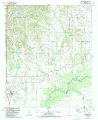
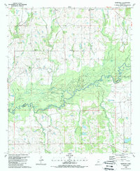 1989 Berryville1989 Print · USGSThe Yazoo and Madison county line follows the winding Big Black River in the 1980s, revealing a landscape of oxbow lakes and rural hamlets. Family historians can locate ancestral sites like Beatties Bluff, Shiloh Chapel, and the Mt Elam Cem.
End of results
Showing maps 1-24 of 24
Top cities of Madison County
- Madison historical maps
- Ridgeland historical maps
- Canton historical maps
- Gluckstadt historical maps
- Flora historical maps
Frequently asked questions
- What are the different types of historical maps available for Madison County?
- What is the oldest map of Madison County?
- Where can I purchase historical maps of Madison County for my home or office?
- Where can I download high-res historical maps of Madison County?
- Are there historical topographic maps available for Madison County?
- Is there historical aerial imagery available for Madison County?
- Where are historical maps of Madison County sourced from?