1970s Maps of Neshoba County, Mississippi
Explore 10 historic maps of Neshoba County from the 1970s. These maps offer a rare glimpse into what life looked like during the 1970s — showing old roads, neighborhoods, homes, and landmarks that have changed or disappeared over time.
Whether you're researching your family's past, planning a metal detecting trip, or studying how Neshoba County's landscape evolved across the 1970s, these high-resolution maps are a powerful tool for exploring the history of this region.
- Focus on a specific era: All maps on this page are from the 1970s, giving you a focused view of this time period.
- See what’s changed: Compare century-old streets, trails, and buildings to today's modern landscape using overlays and satellite layers.
- Research with precision: Use these maps for genealogy, historical research, land use analysis, or educational projects.
- View, download, or print: Maps are fully viewable online in high resolution, and can be downloaded or printed for your own records.
Start exploring Neshoba County's history through authentic maps from the 1970s. This is your window into the past.
Neshoba County, MS maps
(10)- 1972 Map of Pearl River, 1973 Print
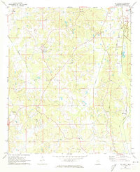
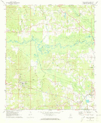 1972 Pearl River1973 Print · USGSThe Pearl River community and the outskirts of Philadelphia appear here in the early seventies, showing a landscape of tribal administration and rural industry. Genealogists and local historians can locate the Tribal Office, Choctaw Youth Center, and Old Pearl Valley Ch.2 unique versions available
 - 1972 Map of Plattsburg, 1973 Print
 1972 Plattsburg1973 Print · USGSThe Winston and Neshoba county line divides this Mississippi landscape in the early seventies, a region of family farms and creek bottoms. Genealogists can trace local heritage through numerous landmarks like Indian Spring Ch, Lee Cem, and Plattsburg.
 - 1972 Map of Noxapater, 1973 Print
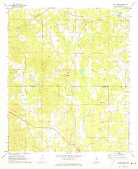
 1972 Noxapater1973 Print · USGSWinston County's timber and rail landscape is well-preserved here in the early seventies, centered on the town of Noxapater. Genealogists and historians can trace local landmarks like Stallo, the Gulf Mobile and Ohio railroad, and country churches like Salem Ch.
 - 1972 Map of Deemer, 1973 Print
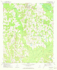
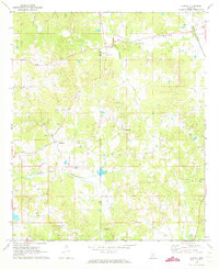
 1972 Deemer1973 Print · USGSNeshoba County's rural landscape is captured here in the early seventies, showing a network of small communities and canal-drained bottomlands. Researchers can locate family landmarks such as Spring Hill Cem, Tucker, and the Mt Olive Ch along the Beatline road.2 unique versions available
 - 1972 Map of Union East, 1973 Print
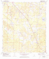
 1972 Union East1973 Print · USGSNewton and Neshoba counties in the early seventies reveal a rural landscape connected by the Gulf Mobile and Ohio rail line. Researchers can trace local family roots at Sunny Hill Cem or find old community centers like Beulah-Hubbard Sch and Rock Branch Ch.2 unique versions available
 - 1972 Map of Philadelphia, 1973 Print
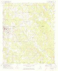
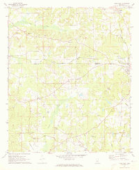
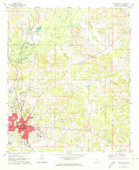 1972 Philadelphia1973 Print · USGSThe Neshoba County seat and surrounding timberlands are captured in the early 1970s, as Philadelphia expanded along the Gulf Mobile and Ohio Railroad. Genealogists can trace family names at Donald Cem, Cedarlawn Cem, and rural sites like Longino Ch.2 unique versions available
 - 1972 Map of Madden, 1973 Print
 1972 Madden1973 Print · USGSAcross the border of Leake and Neshoba counties in the early seventies, this rural landscape reveals a community built around small-town centers and country churches. Genealogists can trace family roots through several landmarks like Leake Academy, Mt Bethany Ch, and the Carolina Cem.
 - 1972 Map of Sebastopol, 1973 Print
 1972 Sebastopol1973 Print · USGSThe intersection of four counties in central Mississippi comes alive in the early seventies, centered on the railroad town of Sebastopol. Genealogists and historians can trace the locations of rural landmarks like Steam Mill, Milldale Cem, and Hays.
 - 1972 Map of McDonald, 1973 Print
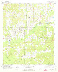
 1972 McDonald1973 Print · USGSNeshoba County's rural heartland is captured in the early 1970s, showing a landscape of small farming communities and canal networks. Genealogists can locate family landmarks like Morrow Memorial Cem, Bluff Springs Ch, and the settlement of Dixon.2 unique versions available
 - 1972 Map of Union West, 1973 Print
 1972 Union West1973 Print · USGSNewton and Neshoba counties appear here in the early 1970s, as rural communities thrived along the Gulf Mobile and Ohio rail line. Genealogists can trace family roots through several local landmarks like Hudsons Chapel Cemetery, Evans Tabernacle, and Spring Hill Ch.2 unique versions available
End of results
Showing maps 1-10 of 10
Top cities of Neshoba County
Frequently asked questions
- What are the different types of historical maps available for Neshoba County?
- What is the oldest map of Neshoba County?
- Where can I purchase historical maps of Neshoba County for my home or office?
- Where can I download high-res historical maps of Neshoba County?
- Are there historical topographic maps available for Neshoba County?
- Is there historical aerial imagery available for Neshoba County?
- Where are historical maps of Neshoba County sourced from?