
1972 Map of Pearl River
USGS Topo · Published 1973About this map
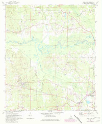
Choctaw Central High Sch and the Tribal Office serve as focal points for the Pearl River community in this early 1970s record of Neshoba County. The landscape is defined by the winding course of the Pearl River, which feeds into Mud Lake and Myers Lake, while the Kentawka Canal and Little Kentawka Canal cut straight paths through the wetlands to the south. This era shows a mix of traditional rural life and modern infrastructure, where local landmarks like the Black Jack Ch and Beulah Chapel Cem stand near industrial features like the Claypits and the Filtration Plant. On the eastern edge, the growth of Philadelphia is evident at the Philadelphia Municipal Airport and the Radio Tower (WHOG), while the community of Williamsville features a Drive-in Theater along the highway.
Find a feature on this map
38 named features on this map. Tap any name to fly to it.
Don’t see what you’re looking for? This feature index may not catch every label — zoom into the map to look around manually.
Map Details
Editions of this 1972 Pearl River Map
2 editions found
Other maps of this area

1953 · Meridian
USGS Topo · 1:250,000

1957 · Meridian
USGS Topo · 1:250,000

1962 · Edinburg
USGS Topo · 1:62,500

1965 · Meridian
USGS Topo · 1:250,000

1972 · Plattsburg
USGS Topo · 1:24,000
1972 · Noxapater
USGS Topo · 1:24,000

1972 · Deemer
USGS Topo · 1:24,000
1972 · Philadelphia
USGS Topo · 1:24,000

1972 · Madden
USGS Topo · 1:24,000
1972 · McDonald
USGS Topo · 1:24,000