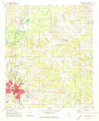
1972 Map of Philadelphia
USGS Topo · Published 1973About this map
The Neshoba County seat of Philadelphia serves as the focal point of this 1970s landscape, where the Gulf Mobile and Ohio Railroad tracks parallel the upper reaches of the Pearl River. The urban core is detailed with civic landmarks like the Courthouse and Hospital, surrounded by residential expansion marked by the Neshoba Central High Sch and the Golf Course. To the north, the smaller settlement of Burnside sits near the Burnside Lake and the expansive Burnside County Park, indicating the area's mix of municipal development and recreational space.
Find a feature on this map
43 named features on this map. Tap any name to fly to it.
Don’t see what you’re looking for? This feature index may not catch every label — zoom into the map to look around manually.
Map Details
Editions of this 1972 Philadelphia Map
2 editions found
Other maps of this area

1953 · Meridian
USGS Topo · 1:250,000

1957 · Meridian
USGS Topo · 1:250,000

1962 · House
USGS Topo · 1:24,000

1962 · Vernon
USGS Topo · 1:24,000

1962 · Owl Creek
USGS Topo · 1:24,000

1965 · Meridian
USGS Topo · 1:250,000

1972 · Pearl River
USGS Topo · 1:24,000

1972 · Plattsburg
USGS Topo · 1:24,000
1972 · Noxapater
USGS Topo · 1:24,000

1972 · Deemer
USGS Topo · 1:24,000