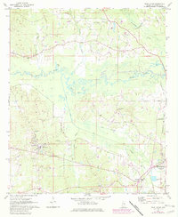
1972 Map of Pearl River
USGS Topo · Published 1982About this map
The Choctaw Indian Reservation dominates this central Neshoba County landscape, showing the community infrastructure in place during the early 1970s. The settlement of Pearl River serves as a focal point, featuring the Tribal Office, the Choctaw Youth Center, and Choctaw Central High Sch. To the southeast, the urban expansion of Philadelphia begins to reach toward Williamsville, where a Drive-in Theater and the Radio Tower (WHOG) stand near the Kentawka Canal.
Find a feature on this map
37 named features on this map. Tap any name to fly to it.
Don’t see what you’re looking for? This feature index may not catch every label — zoom into the map to look around manually.
Map Details
Editions of this 1972 Pearl River Map
2 editions found
Other maps of this area

1953 · Meridian
USGS Topo · 1:250,000

1957 · Meridian
USGS Topo · 1:250,000

1962 · Edinburg
USGS Topo · 1:62,500

1965 · Meridian
USGS Topo · 1:250,000

1972 · Pearl River
USGS Topo · 1:24,000

1972 · Plattsburg
USGS Topo · 1:24,000
1972 · Noxapater
USGS Topo · 1:24,000

1972 · Deemer
USGS Topo · 1:24,000
1972 · Philadelphia
USGS Topo · 1:24,000

1972 · Madden
USGS Topo · 1:24,000