Old Maps of Newton County, Mississippi
Explore 113 old maps of Newton County, spanning from 1921 to today. These high-resolution historic maps reveal how streets, neighborhoods, landmarks, and natural features evolved over time — perfect for genealogy, metal detecting, research, and local history exploration.
What you can do with these maps:
- See how Newton County changed over time: Compare historical maps to modern-day views to trace roads, homesites, rail lines & more.
- View detailed metadata: Each map includes creators, publishers, year, scale, and archive source.
- Overlay maps with satellite & LiDAR: Visualize the past alongside modern tools to explore terrain & human change.
- Trusted historical sources: Maps sourced from the USGS, Library of Congress, and other archives.
- Access maps your way: View online, download high-res files, or order prints for personal or research use.
Start exploring old maps of Newton County to uncover forgotten places, hidden landmarks, and the deep history beneath your feet.
Newton County, MS maps
(113)- 1921 Map of Forest
 1921 Forest1921 Print · USGSThe Scott County landscape in the early 1920s is documented here through its rural schoolhouses and family settlements. Genealogists can locate long-standing community centers like the Patrons Union Camp Ground, Singleton Settlement, and Fikestown.
 - 1922 Map of Forest
 1922 Forest1922 Print · USGSScott and Newton Counties are shown here in the early twenties, when timber and rails defined the landscape. You can trace the path of the Alabama and Vicksburg RR, locate family landmarks like Many Roads Hill, and find old meeting grounds like the Patrons Union Campground.2 unique versions available
 - 1950 Map of Forest, 1966 Print
 1950 Forest1966 Print · USGSMid-century Scott County centers on the rail-driven growth of Forest and its surrounding timberlands. Local historians can trace family ties through Singleton Settlement, rural schools like Sylvester Sch, and the Patrons Union Campground.2 unique versions available
 - 1952 Map of Forest
 1952 Forest1952 Print · USGSCentral Mississippi in the early fifties shows a landscape of rail-side growth and established family settlements. You can trace early Scott County history through rural landmarks like the Patrons Union Campground, Singleton Settlement, and Gum Springs.2 unique versions available
 - 1953 Map of Meridian, 1966 Print
 1953 Meridian1966 Print · USGSEast Central Mississippi and the Alabama borderlands are captured here during a period of steady growth and infrastructure expansion. Genealogists and historians can trace rail-town development along the Gulf Mobile & Ohio Railroad and find early settlements like Scooba, Pelahatchie, and De Kalb.2 unique versions available
 - 1957 Map of Meridian
 1957 Meridian1957 Print · USGSEast Central Mississippi and parts of Western Alabama come alive in the mid-1950s, centered on the transit hub of Meridian. Researchers can trace old rail lines like the Illinois Central and find historic sites such as the Choctaw Indian Reservation and Roosevelt State Park.
 - 1957 Map of Chunky, 1958 Print
 1957 Chunky1958 Print · USGSNewton and Lauderdale counties come alive in the mid-1950s, showing a landscape defined by the intersection of three major railroads. Researchers can locate numerous rural landmarks such as Pine Forest Academy, Mt Moriah Ch, and the settlement of Meehan.2 unique versions available
 - 1957 Map of Enterprise, 1958 Print
 1957 Enterprise1958 Print · USGSEast-central Mississippi is shown here in the late fifties, defined by the rail corridors of the Southern and GM&O lines. Researchers can trace family history through dozens of rural sites like Orange Twistwood Sch, Basic City, and Zion Hill Ch.
 - 1962 Map of Post, 1964 Print
 1962 Post1964 Print · USGSFour Mississippi counties meet in this early 1960s survey, showing a rural landscape tied together by local churches and the railroad. Genealogists and researchers can trace family landmarks like Trussel Cem, Antioch Ch, and the rail stop at Perdue.2 unique versions available
 - 1965 Map of Meridian
 1965 Meridian1965 Print · USGSEast Mississippi and West Alabama are mapped here in the mid-sixties as the region's modern highway and reservoir systems began to take shape. Researchers can trace rural lineages through local landmarks like Prince Chapel and Tuscahoma Landing, or follow the historic Gulf Mobile & Ohio rail lines.
 - 1966 Map of Hickory, 1967 Print
 1966 Hickory1967 Print · USGSNewton County in the mid-1960s shows a landscape of rural community and evolving transit. Genealogists can locate family landmarks like Old Norman Cem, Ferguson Cem, and the State Experiment Station near Hickory.
 - 1966 Map of Newton, 1967 Print
 1966 Newton1967 Print · USGSNewton and the surrounding central Mississippi timberlands are captured here in the mid-sixties during a period of infrastructure expansion. Genealogists and historians can locate family landmarks like Evans Cem, Clark Memorial College, and the old Richardson Mill.2 unique versions available
 - 1966 Map of Decatur NW, 1967 Print
 1966 Decatur NW1967 Print · USGSNewton County in the mid-sixties is a landscape of rural family homesteads and country churches tied together by the Gulf Mobile and Ohio railroad. Genealogists can locate precise sites like the Hollingsworth Cem, Bufkin Cem, and Pine Ridge Ch.2 unique versions available
 - 1966 Map of Decatur, 1967 Print
 1966 Decatur1967 Print · USGSDecatur and the surrounding Newton County countryside are captured here in the mid-sixties, showing a landscape defined by small churches and rail. Trace family roots at Brand Cem or follow the path of the Gulf Mobile and Ohio railroad.2 unique versions available
 - 1968 Map of Clear Springs, 1970 Print
 1968 Clear Springs1970 Print · USGSCentral Mississippi's piney woods come alive in the late sixties, showing where the borders of four counties meet within the Bienville National Forest. Genealogists and historians can trace the rural communities around Clear Springs, Mt Calvary Ch, and the Burnett Cem.
 - 1970 Map of Hero, 1972 Print
 1970 Hero1972 Print · USGSThe border of Jasper and Newton Counties comes into focus during the early 1970s, showing a landscape of rural communities and winding creeks. Genealogists can trace local landmarks like Garlandville, Hickory Grove Cem, and churches such as Mt Vernon Ch.2 unique versions available
 - 1970 Map of Montrose North, 1972 Print
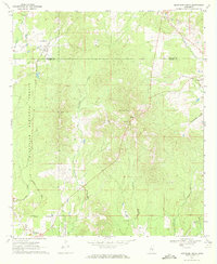 1970 Montrose North1972 Print · USGSJasper and Newton counties in the early 1970s remained a region of timbered hills and quiet railroad junctions. Researchers can trace the Gulf Mobile and Ohio line past Garlandville or locate family sites at Sand Ridge Church and the Pilgrim Rest Ch Cemeteries.2 unique versions available
 - 1972 Map of Union East, 1973 Print
 1972 Union East1973 Print · USGSNewton and Neshoba counties in the early seventies reveal a rural landscape connected by the Gulf Mobile and Ohio rail line. Researchers can trace local family roots at Sunny Hill Cem or find old community centers like Beulah-Hubbard Sch and Rock Branch Ch.2 unique versions available
 - 1972 Map of Sebastopol, 1973 Print
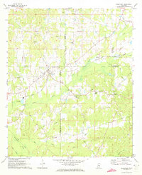 1972 Sebastopol1973 Print · USGSThe intersection of four counties in central Mississippi comes alive in the early seventies, centered on the railroad town of Sebastopol. Genealogists and historians can trace the locations of rural landmarks like Steam Mill, Milldale Cem, and Hays.
 - 1972 Map of Union West, 1973 Print
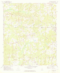 1972 Union West1973 Print · USGSNewton and Neshoba counties appear here in the early 1970s, as rural communities thrived along the Gulf Mobile and Ohio rail line. Genealogists can trace family roots through several local landmarks like Hudsons Chapel Cemetery, Evans Tabernacle, and Spring Hill Ch.2 unique versions available
 - 1982 Map of Conehatta, 1983 Print
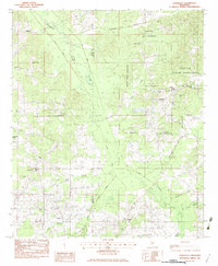 1982 Conehatta1983 Print · USGSThe Choctaw Indian Reservation and the rural communities of eastern Scott and Newton counties are captured here in the early eighties. Genealogists can trace family landmarks like Futch's Cem, Macedonia Ch, and Conehatta Sch.
 - 1982 Map of Lake, 1983 Print
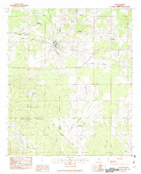 1982 Lake1983 Print · USGSThe Scott and Newton county line comes alive in the 1980s as the railroad passes through Lake. Genealogists and historians can locate Dennis Settlement, the Patrons Union Campground, and small rail sites like Muskegon.
 - 1982 Map of Duffee, 1983 Print
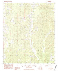 1982 Duffee1983 Print · USGSThe Newton and Lauderdale county line in the early eighties reveals a landscape of dispersed settlements and quiet rural industry. Researchers can trace family history through numerous landmarks like Mt Carmon Cem, the community of Center Ridge, and the path of an Abandoned Railroad.
 - 1983 Map of Rose Hill
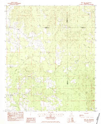 1983 Rose Hill1983 Print · USGSIn the early eighties, this eastern Mississippi boundary region maintained its character as a landscape of rural congregations and winding waterways. Trace the community ties between Rose Hill and Twistwood through landmarks like Rose Hill Cem and East Galilee Ch.
 - 1983 Map of Chunky
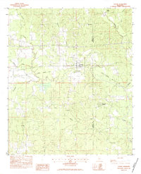 1983 Chunky1983 Print · USGSEastern Newton County in the early eighties centers on the railroad village of Chunky and its surrounding river bottoms. Genealogists and historians can trace rural congregations at New Providence Ch and locate family resting places like McGee Cem or the Pine Forest Academy.2 unique versions available
Showing maps 1-25 of 113
Top cities of Newton County
Frequently asked questions
- What are the different types of historical maps available for Newton County?
- What is the oldest map of Newton County?
- Where can I purchase historical maps of Newton County for my home or office?
- Where can I download high-res historical maps of Newton County?
- Are there historical topographic maps available for Newton County?
- Is there historical aerial imagery available for Newton County?
- Where are historical maps of Newton County sourced from?