1960s Maps of Newton County, Mississippi
Explore 7 historic maps of Newton County from the 1960s. These maps offer a rare glimpse into what life looked like during the 1960s — showing old roads, neighborhoods, homes, and landmarks that have changed or disappeared over time.
Whether you're researching your family's past, planning a metal detecting trip, or studying how Newton County's landscape evolved across the 1960s, these high-resolution maps are a powerful tool for exploring the history of this region.
- Focus on a specific era: All maps on this page are from the 1960s, giving you a focused view of this time period.
- See what’s changed: Compare century-old streets, trails, and buildings to today's modern landscape using overlays and satellite layers.
- Research with precision: Use these maps for genealogy, historical research, land use analysis, or educational projects.
- View, download, or print: Maps are fully viewable online in high resolution, and can be downloaded or printed for your own records.
Start exploring Newton County's history through authentic maps from the 1960s. This is your window into the past.
Newton County, MS maps
(7)- 1962 Map of Post, 1964 Print
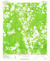 1962 Post1964 Print · USGSFour Mississippi counties meet in this early 1960s survey, showing a rural landscape tied together by local churches and the railroad. Genealogists and researchers can trace family landmarks like Trussel Cem, Antioch Ch, and the rail stop at Perdue.2 unique versions available
 - 1965 Map of Meridian
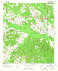
 1965 Meridian1965 Print · USGSEast Mississippi and West Alabama are mapped here in the mid-sixties as the region's modern highway and reservoir systems began to take shape. Researchers can trace rural lineages through local landmarks like Prince Chapel and Tuscahoma Landing, or follow the historic Gulf Mobile & Ohio rail lines.
 - 1966 Map of Hickory, 1967 Print
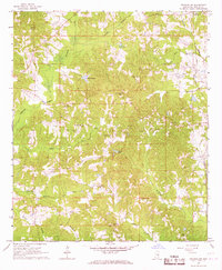
 1966 Hickory1967 Print · USGSNewton County in the mid-1960s shows a landscape of rural community and evolving transit. Genealogists can locate family landmarks like Old Norman Cem, Ferguson Cem, and the State Experiment Station near Hickory.
 - 1966 Map of Newton, 1967 Print
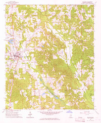
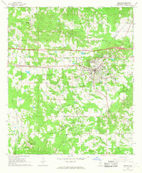 1966 Newton1967 Print · USGSNewton and the surrounding central Mississippi timberlands are captured here in the mid-sixties during a period of infrastructure expansion. Genealogists and historians can locate family landmarks like Evans Cem, Clark Memorial College, and the old Richardson Mill.2 unique versions available
 - 1966 Map of Decatur NW, 1967 Print
 1966 Decatur NW1967 Print · USGSNewton County in the mid-sixties is a landscape of rural family homesteads and country churches tied together by the Gulf Mobile and Ohio railroad. Genealogists can locate precise sites like the Hollingsworth Cem, Bufkin Cem, and Pine Ridge Ch.2 unique versions available
 - 1966 Map of Decatur, 1967 Print
 1966 Decatur1967 Print · USGSDecatur and the surrounding Newton County countryside are captured here in the mid-sixties, showing a landscape defined by small churches and rail. Trace family roots at Brand Cem or follow the path of the Gulf Mobile and Ohio railroad.2 unique versions available
 - 1968 Map of Clear Springs, 1970 Print
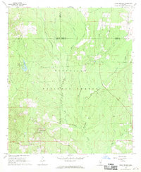 1968 Clear Springs1970 Print · USGSCentral Mississippi's piney woods come alive in the late sixties, showing where the borders of four counties meet within the Bienville National Forest. Genealogists and historians can trace the rural communities around Clear Springs, Mt Calvary Ch, and the Burnett Cem.
End of results
Showing maps 1-7 of 7
Top cities of Newton County
Frequently asked questions
- What are the different types of historical maps available for Newton County?
- What is the oldest map of Newton County?
- Where can I purchase historical maps of Newton County for my home or office?
- Where can I download high-res historical maps of Newton County?
- Are there historical topographic maps available for Newton County?
- Is there historical aerial imagery available for Newton County?
- Where are historical maps of Newton County sourced from?